MyTopo
Fail Ranch Montana US Topo Map
Couldn't load pickup availability
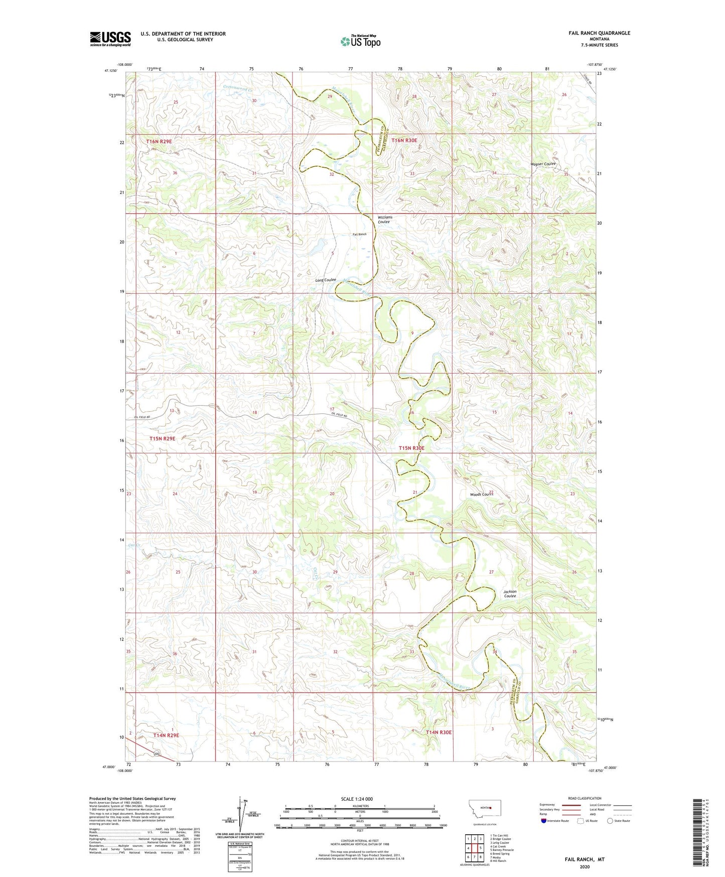
2024 topographic map quadrangle Fail Ranch in the state of Montana. Scale: 1:24000. Based on the newly updated USGS 7.5' US Topo map series, this map is in the following counties: Petroleum, Garfield. The map contains contour data, water features, and other items you are used to seeing on USGS maps, but also has updated roads and other features. This is the next generation of topographic maps. Printed on high-quality waterproof paper with UV fade-resistant inks.
Quads adjacent to this one:
West: Cat Creek
Northwest: Tin Can Hill
North: Bridge Coulee
Northeast: Lelig Coulee
East: Barney Pinnacle
Southeast: Hill Ranch
South: Mosby
Southwest: Breed Spring
This map covers the same area as the classic USGS quad with code o47107a8.
Contains the following named places: 15N29E11DD__01 Well, 15N30E21BAC_01 Well, 15N30E27CAAA01 Well, Brown School, Cat Creek, Cottonwood Creek, Dobson School, Fail Ranch, Jackson Coulee, Long Coulee, Mosby Dome Cat Creek Oil Field, Moss Ranch, Sage Hen Creek, US Number 44 Dam, West Dome Cat Creek Oil Field, Williams Coulee, Woods Coulee