MyTopo
Jellison Place Montana US Topo Map
Couldn't load pickup availability
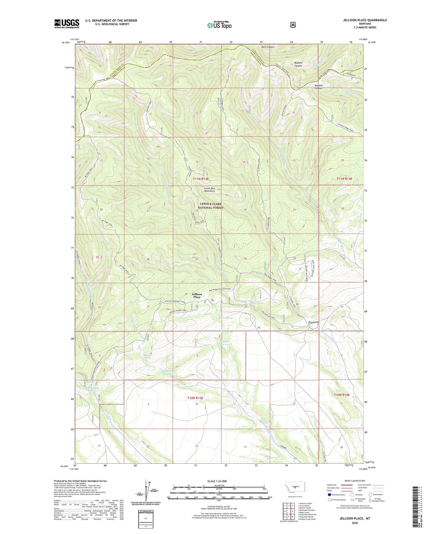
2020 topographic map quadrangle Jellison Place in the state of Montana. Scale: 1:24000. Based on the newly updated USGS 7.5' US Topo map series, this map is in the following counties: Wheatland, Judith Basin. The map contains contour data, water features, and other items you are used to seeing on USGS maps, but also has updated roads and other features. This is the next generation of topographic maps. Printed on high-quality waterproof paper with UV fade-resistant inks.
Quads adjacent to this one:
West: Haymaker Narrows
Northwest: Browns Canyon
North: Twin Sisters
Northeast: Martin Coulee
East: Mead Creek
Southeast: Hopley Creek North
South: Haymaker Ranch
Southwest: Haymaker Ranch SW
Contains the following named places: 10N13E12ABBA01 Well, Boecher Spring, Capser Ranch, Dry Gulch, Forks Spring, Hopley Spring, Jellison Place, Jellison Reservoir, Middle Fork Reservoir, Muir Spring, West Hopley Spring