MyTopo
Kachia Reservoir Montana US Topo Map
Couldn't load pickup availability
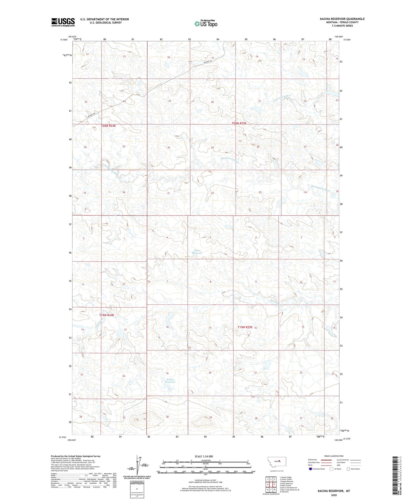
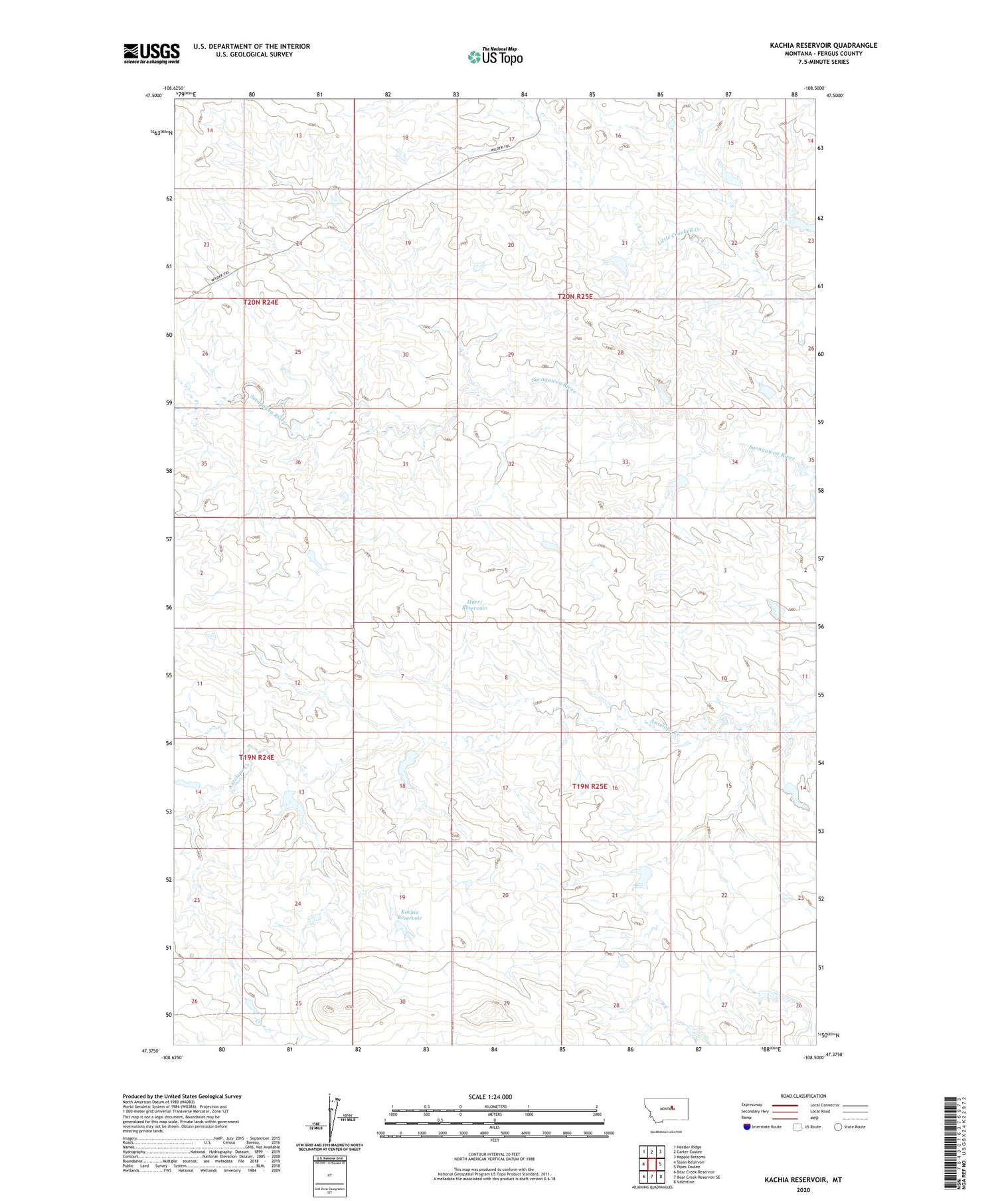
2020 topographic map quadrangle Kachia Reservoir in the state of Montana. Scale: 1:24000. Based on the newly updated USGS 7.5' US Topo map series, this map is in the following counties: Fergus. The map contains contour data, water features, and other items you are used to seeing on USGS maps, but also has updated roads and other features. This is the next generation of topographic maps. Printed on high-quality waterproof paper with UV fade-resistant inks.
Quads adjacent to this one:
West: Sloan Reservoir
Northwest: Hessler Ridge
North: Carter Coulee
Northeast: Kepple Bottoms
East: Pipes Coulee
Southeast: Valentine
South: Bear Creek Reservoir SE
Southwest: Bear Creek Reservoir
Contains the following named places: 20N24E25AAB_01 Well, Cottonwood Crossing, Ed Styer Number 3 Dam, Ed Styer Number 4 Dam, Ed Styer Number 5 Dam, Harri Reservoir, Kachia Post Office, Kachia Reservoir, Kachia School, North Roy Dam