MyTopo
Pipes Coulee Montana US Topo Map
Couldn't load pickup availability
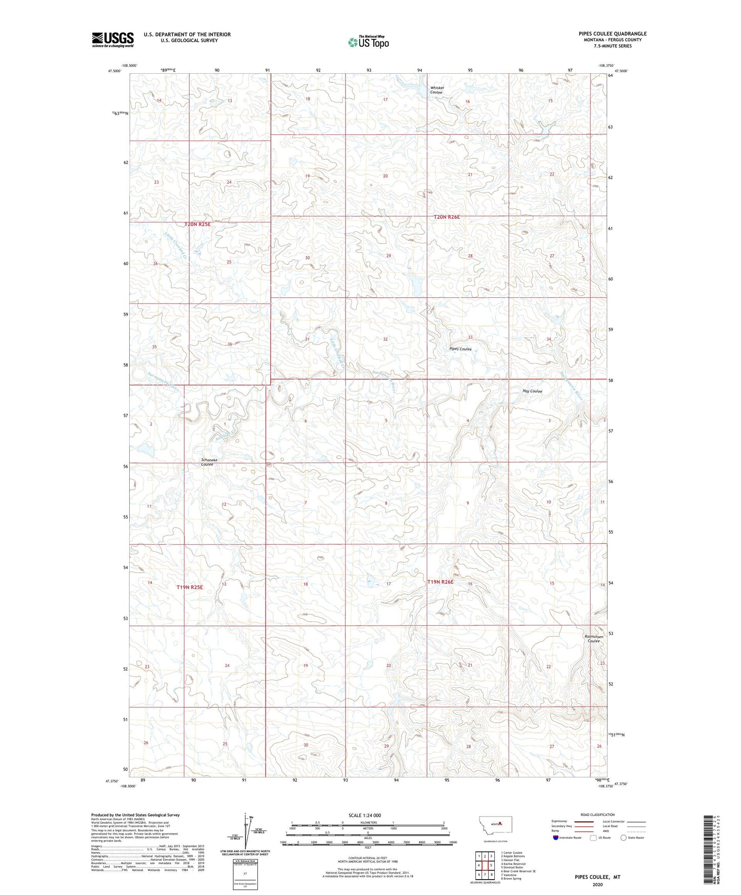
2024 topographic map quadrangle Pipes Coulee in the state of Montana. Scale: 1:24000. Based on the newly updated USGS 7.5' US Topo map series, this map is in the following counties: Fergus. The map contains contour data, water features, and other items you are used to seeing on USGS maps, but also has updated roads and other features. This is the next generation of topographic maps. Printed on high-quality waterproof paper with UV fade-resistant inks.
Quads adjacent to this one:
West: Kachia Reservoir
Northwest: Carter Coulee
North: Kepple Bottoms
Northeast: Hanson Flat
East: Dovetail Butte
Southeast: Brown Spring
South: Valentine
Southwest: Bear Creek Reservoir SE
This map covers the same area as the classic USGS quad with code o47108d4.
Contains the following named places: Antelope Creek, Buffalo Wallow Dam, Cottonwood Dam, Gore School, Hay Coulee, Little Crooked Creek, Little Crooked Rudolph Dam, Pipes Coulee, Schoneke Coulee, Umstead Reservoir Dam