MyTopo
Medicine Hot Springs Montana US Topo Map
Couldn't load pickup availability
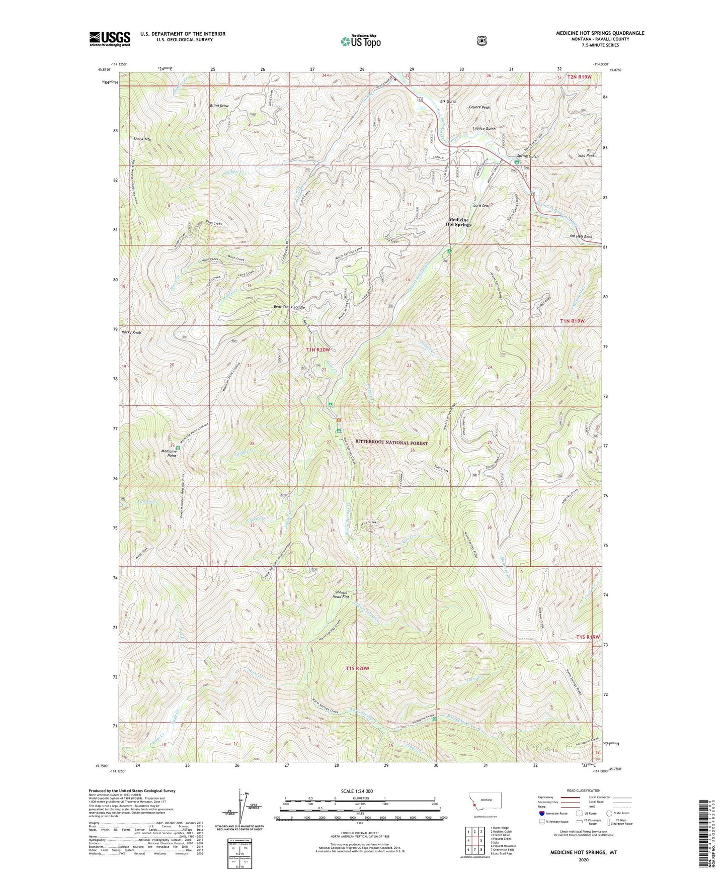
2020 topographic map quadrangle Medicine Hot Springs in the state of Montana. Scale: 1:24000. Based on the newly updated USGS 7.5' US Topo map series, this map is in the following counties: Ravalli. The map contains contour data, water features, and other items you are used to seeing on USGS maps, but also has updated roads and other features. This is the next generation of topographic maps. Printed on high-quality waterproof paper with UV fade-resistant inks.
Quads adjacent to this one:
West: Piquett Creek
Northwest: Burnt Ridge
North: Robbins Gulch
Northeast: French Basin
East: Sula
Southeast: Lost Trail Pass
South: Overwhich Falls
Southwest: Piquett Mountain
Contains the following named places: 01N20W12ABAB01 Well, 01N20W12CCCD01 Well, 01N20W12CCD_01 Spring, 01N20W12CCDB01 Well, Base Creek, Bear Creek, Bear Creek Saddle, Coyote Gulch, Coyote Peak, Crazy Creek, Crazy Creek Campground, Elk Gulch, Fault Creek, Fire Creek, Gilbert Creek, Hart Creek, Jim Hell Rock, Lord Draw, Lupine Creek, Medicine Hot Springs, Medicine Point, Moon Creek, Moosehead Campground, Planet Creek, Porcupine Creek, Prayer Creek, Sheeps Head Creek, Sheeps Head Flat, Shook Mountain, Smoke Creek, Spring Gulch, Spring Gulch Campground, Sula Division, Three Forks, Tumble Creek, Warm Springs Campground, Warm Springs Creek, Warm Springs Trailhead, Wiles Creek