MyTopo
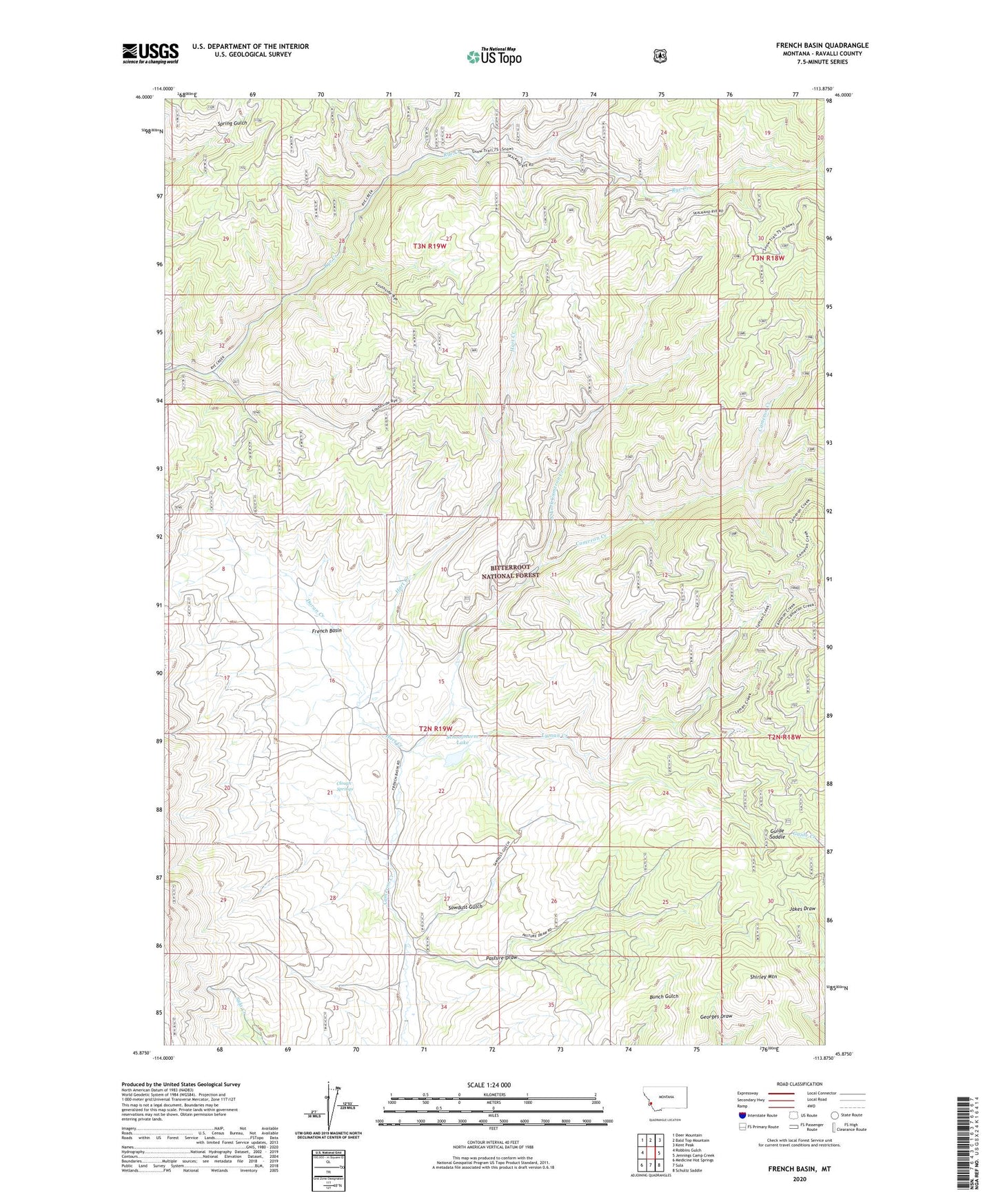
French Basin Montana US Topo Map
Couldn't load pickup availability
Also explore the French Basin Forest Service Topo of this same quad for updated USFS data
2024 topographic map quadrangle French Basin in the state of Montana. Scale: 1:24000. Based on the newly updated USGS 7.5' US Topo map series, this map is in the following counties: Ravalli. The map contains contour data, water features, and other items you are used to seeing on USGS maps, but also has updated roads and other features. This is the next generation of topographic maps. Printed on high-quality waterproof paper with UV fade-resistant inks.
Quads adjacent to this one:
West: Robbins Gulch
Northwest: Deer Mountain
North: Bald Top Mountain
Northeast: Kent Peak
East: Jennings Camp Creek
Southeast: Schultz Saddle
South: Sula
Southwest: Medicine Hot Springs
This map covers the same area as the classic USGS quad with code o45113h8.
Contains the following named places: Big Corral, Clough Springs, Doran Creek, French Basin, Guide Saddle, Hart Creek, Lyman Creek, North Fork Cameron Creek, Pasture Draw, Sawdust Gulch, Schoolmarm Lake, Shining Mountain Dam, Shirley Mountain, Sula State Forest, Weird Tom