MyTopo
Pagoda Mountain Montana US Topo Map
Couldn't load pickup availability
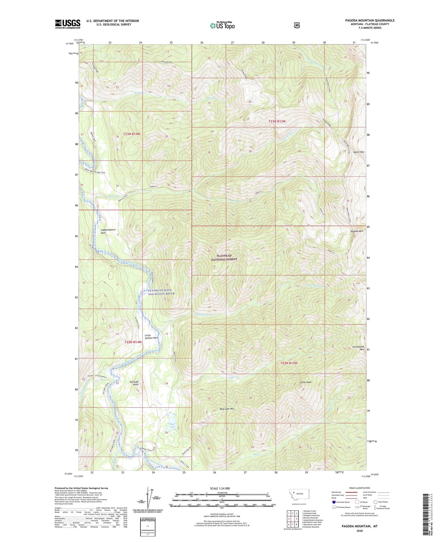
2020 topographic map quadrangle Pagoda Mountain in the state of Montana. Scale: 1:24000. Based on the newly updated USGS 7.5' US Topo map series, this map is in the following counties: Flathead. The map contains contour data, water features, and other items you are used to seeing on USGS maps, but also has updated roads and other features. This is the next generation of topographic maps. Printed on high-quality waterproof paper with UV fade-resistant inks.
Quads adjacent to this one:
West: Marmot Mountain
Northwest: Meadow Creek
North: Cathedral Peak
Northeast: Bungalow Mountain
East: Amphitheatre Mountain
Southeast: Haystack Mountain
South: Big Salmon Lake East
Southwest: Big Salmon Lake West
Contains the following named places: Big Salmon Creek, Black Bear Guard Station, Cone Peak, Damnation Creek, Helen Creek, Helen Mountain, Hodag Creek, Independence Park, Lewis Creek, Little Salmon Creek, Little Salmon Park, Mud Lake, Mud Lake Mountain, North Fork Helen Creek, Pagoda Mountain, Pagoda Mountain Lookout, Salmon Forks Guard Station, Snow Creek, Solitude Point, Turtlehead Mountain