MyTopo
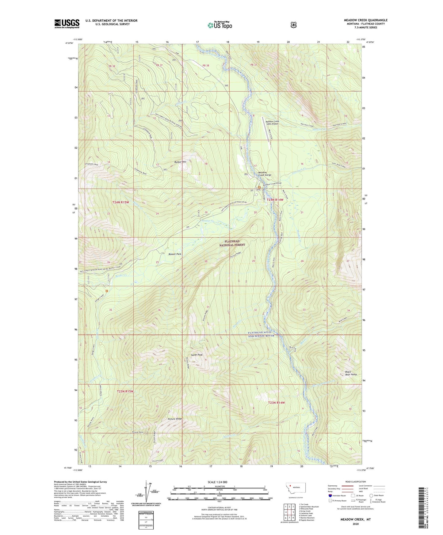
Meadow Creek Montana US Topo Map
Couldn't load pickup availability
Also explore the Meadow Creek Forest Service Topo of this same quad for updated USFS data
2024 topographic map quadrangle Meadow Creek in the state of Montana. Scale: 1:24000. Based on the newly updated USGS 7.5' US Topo map series, this map is in the following counties: Flathead. The map contains contour data, water features, and other items you are used to seeing on USGS maps, but also has updated roads and other features. This is the next generation of topographic maps. Printed on high-quality waterproof paper with UV fade-resistant inks.
Quads adjacent to this one:
West: String Creek
Northwest: Tin Creek
North: Spotted Bear Mountain
Northeast: Whitcomb Peak
East: Cathedral Peak
Southeast: Pagoda Mountain
South: Marmot Mountain
Southwest: Sunburst Lake
This map covers the same area as the classic USGS quad with code o47113g4.
Contains the following named places: Black Bear Hump, Bunker Creek, Bunker Hill, Bunker Park, Cedar Creek, Feather Creek, Gorge Creek, Harrison Creek, Henry Anderson Creek, Lost Jack Creek, Meadow Creek, Meadow Creek Gorge, Meadow Creek Guard Station, Meadow Creek Recreaton Site, Meadow Creek USFS Airport, Mid Creek, Picture Creek, Sarah Creek, Sarah Peak, Willow Creek