
MyTopo
Pinchout Creek Montana US Topo Map
Couldn't load pickup availability
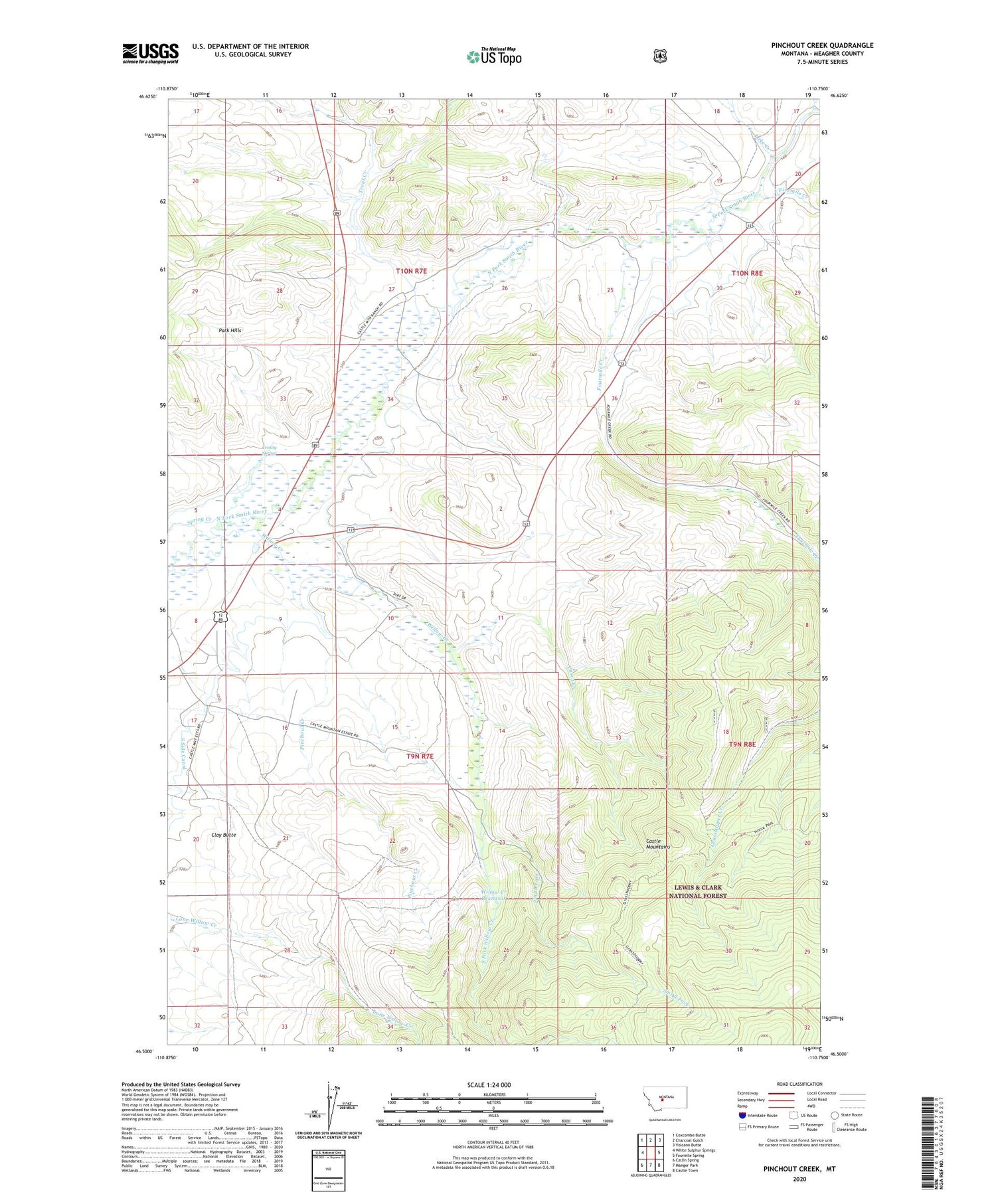
2020 topographic map quadrangle Pinchout Creek in the state of Montana. Scale: 1:24000. Based on the newly updated USGS 7.5' US Topo map series, this map is in the following counties: Meagher. The map contains contour data, water features, and other items you are used to seeing on USGS maps, but also has updated roads and other features. This is the next generation of topographic maps. Printed on high-quality waterproof paper with UV fade-resistant inks.
Quads adjacent to this one:
West: White Sulphur Springs
Northwest: Coxcombe Butte
North: Charcoal Gulch
Northeast: Volcano Butte
East: Fourmile Spring
Southeast: Castle Town
South: Manger Park
Southwest: Catlin Spring
Contains the following named places: 09N07E04DC__01 Well, 09N07E05AD__01 Well, 09N07E08AC__01 Well, 10N07E25C___01 Well, 10N07E27AC__01 Well, 10N07E35B___01 Well, Casey Creek, Clay Butte, Cut Bank Mine, Fivemile Creek, Fourmile Creek, Lake Creek, NW NW Section 19 Mine, NW SE Section 23 Mine, Pinchout Creek, Ringling Mine, Smith Fork, South Fork Willow Creek, South Side Canal, Trinity Spring, Trout Creek, Willow Creek, Willow Creek Reservoir


