MyTopo
Charcoal Gulch Montana US Topo Map
Couldn't load pickup availability
Also explore the Charcoal Gulch Forest Service Topo of this same quad for updated USFS data
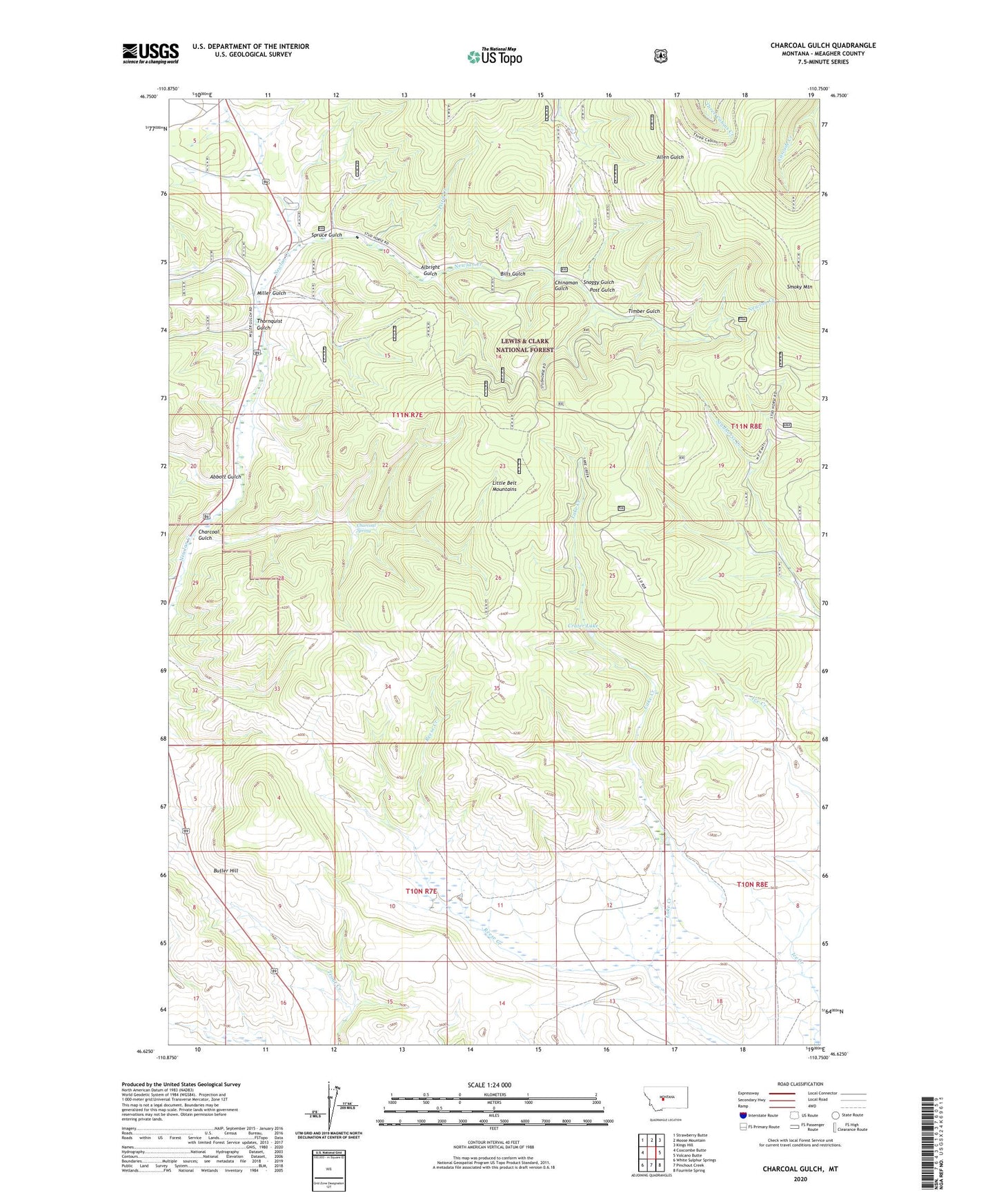
2024 topographic map quadrangle Charcoal Gulch in the state of Montana. Scale: 1:24000. Based on the newly updated USGS 7.5' US Topo map series, this map is in the following counties: Meagher. The map contains contour data, water features, and other items you are used to seeing on USGS maps, but also has updated roads and other features. This is the next generation of topographic maps. Printed on high-quality waterproof paper with UV fade-resistant inks.
Quads adjacent to this one:
West: Coxcombe Butte
Northwest: Strawberry Butte
North: Moose Mountain
Northeast: Kings Hill
East: Volcano Butte
Southeast: Fourmile Spring
South: Pinchout Creek
Southwest: White Sulphur Springs
This map covers the same area as the classic USGS quad with code o46110f7.
Contains the following named places: Abbott Gulch, Albright Gulch, Bills Gulch, Butler Hill, Charcoal Gulch, Charcoal Spring, Chinaman Gulch, Crater Lake, Ice Creek, Miller Gulch, Newlan Creek Guard Station, Newland Creek Quarry, NW NE Section 18 Mine, Pistol Creek, Post Gulch, Reese Creek, Smoky Mountain, Snaggy Gulch, Spruce Gulch, SW NE Section 10 Mine, Thornquist Gulch, Timber Gulch