MyTopo
Pondera School Montana US Topo Map
Couldn't load pickup availability
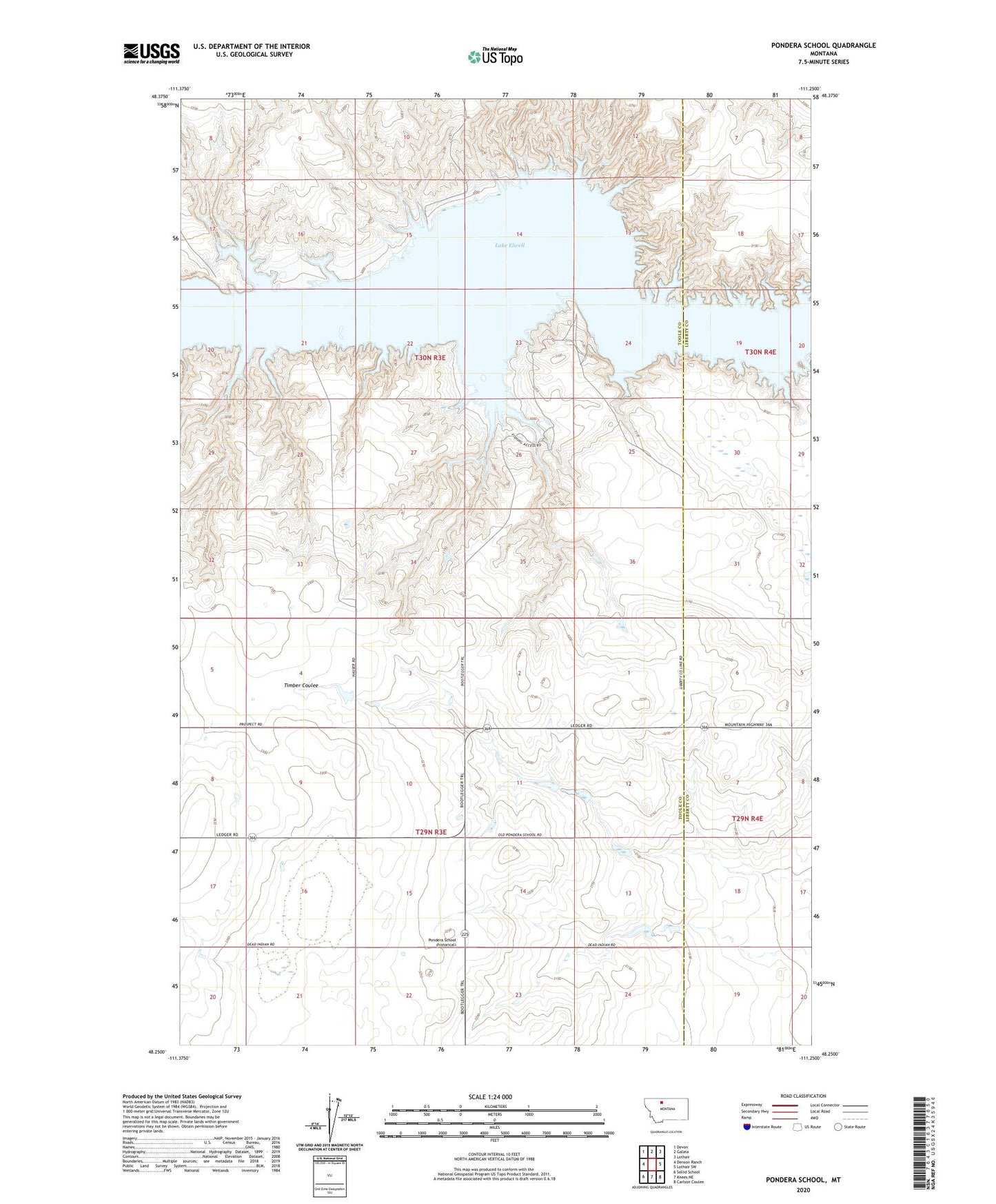
2020 topographic map quadrangle Pondera School in the state of Montana. Scale: 1:24000. Based on the newly updated USGS 7.5' US Topo map series, this map is in the following counties: Toole, Liberty. The map contains contour data, water features, and other items you are used to seeing on USGS maps, but also has updated roads and other features. This is the next generation of topographic maps. Printed on high-quality waterproof paper with UV fade-resistant inks.
Quads adjacent to this one:
West: Denson Ranch
Northwest: Devon
North: Galata
Northeast: Lothair
East: Lothair SW
Southeast: Carlson Coulee
South: Knees NE
Southwest: Sollid School
Contains the following named places: 35N04E18DBAB01 Well, 59456, Beatrice Post Office, Gouchenour Dam, Lake Elwell, North Bootlegger Campground, North Bootlegger Picnic Area, Pondera School, South Bootlegger Campground, South Bootlegger Picnic Area, Underdal Number 1 Dam, Underdal Number 2 Dam