MyTopo
Galata Montana US Topo Map
Couldn't load pickup availability
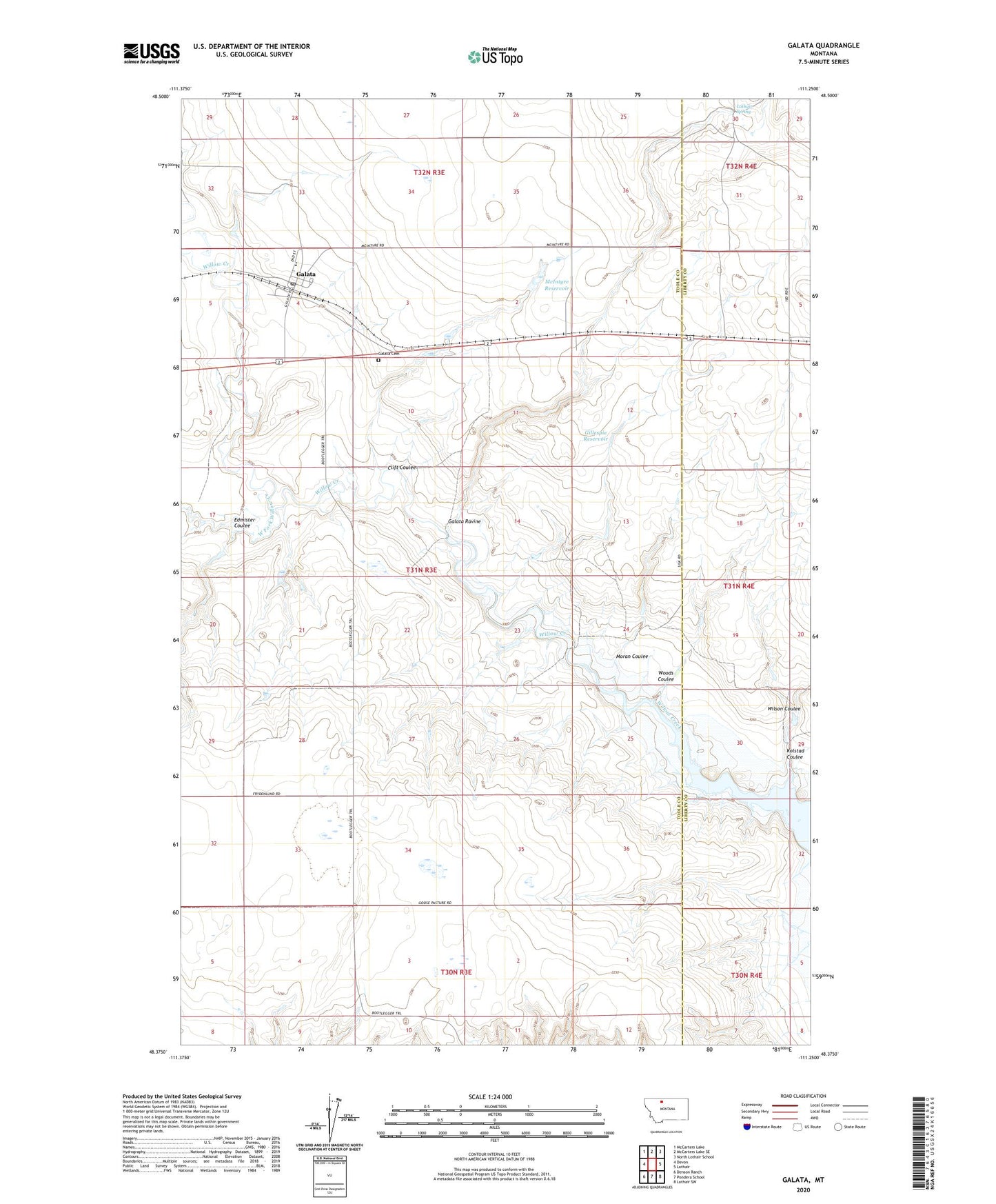
2024 topographic map quadrangle Galata in the state of Montana. Scale: 1:24000. Based on the newly updated USGS 7.5' US Topo map series, this map is in the following counties: Toole, Liberty. The map contains contour data, water features, and other items you are used to seeing on USGS maps, but also has updated roads and other features. This is the next generation of topographic maps. Printed on high-quality waterproof paper with UV fade-resistant inks.
Quads adjacent to this one:
West: Devon
Northwest: McCarters Lake
North: McCarters Lake SE
Northeast: North Lothair School
East: Lothair
Southeast: Lothair SW
South: Pondera School
Southwest: Denson Ranch
This map covers the same area as the classic USGS quad with code o48111d3.
Contains the following named places: Clift Coulee, Edmister Coulee, Galata, Galata Cemetery, Galata Lutheran Church, Galata Motel and RV Campground, Galata Post Office, Galata Ravine, Galata School, Gillespie Reservoir, Hess, Kolstad Coulee, Lothair Spring, McIntyre Reservoir, McIntyre Reservoir Dam, Moran Coulee, West Fork Willow Creek, Wilson Coulee, Woods Coulee, Zelenka Dam