MyTopo
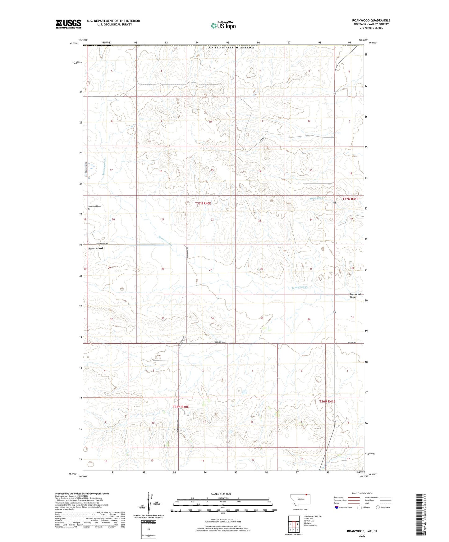
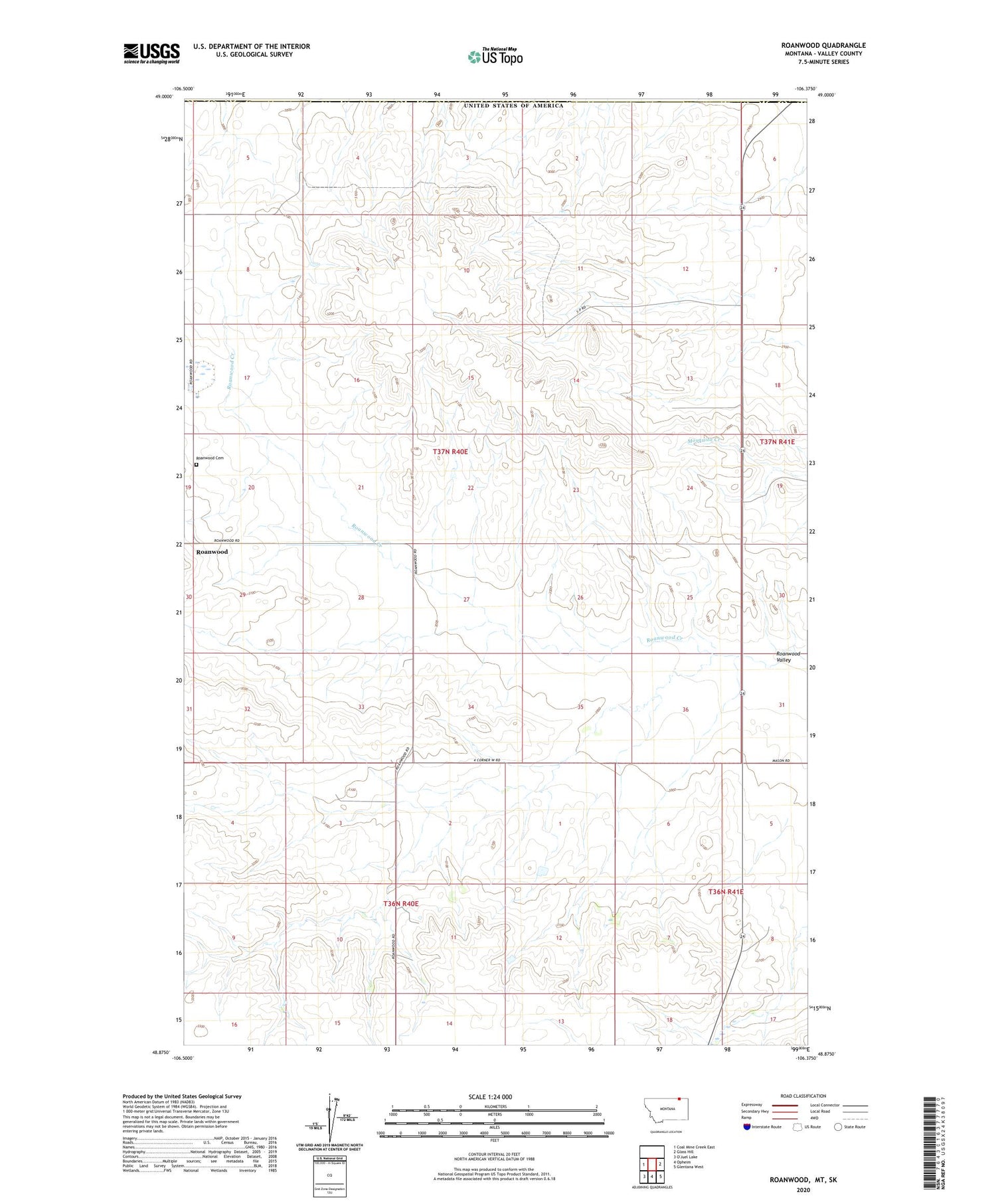
Roanwood Montana US Topo Map
Couldn't load pickup availability
2020 topographic map quadrangle Roanwood in the state of Montana. Scale: 1:24000. Based on the newly updated USGS 7.5' US Topo map series, this map is in the following counties: Valley. The map contains contour data, water features, and other items you are used to seeing on USGS maps, but also has updated roads and other features. This is the next generation of topographic maps. Printed on high-quality waterproof paper with UV fade-resistant inks.
Quads adjacent to this one:
West: Coal Mine Creek East
East: Glass Hill
Southeast: Glentana West
South: Opheim
Contains the following named places: Pleasant View School, Roanwood, Roanwood Cemetery, Roanwood Evangelical Lutheran Church, Roanwood Post Office, Roanwood Valley, Spring Valley School, United States Customs and Border Protection Opheim Port of Entry