MyTopo
Sam George Hill Montana US Topo Map
Couldn't load pickup availability
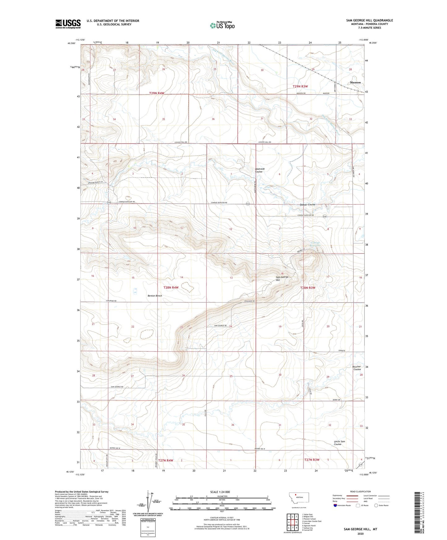
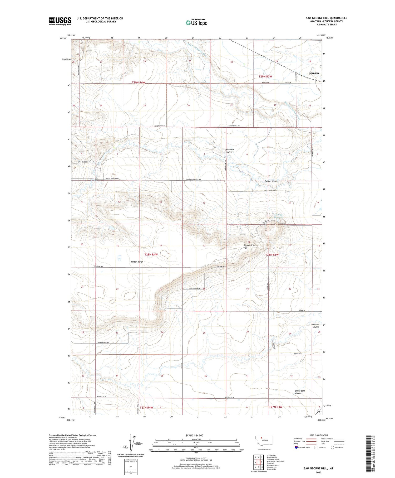
2020 topographic map quadrangle Sam George Hill in the state of Montana. Scale: 1:24000. Based on the newly updated USGS 7.5' US Topo map series, this map is in the following counties: Pondera. The map contains contour data, water features, and other items you are used to seeing on USGS maps, but also has updated roads and other features. This is the next generation of topographic maps. Printed on high-quality waterproof paper with UV fade-resistant inks.
Quads adjacent to this one:
West: Lone Man Coulee East
Northwest: Valier East
North: Belgian Hill
Northeast: Pioneer School
East: Conrad
Southeast: Conrad SW
South: Gallup City
Southwest: Agawam North
Contains the following named places: 28N03W17AABB01 Well, 28N03W17ABBC01 Well, 28N03W17ABDB01 Well, Benton Bench, Boucher Coulee, Conrad Reservoir, DeBoer Coulee, Earhart School, Graham Ranch, Haatvedt Coulee, King School, MacLain Ranch, Manson, Manson Post Office, Manson School, Old Camp, Sam George Hill