MyTopo
Agawam North Montana US Topo Map
Couldn't load pickup availability
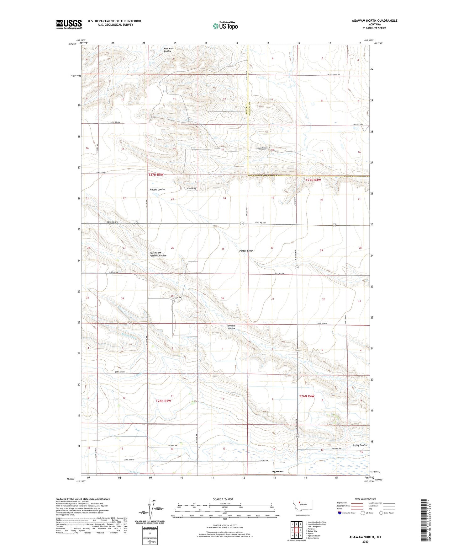
2024 topographic map quadrangle Agawam North in the state of Montana. Scale: 1:24000. Based on the newly updated USGS 7.5' US Topo map series, this map is in the following counties: Teton, Pondera. The map contains contour data, water features, and other items you are used to seeing on USGS maps, but also has updated roads and other features. This is the next generation of topographic maps. Printed on high-quality waterproof paper with UV fade-resistant inks.
Quads adjacent to this one:
West: Pendroy
Northwest: Lone Man Coulee West
North: Lone Man Coulee East
Northeast: Sam George Hill
East: Gallup City
Southeast: Eyraud Lakes
South: Agawam South
Southwest: Bynum
This map covers the same area as the classic USGS quad with code o48112a2.
Contains the following named places: 26N05W12CBBB01 Well, Lincoln School, North Fork Farmers Coulee, Porter Bench, Porter Bench School, Porter Post Office, Smith Ranch, Spring Coulee, Talifson School