MyTopo
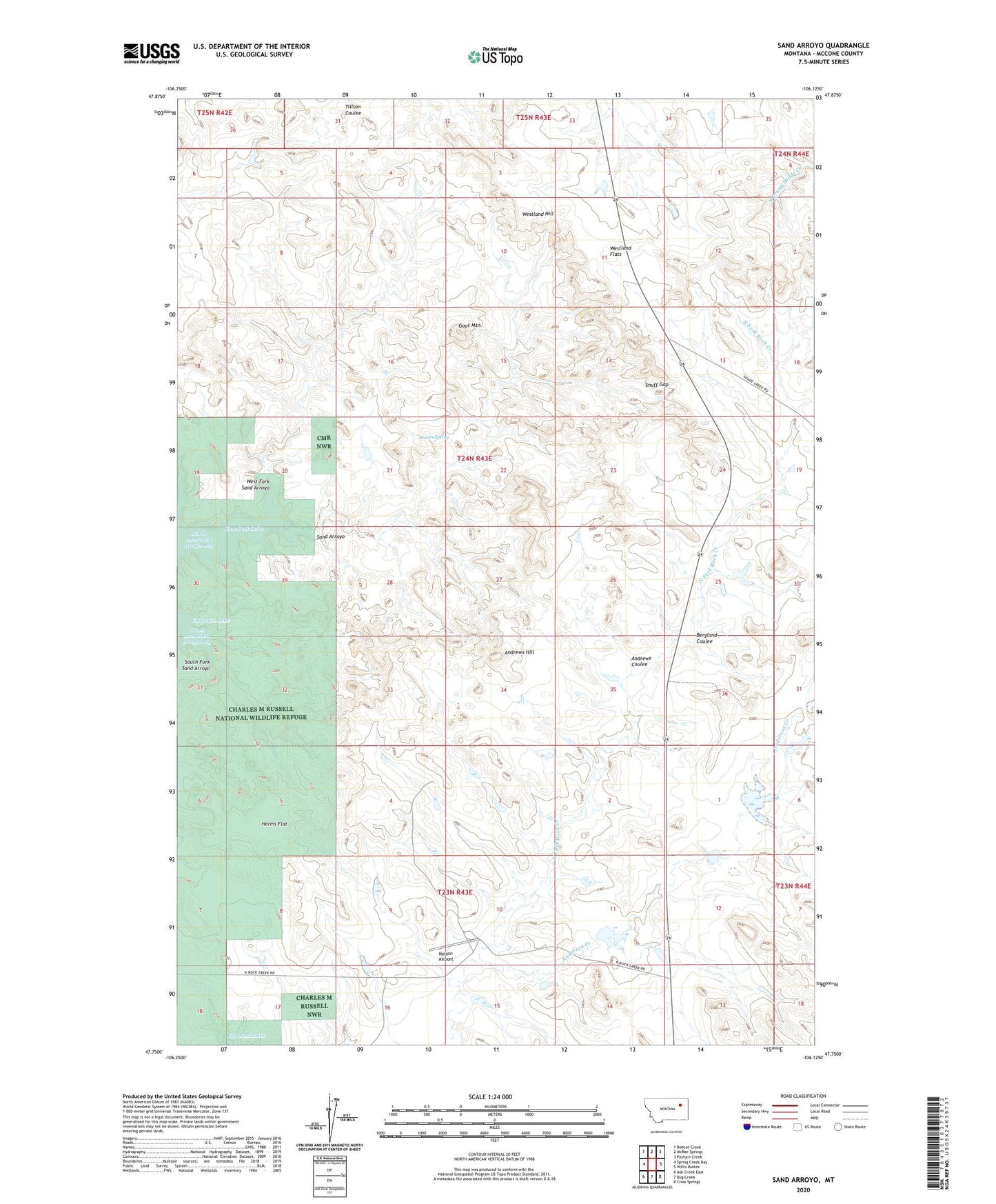
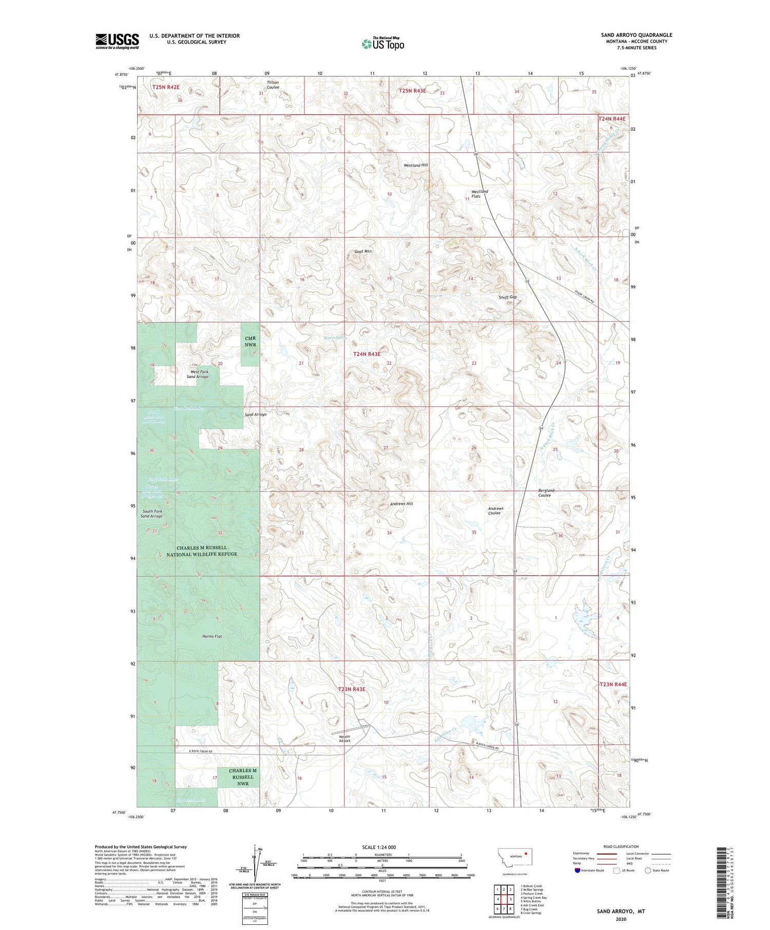
Sand Arroyo Montana US Topo Map
Couldn't load pickup availability
2020 topographic map quadrangle Sand Arroyo in the state of Montana. Scale: 1:24000. Based on the newly updated USGS 7.5' US Topo map series, this map is in the following counties: McCone. The map contains contour data, water features, and other items you are used to seeing on USGS maps, but also has updated roads and other features. This is the next generation of topographic maps. Printed on high-quality waterproof paper with UV fade-resistant inks.
Quads adjacent to this one:
West: Spring Creek Bay
Northwest: Bobcat Creek
North: McRae Springs
Northeast: Pasture Creek
East: Willis Buttes
Southeast: Crow Springs
South: Bug Creek
Southwest: Ash Creek East
Contains the following named places: 23N43E02DABA01 Well, 59223, Anderson Creek, Andrews Coulee, Andrews Hill, Bergland Coulee, Bonin Post Office, Bonin School, Goat Mountain, Harms Flat, Lyle Nelson Number 7 Dam, Lyle Nelson Number 8 Dam, Nelson Airport, Nelson Number 1 Dam, Nelson Number 2 Dam, North Arm Sand Arroyo Bay, Reaves Spring, Sand Arroyo, Sand Arroyo Badlands, Snuff Gap, South Fork Sand Arroyo, Thora Number 2 Dam, West Fork Sand Arroyo, Westland Flats, Westland Hill