MyTopo
Crow Springs Montana US Topo Map
Couldn't load pickup availability
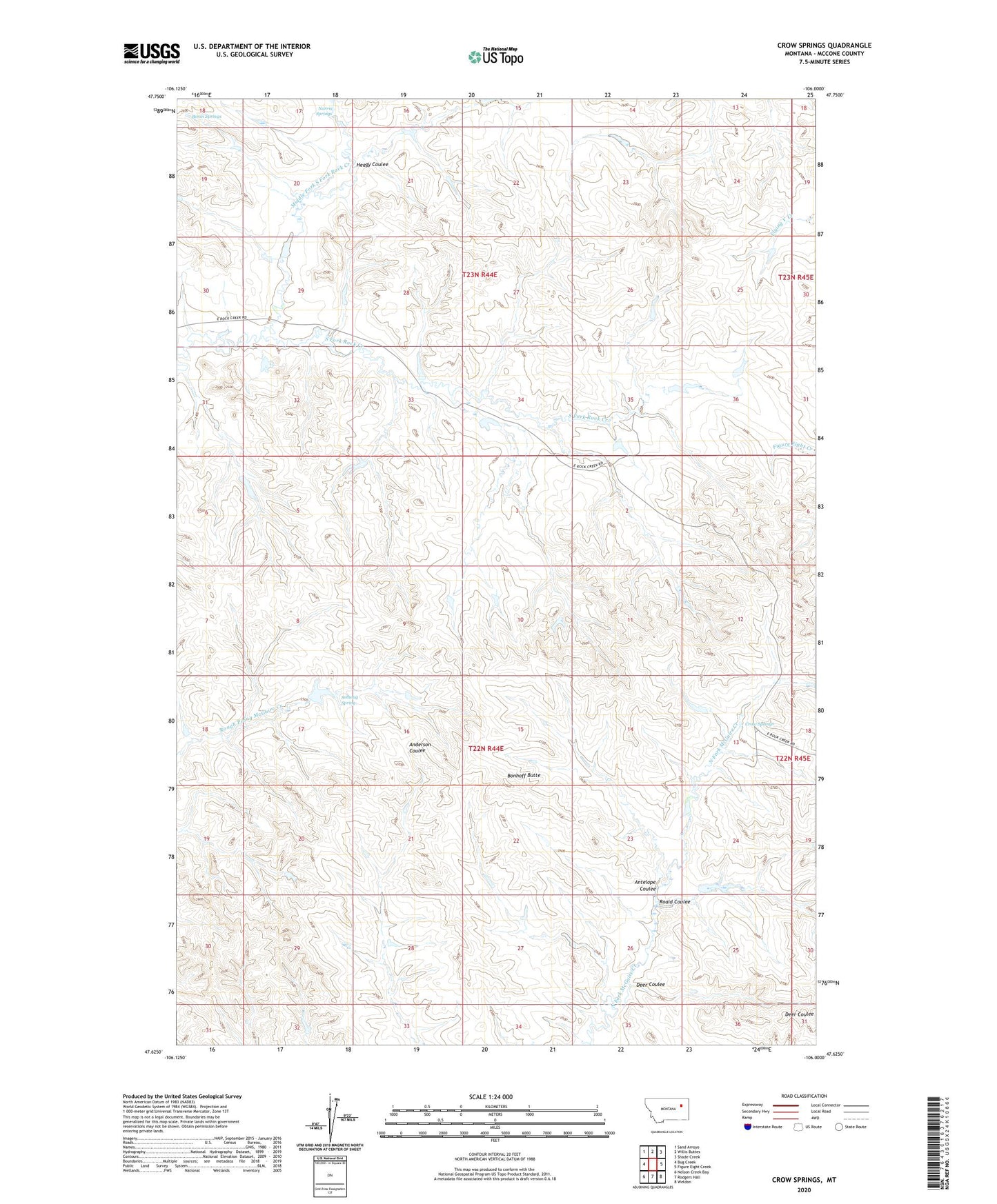
2024 topographic map quadrangle Crow Springs in the state of Montana. Scale: 1:24000. Based on the newly updated USGS 7.5' US Topo map series, this map is in the following counties: McCone. The map contains contour data, water features, and other items you are used to seeing on USGS maps, but also has updated roads and other features. This is the next generation of topographic maps. Printed on high-quality waterproof paper with UV fade-resistant inks.
Quads adjacent to this one:
West: Bug Creek
Northwest: Sand Arroyo
North: Willis Buttes
Northeast: Shade Creek
East: Figure Eight Creek
Southeast: Weldon
South: Rodgers Hall
Southwest: Nelson Creek Bay
This map covers the same area as the classic USGS quad with code o47106f1.
Contains the following named places: 22N45E31BBDB01 Well, Antelope Coulee, Bobcat Reservoir Dam, Bonhoff Butte, Bonin Springs, Crow Number 1 Dam, Crow Number 2 Dam, Crow Springs, Deer Coulee, Heagy Coulee, Horse Trough Dam, L Pawlowski Number 3 Dam, Late Creek Reservoir Dam, Middle Fork South Fork Rock Creek, Moonlight Reservoir Dam, Norris Springs, Quam Post Office, Roald Coulee, Solhaug Spring, South Rock Creek Reservoir Dam, Towe Farms Number 4 Dam, W Pawlowski Reservoir Dam, Wayne Number 2 Dam