
MyTopo
Valier East Montana US Topo Map
Couldn't load pickup availability
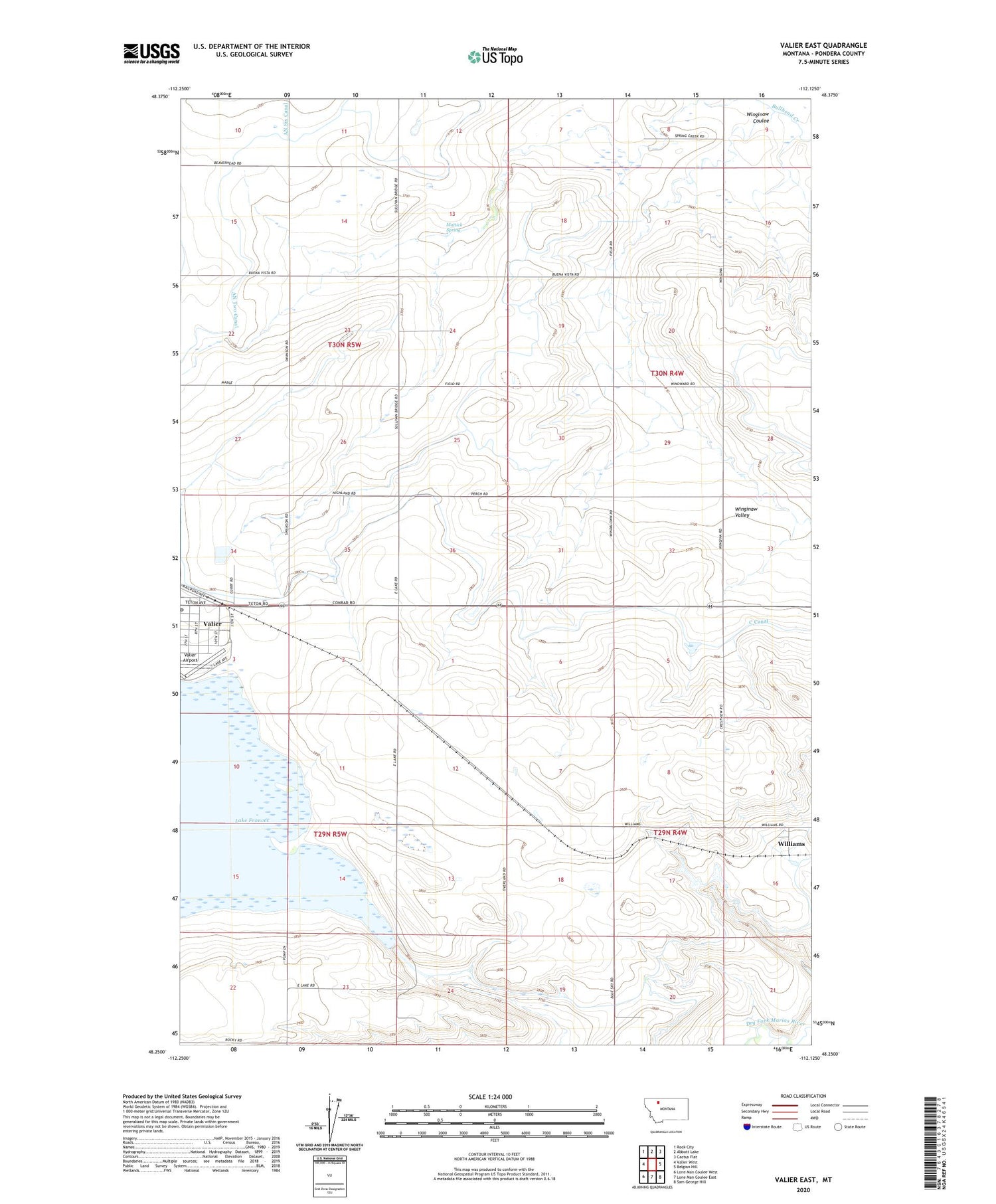
2020 topographic map quadrangle Valier East in the state of Montana. Scale: 1:24000. Based on the newly updated USGS 7.5' US Topo map series, this map is in the following counties: Pondera. The map contains contour data, water features, and other items you are used to seeing on USGS maps, but also has updated roads and other features. This is the next generation of topographic maps. Printed on high-quality waterproof paper with UV fade-resistant inks.
Quads adjacent to this one:
West: Valier West
Northwest: Rock City
North: Abbott Lake
Northeast: Cactus Flat
East: Belgian Hill
Southeast: Sam George Hill
South: Lone Man Coulee East
Southwest: Lone Man Coulee West
Contains the following named places: 29N04W08CCD_01 Well, 30N04W17AAAA01 Well, Buena Vista School, Bull Pen Number 1 Dam, Bull Pen Number 2 Dam, C Canal, Cargill Elevator, General Mills Incorporated Elevator, Harvest States Cooperatives Elevator, International Elevator, Lake Frances Dam, Lake School, Mattick Spring, Plainview School, Rocky Mountain Elevator, Sill Ranch, Spinning Ranch, Valier, Valier Airport, Valier Jehovahs Witnesses Church, Valier Post Office, Williams, Williams Post Office, Williams School, Winginaw Coulee, Winginaw Valley


