MyTopo
Valier West Montana US Topo Map
Couldn't load pickup availability
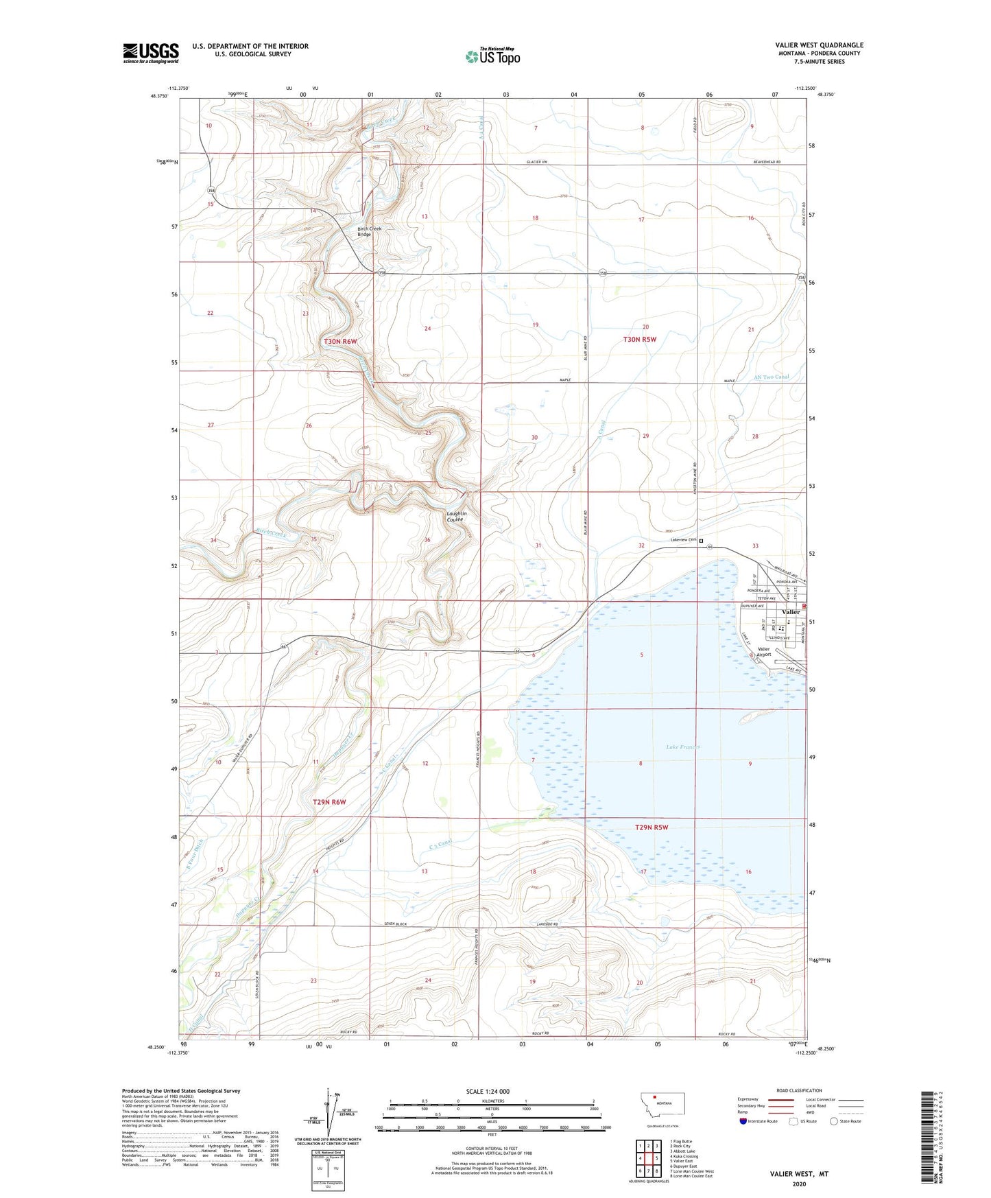
2024 topographic map quadrangle Valier West in the state of Montana. Scale: 1:24000. Based on the newly updated USGS 7.5' US Topo map series, this map is in the following counties: Pondera. The map contains contour data, water features, and other items you are used to seeing on USGS maps, but also has updated roads and other features. This is the next generation of topographic maps. Printed on high-quality waterproof paper with UV fade-resistant inks.
Quads adjacent to this one:
West: Kuka Crossing
Northwest: Flag Butte
North: Rock City
Northeast: Abbott Lake
East: Valier East
Southeast: Lone Man Coulee East
South: Lone Man Coulee West
Southwest: Dupuyer East
This map covers the same area as the classic USGS quad with code o48112c3.
Contains the following named places: 29N06W24DABA01 Well, 30N05W33DDB_01 Well, A 4 Canal, A Canal, AN Two Canal, Birch Creek Bridge, Birchfield School, C 3 Canal, C Canal, Dupuyer Creek, First Baptist Church, Frances Heights School, Goolin Ranch, Highland School, Home Ranch, Kilian Ranch, Lake Frances, Lake Frances North Dam, Lakeview Cemetery, Laughlin Coulee, Miller Park, Mountain View School, Parker Ranch, Saint Francis Catholic Church, Town of Valier, Valier, Valier Clinic, Valier Elementary School, Valier High School, Valier Lutheran Church, Valier Public Library, Valier United Methodist Church, Valier Volunteer Fire Department, Wayman Ranch