MyTopo
Victor Montana US Topo Map
Couldn't load pickup availability
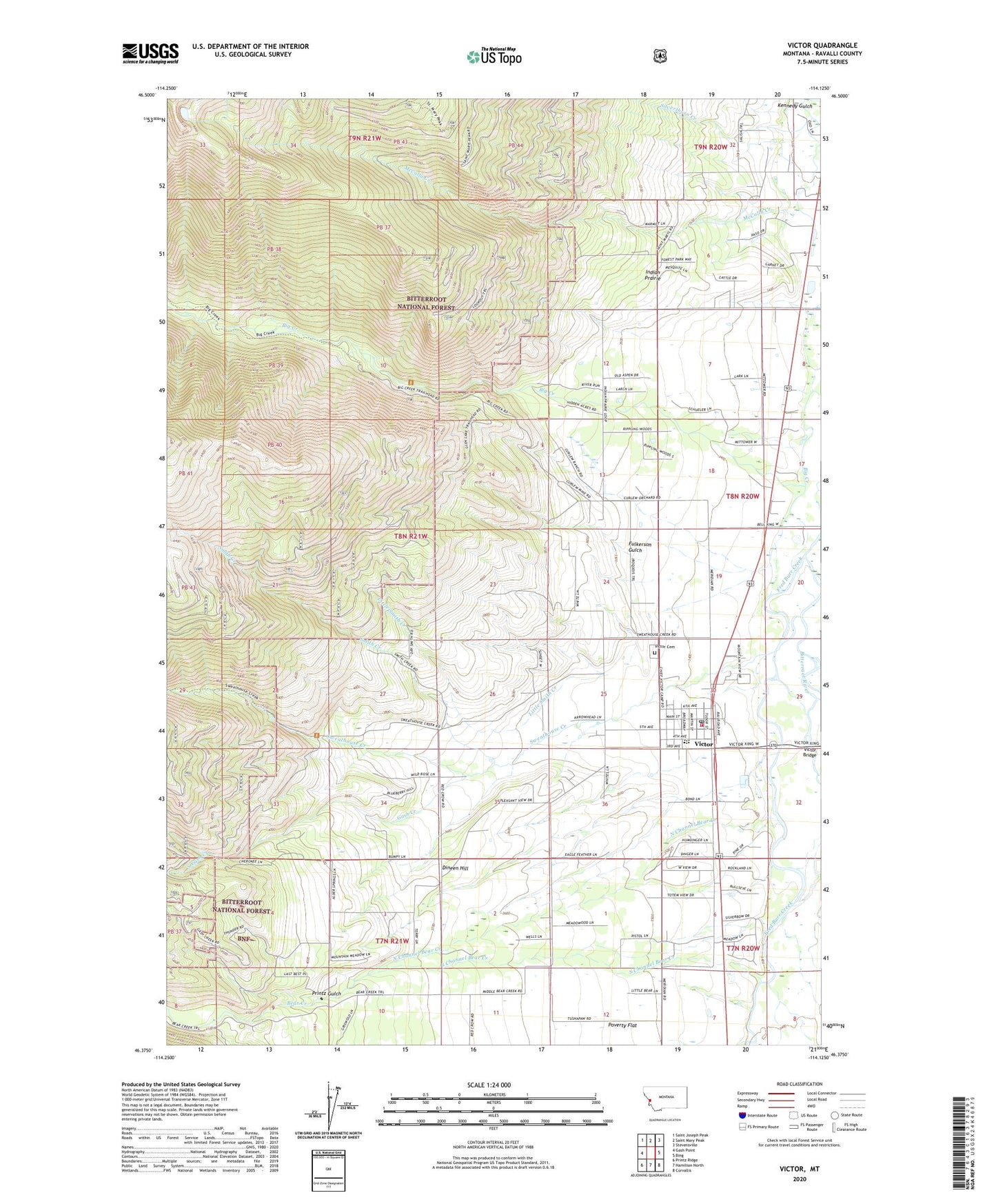
2020 topographic map quadrangle Victor in the state of Montana. Scale: 1:24000. Based on the newly updated USGS 7.5' US Topo map series, this map is in the following counties: Ravalli. The map contains contour data, water features, and other items you are used to seeing on USGS maps, but also has updated roads and other features. This is the next generation of topographic maps. Printed on high-quality waterproof paper with UV fade-resistant inks.
Quads adjacent to this one:
West: Gash Point
Northwest: Saint Joseph Peak
North: Saint Mary Peak
Northeast: Stevensville
East: Bing
Southeast: Corvallis
South: Hamilton North
Southwest: Printz Ridge
Contains the following named places: 07N20W07BA__01 Well, 07N21W11BD__01 Well, 08N20W05BA__01 Well, 08N20W05CC__01 Well, 08N20W06CC__01 Well, 08N20W07AB__01 Well, 08N20W18DD__01 Well, 08N20W19BAAD03 Well, 08N20W30CA__01 Well, 08N20W30DC__01 Well, 08N20W31DDD_01 Well, 08N21W24ACDA01 Well, 08N21W24BCBA01 Well, 08N21W26DD__01 Well, 08N21W27DCB_01 Well, Bear Creek, Bell Crossing Fishing Access Site, Blue Bird Mine, Calvary Baptist Church, Church of the Nazarene, Curlew, Curlew Mine, Curlew Mines, Curlew School, Dineen Hill, Dunbar, Fulkerson Gulch, Gash Creek, House of Praise, Indian Prairie, Little Smith Creek, McCalla Lake Dam, Mittower, North Channel Bear Creek, Our Lady of the Bitterroot Chapel of the Society of Saint Pius X, Pleasant View Mine, Printz Gulch, SE SW Section 15 Mine, Silverthorn Creek, Smith Creek, South Channel Bear Creek, South Gash Creek, Sweat House, Sweathouse Creek, Tudor, Victor, Victor Ambulance, Victor Bridge, Victor Cemetery, Victor Census Designated Place, Victor Community Church, Victor Fire Department, Victor Heritage Museum, Victor Park, Victor Post Office, Victor Schools