MyTopo
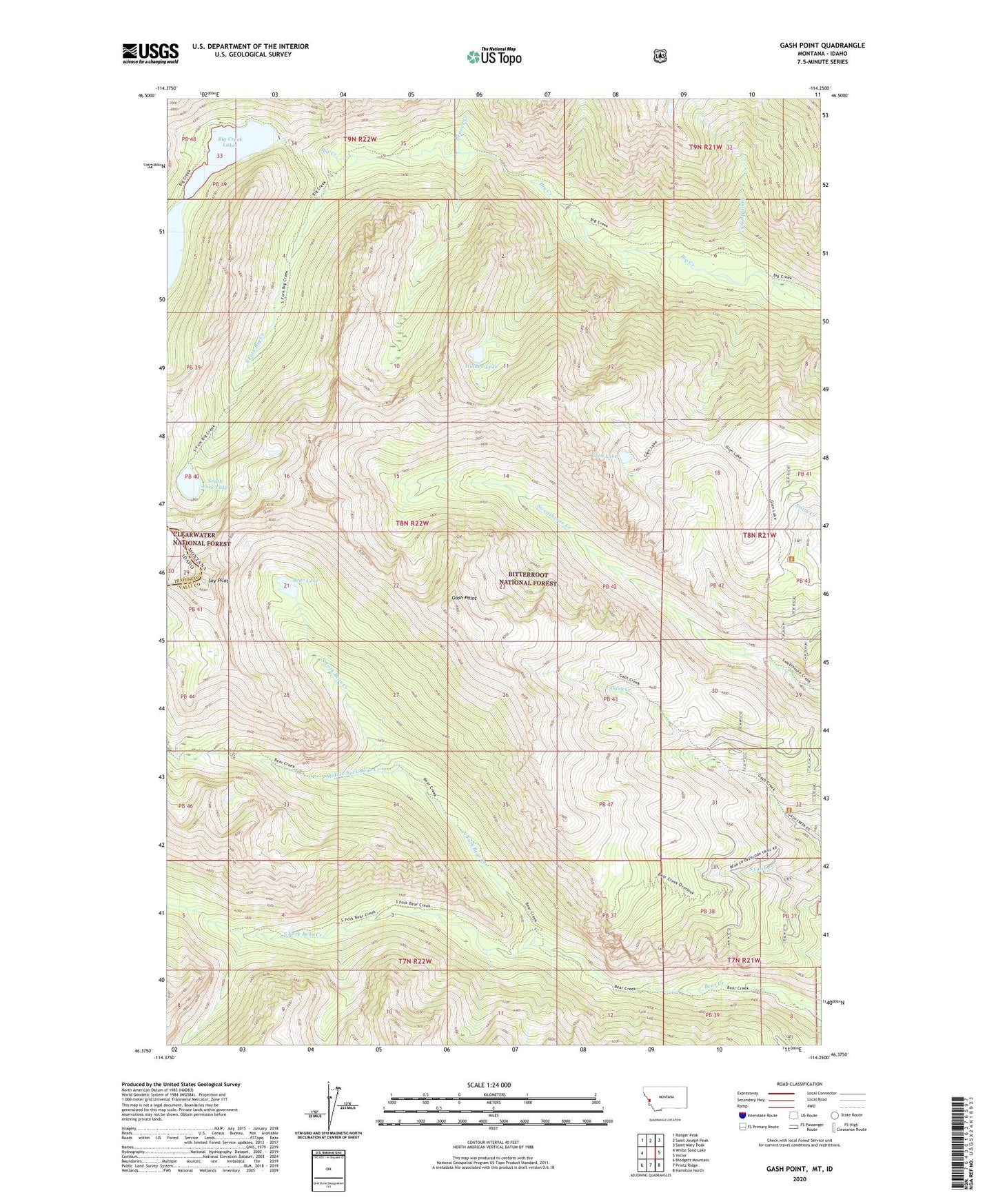
Gash Point Montana US Topo Map
Couldn't load pickup availability
Also explore the Gash Point Forest Service Topo of this same quad for updated USFS data
2024 topographic map quadrangle Gash Point in the state of Montana. Scale: 1:24000. Based on the newly updated USGS 7.5' US Topo map series, this map is in the following counties: Ravalli, Idaho. The map contains contour data, water features, and other items you are used to seeing on USGS maps, but also has updated roads and other features. This is the next generation of topographic maps. Printed on high-quality waterproof paper with UV fade-resistant inks.
Quads adjacent to this one:
West: White Sand Lake
Northwest: Ranger Peak
North: Saint Joseph Peak
Northeast: Saint Mary Peak
East: Victor
Southeast: Hamilton North
South: Printz Ridge
Southwest: Blodgett Mountain
This map covers the same area as the classic USGS quad with code o46114d3.
Contains the following named places: Bear Creek Overlook Point of Interest, Bear Creek Trailhead, Bear Lake, Beaver Creek, Big Creek Lake Dam, Big Creek Lakes, Big Creek Number 2 Dam, Gash Point, Glen Lake, Hidden Lake, Middle Fork Bear Creek, North Fork Bear Creek, Saint Mary Creek, Sky Pilot, South Fork Bear Creek, South Fork Big Creek, South Fork Lake, Starr Mine, Victor Division, ZIP Code: 59875