
MyTopo
Ainsworth Nebraska US Topo Map
Couldn't load pickup availability
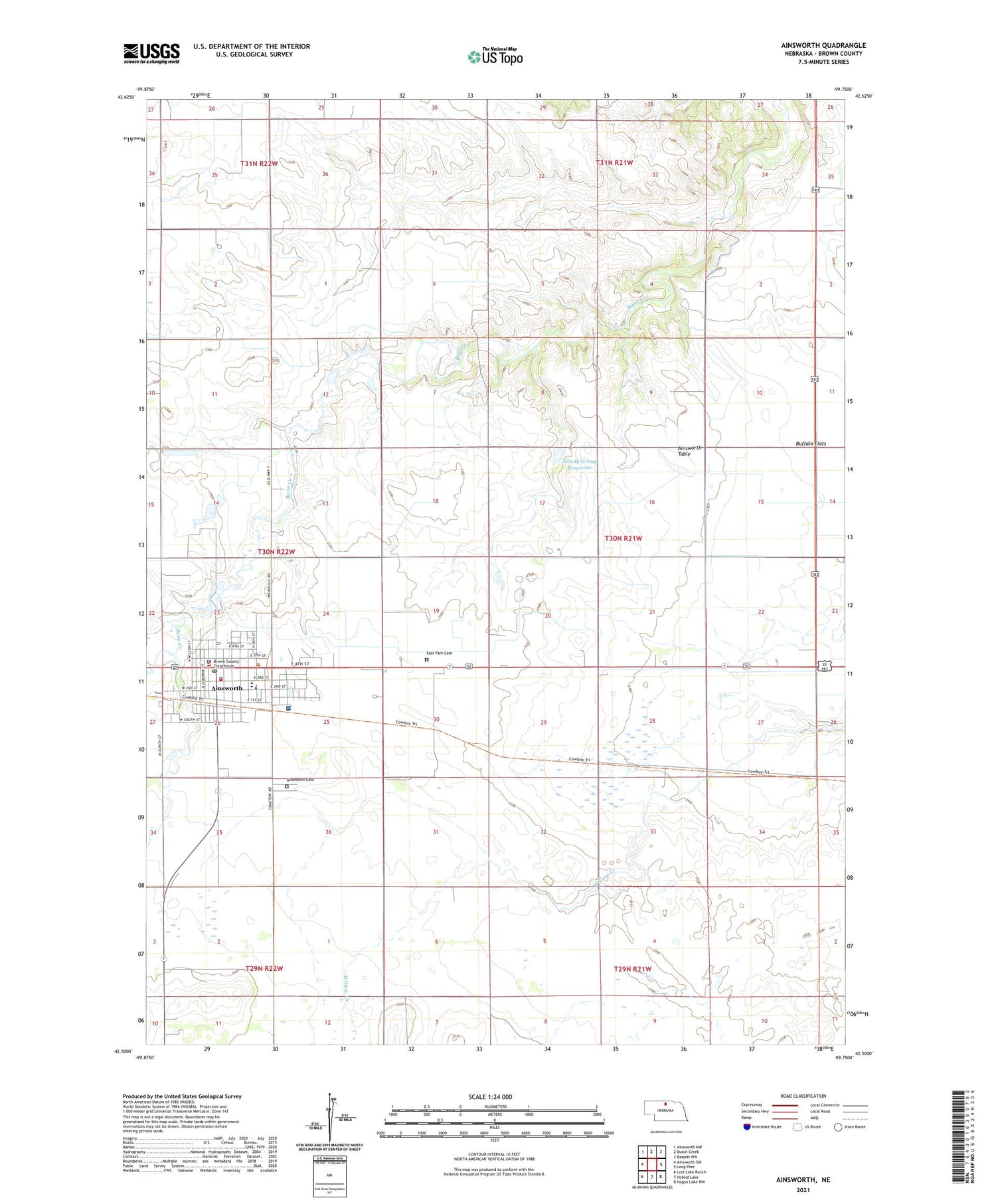
2021 topographic map quadrangle Ainsworth in the state of Nebraska. Scale: 1:24000. Based on the newly updated USGS 7.5' US Topo map series, this map is in the following counties: Brown. The map contains contour data, water features, and other items you are used to seeing on USGS maps, but also has updated roads and other features. This is the next generation of topographic maps. Printed on high-quality waterproof paper with UV fade-resistant inks.
Quads adjacent to this one:
West: Ainsworth SW
Northwest: Ainsworth NW
North: Dutch Creek
Northeast: Bassett NW
East: Long Pine
Southeast: Hagan Lake NW
South: Hofeld Lake
Southwest: Lost Lake Ranch
Contains the following named places: Ainsworth, Ainsworth Cemetery, Ainsworth Community Schools, Ainsworth Family Clinic, Ainsworth Feed Yards, Ainsworth Police Department, Ainsworth Post Office, Ainsworth Public Library, Ainsworth Table, Ainsworth Volunteer Fire Department, Assembly of God Church, Berean Fundamental Church, Brown County Ambulance Association, Brown County Clinic, Brown County Courthouse, Brown County Hospital, Brown County Sheriff's Office, Buffalo Flats, Church of the Nazarene, City of Ainsworth, Coleman House, Community Care of Ainsworth, Congregational United Church of Christ, East City Park, East City Park Campground, East Park Cemetery, Eddys School, Evangelical Free Church, Faith Baptist Church, Jehovahs Witnesses Kingdom Hall, KBRB-AM (Ainsworth), KBRB-FM (Ainsworth), Lazy A Motel and Campground, Moody Group Dam, Moody Group Reservoir, New Apostolic Church, Parkside Berean Church, Saint Pius X Catholic Church, School Number 20, School Number 27, School Number 55, Sellors-Barton Museum, Skinners Motor Court, United Methodist Church, Zion Lutheran Church


