MyTopo
Bassett NW Nebraska US Topo Map
Couldn't load pickup availability
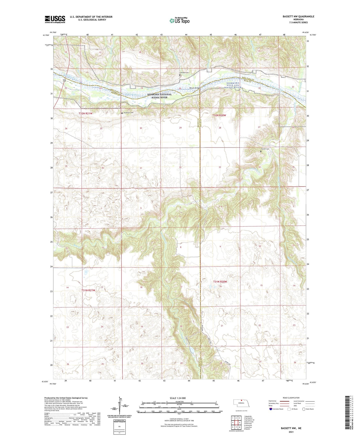
2021 topographic map quadrangle Bassett NW in the state of Nebraska. Scale: 1:24000. Based on the newly updated USGS 7.5' US Topo map series, this map is in the following counties: Brown, Rock, Keya Paha. The map contains contour data, water features, and other items you are used to seeing on USGS maps, but also has updated roads and other features. This is the next generation of topographic maps. Printed on high-quality waterproof paper with UV fade-resistant inks.
Quads adjacent to this one:
West: Dutch Creek
Northwest: Meadville
North: Springview
Northeast: Springview SE
East: Riverview
Southeast: Bassett
South: Long Pine
Southwest: Ainsworth
This map covers the same area as the classic USGS quad with code o42099f6.
Contains the following named places: Beeman Creek, Bone Creek, Brinkerhoff Election Precinct, Camp Meeting Ground, Cuba Church, Devils Canyon, Dry Creek, Huishizer Cemetery, Leonard Cemetery, Long Pine Creek, Luckey Creek, McLain Bridge, North Pine Election Precinct, Pine Glen State Wildlife Management Area, Prosser Creek, Putnam Cemetery, Rickman Creek, School Number 26, School Number 29, Short Pine Creek, Thomas Creek, Township of Brinkerhoff, Winfield, Winfield Post Office, Winfield School