MyTopo
Angora Nebraska US Topo Map
Couldn't load pickup availability
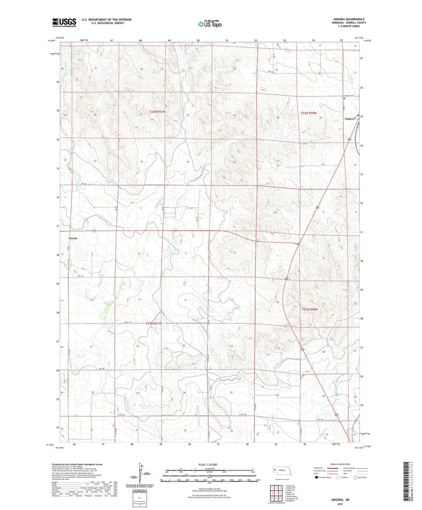
2021 topographic map quadrangle Angora in the state of Nebraska. Scale: 1:24000. Based on the newly updated USGS 7.5' US Topo map series, this map is in the following counties: Morrill. The map contains contour data, water features, and other items you are used to seeing on USGS maps, but also has updated roads and other features. This is the next generation of topographic maps. Printed on high-quality waterproof paper with UV fade-resistant inks.
Quads adjacent to this one:
West: Bayard
Northwest: Bayard NE
North: Angora NW
Northeast: Angora NE
East: Angora SE
Southeast: Bridgeport
South: Bridgeport NW
Southwest: South Bayard
Contains the following named places: Angora, Angora Cemetery, Angora Public School, Blackburn Dam, Blackburn Reservoir, Haynes Station, Loomis Dam, Loomis Reservoir, Perrin, School No C-14, School Number 73, West Water Creek, West Water Creek Dam, West Water Creek Reservoir