MyTopo
South Bayard Nebraska US Topo Map
Couldn't load pickup availability
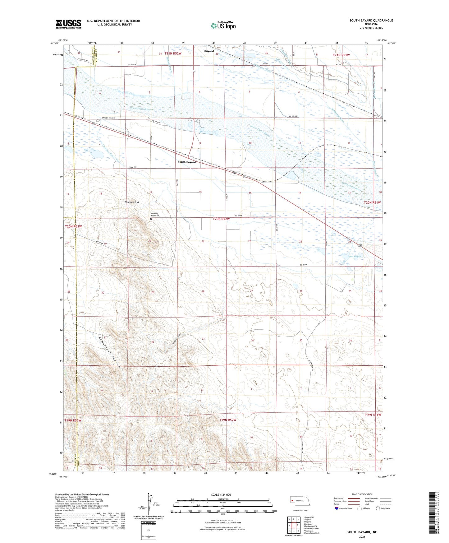
2021 topographic map quadrangle South Bayard in the state of Nebraska. Scale: 1:24000. Based on the newly updated USGS 7.5' US Topo map series, this map is in the following counties: Morrill, Banner, Scotts Bluff. The map contains contour data, water features, and other items you are used to seeing on USGS maps, but also has updated roads and other features. This is the next generation of topographic maps. Printed on high-quality waterproof paper with UV fade-resistant inks.
Quads adjacent to this one:
West: McGrew
Northwest: Bayard SW
North: Bayard
Northeast: Angora
East: Bridgeport NW
Southeast: Roundhouse Rock
South: Redington
Southwest: Hackberry Creek
This map covers the same area as the classic USGS quad with code o41103f3.
Contains the following named places: Bayard Drain, Bedding Canyon, Chimney Rock, Chimney Rock Canal, Chimney Rock Cemetery, Chimney Rock National Historic Site, Chimney Rock Pony Express Station, Chimney Rock Post Office, East Bayard, Facus Springs, McManigal Canyon, Oregon Trail Wagon Train Campground, School Number 13, School Number 50, South Bayard, Wildhorse Drain