MyTopo
Bayard Nebraska US Topo Map
Couldn't load pickup availability
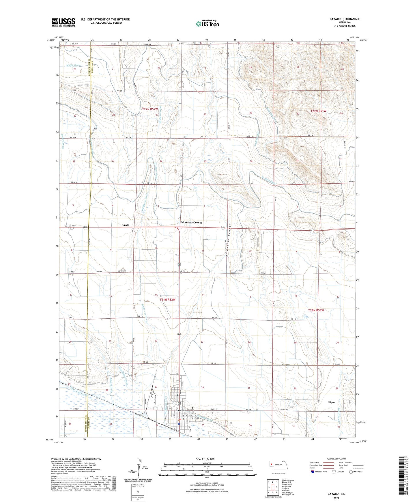
2021 topographic map quadrangle Bayard in the state of Nebraska. Scale: 1:24000. Based on the newly updated USGS 7.5' US Topo map series, this map is in the following counties: Morrill, Scotts Bluff. The map contains contour data, water features, and other items you are used to seeing on USGS maps, but also has updated roads and other features. This is the next generation of topographic maps. Printed on high-quality waterproof paper with UV fade-resistant inks.
Quads adjacent to this one:
West: Bayard SW
Northwest: Lake Minatare
North: Bayard NE
Northeast: Angora NW
East: Angora
Southeast: Bridgeport NW
South: South Bayard
Southwest: McGrew
Contains the following named places: Assembly of God Church, Assumption Greek Orthodox Church, Bayard, Bayard Chimney Rock Museum, Bayard Clinic, Bayard Elementary School, Bayard Fire and Rescue, Bayard Memorial Chapel, Bayard Police Department, Bayard Post Office, Bayard Public Library, Bayard Secondary School, Chimney Rock Clinic, Chimney Rock Golf Course, Chimney Rock Medical Center, Chimney Rock Villa Home, Church of Christ, City of Bayard, Community Bible Church, Craft, Davidson Dam, Davidson Reservoir, East Bayard Election Precinct, Hope Congregational Church, Kelley Bean Company Incorporated Elevator, Lowline Canal, Moomaw Corner, Mount Calvary Lutheran Church, Ninemile Canal, Piper, Sacred Heart Catholic Church, School Number 61, School Number 73, School Number 96, Short Line Canal, Stuckenhole Drain, Trinidad Bean and Elevator Company Elevator, United Church of Christ, United Methodist Church, Wildhorse Canyon, Wildhorse Church, Wildhorse Dam 14-A, Wildhorse Dam 5-A, Wildhorse Reservoir 14-A, Wildhorse Reservoir 5-A, ZIP Code: 69334