
MyTopo
Big Springs Nebraska US Topo Map
Couldn't load pickup availability
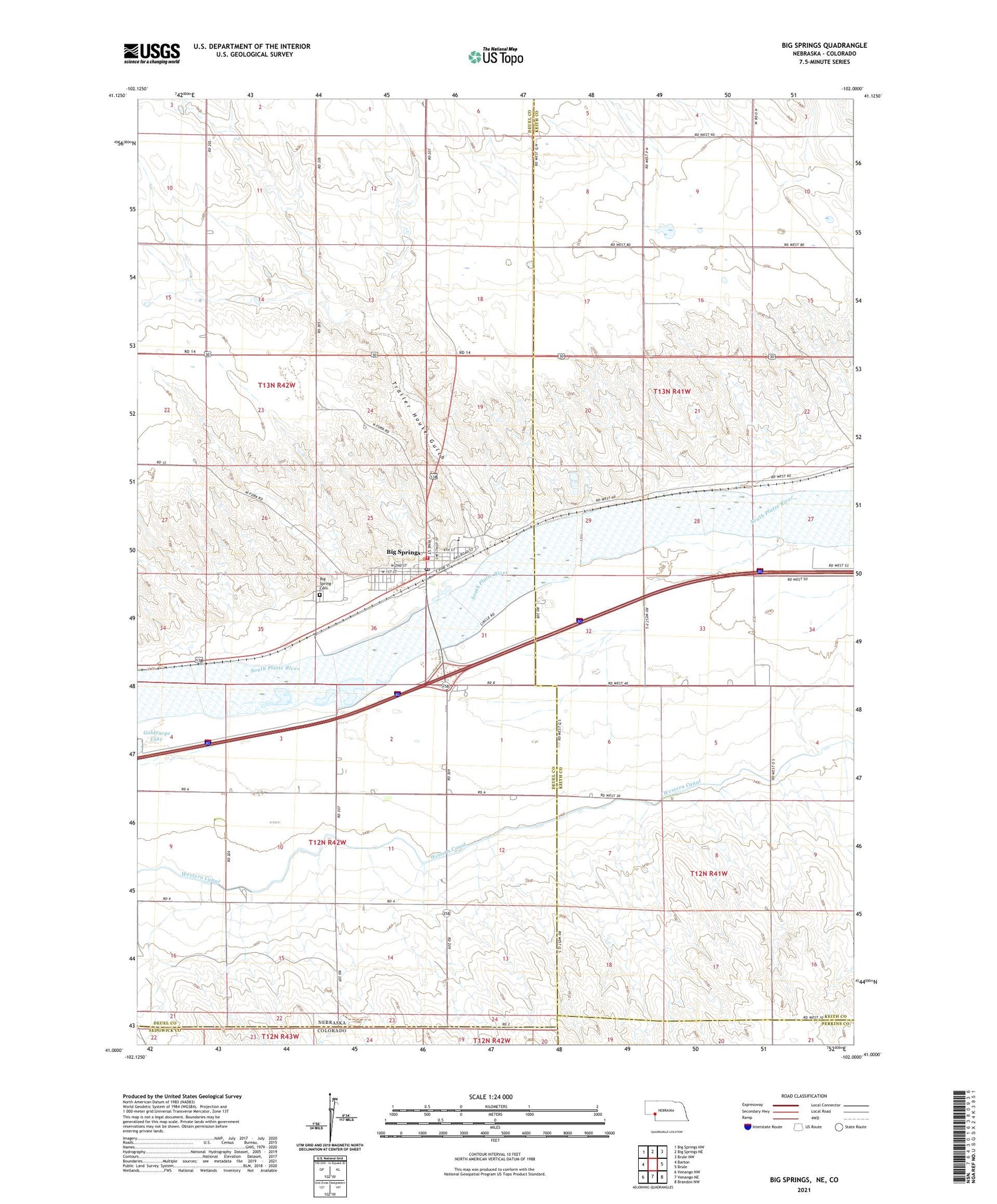
2021 topographic map quadrangle Big Springs in the state of Nebraska. Scale: 1:24000. Based on the newly updated USGS 7.5' US Topo map series, this map is in the following counties: Deuel, Keith, Perkins, Sedgwick. The map contains contour data, water features, and other items you are used to seeing on USGS maps, but also has updated roads and other features. This is the next generation of topographic maps. Printed on high-quality waterproof paper with UV fade-resistant inks.
Quads adjacent to this one:
West: Barton
Northwest: Big Springs NW
North: Big Springs NE
Northeast: Brule NW
East: Brule
Southeast: Brandon NW
South: Venango NE
Southwest: Venango NW
Contains the following named places: Assembly of God Church, Big Spring Cemetery, Big Springs, Big Springs Junction, Big Springs Post Office, Big Springs Public Library, Big Springs Volunteer Fire and Rescue, Cottonwood Corner School, Eiker Park, Farmers Cooperative Elevator Association Elevator, McGreer Camper Park, Newman Airport, Phelps Hotel Historical Marker, Sam Bass and the Big Springs Robbery Historical Marker, School Number 30, South Platte Elementary School, South Platte High School, Trailer House Gulch, United Methodist Church, Valley Medical Clinic, Village of Big Springs, Waterman Sod House Historical Marker, Western Canal, Zion Lutheran Church


