MyTopo
Bloomfield Nebraska US Topo Map
Couldn't load pickup availability
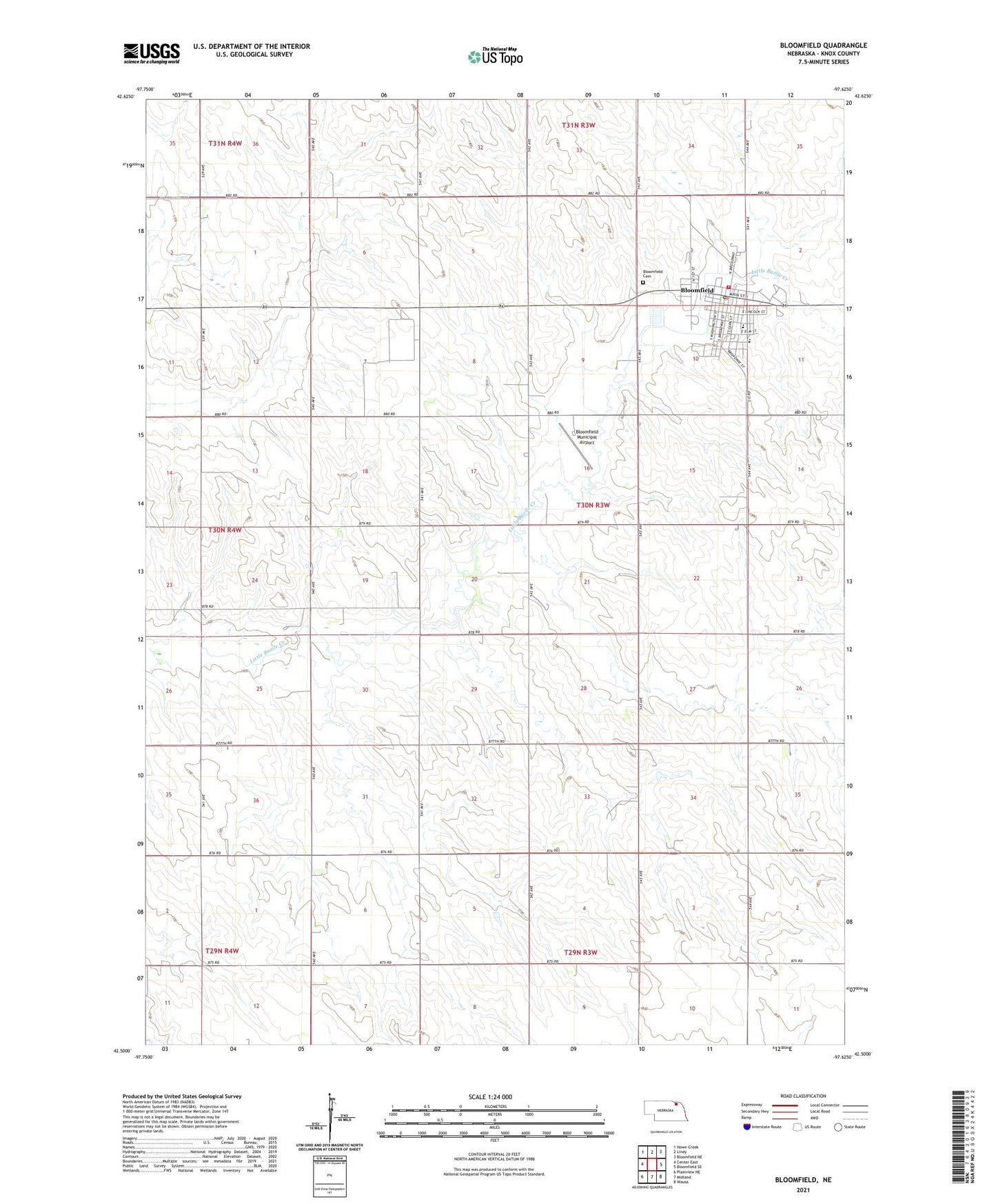
2021 topographic map quadrangle Bloomfield in the state of Nebraska. Scale: 1:24000. Based on the newly updated USGS 7.5' US Topo map series, this map is in the following counties: Knox. The map contains contour data, water features, and other items you are used to seeing on USGS maps, but also has updated roads and other features. This is the next generation of topographic maps. Printed on high-quality waterproof paper with UV fade-resistant inks.
Quads adjacent to this one:
West: Center East
Northwest: Howe Creek
North: Lindy
Northeast: Bloomfield NE
East: Bloomfield SE
Southeast: Wausa
South: Midland
Southwest: Plainview NE
Contains the following named places: Bloomfield, Bloomfield Ambulance Service, Bloomfield Cemetery, Bloomfield City Park, Bloomfield Dental Clinic, Bloomfield Elementary School, Bloomfield Fair Grounds, Bloomfield Fire Department - Bloomfield Rural Fire Department, Bloomfield Good Samaritan Center, Bloomfield Junior - Senior High School, Bloomfield Municipal Airport, Bloomfield Police Department, Bloomfield Post Office, Bloomfield Public Library, Bloomfield Trailer Court, Bloomfield Vision Clinic, Butte Creek Farmers Co-op Elevator, City of Bloomfield, First Trinity Lutheran Church, M G Waldbaum Company Elevator, Saint Andrews Catholic Church, Saint Marks Lutheran Church, Township of Morton, United Methodist Church