MyTopo
Lindy Nebraska US Topo Map
Couldn't load pickup availability
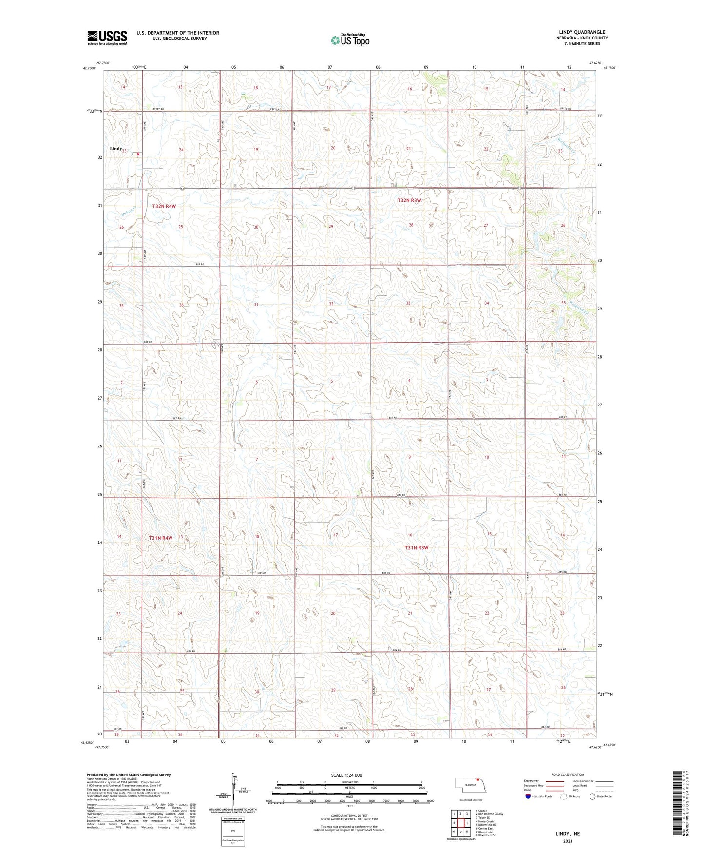
2021 topographic map quadrangle Lindy in the state of Nebraska. Scale: 1:24000. Based on the newly updated USGS 7.5' US Topo map series, this map is in the following counties: Knox. The map contains contour data, water features, and other items you are used to seeing on USGS maps, but also has updated roads and other features. This is the next generation of topographic maps. Printed on high-quality waterproof paper with UV fade-resistant inks.
Quads adjacent to this one:
West: Howe Creek
Northwest: Santee
North: Bon Homme Colony
Northeast: Tabor SE
East: Bloomfield NE
Southeast: Bloomfield SE
South: Bloomfield
Southwest: Center East
This map covers the same area as the classic USGS quad with code o42097f6.
Contains the following named places: Bloomfield Fire Department - Bloomfield Rural Fire Department Lindy Station, Lindy, Lindy Census Designated Place, Township of Addison, Township of Peoria, ZIP Code: 68718