MyTopo
Campbell Nebraska US Topo Map
Couldn't load pickup availability
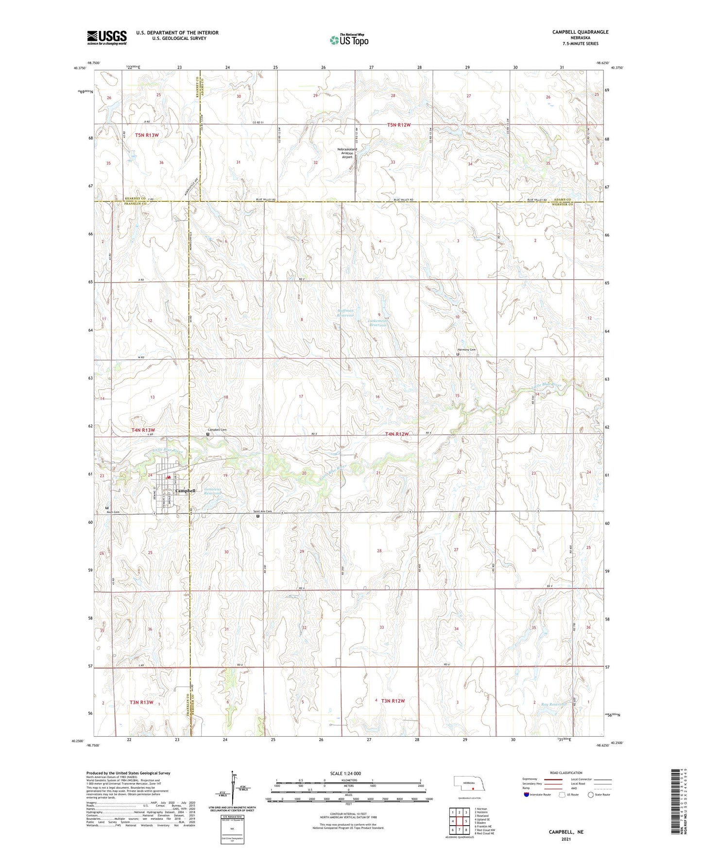
2021 topographic map quadrangle Campbell in the state of Nebraska. Scale: 1:24000. Based on the newly updated USGS 7.5' US Topo map series, this map is in the following counties: Webster, Adams, Franklin, Kearney. The map contains contour data, water features, and other items you are used to seeing on USGS maps, but also has updated roads and other features. This is the next generation of topographic maps. Printed on high-quality waterproof paper with UV fade-resistant inks.
Quads adjacent to this one:
West: Upland SE
Northwest: Norman
North: Holstein
Northeast: Roseland
East: Bladen
Southeast: Red Cloud NE
South: Red Cloud NW
Southwest: Franklin NE
Contains the following named places: Campbell, Campbell Cemetery, Campbell Post Office, Campbell Public Library, Campbell Public School, Campbell Rural Fire District, Campbell Volunteer Fire Department, Franklin County Memorial Hospital Campbell Medical Clinic, Genereux Dam, Genereux Reservoir, Grandview Manor Nursing Home, Harmony Cemetery, Hoffman Dam, Hoffman Reservoir, Koch Cemetery, Lutkemeier Dam, Lutkemeier Reservoir, Nebraskaland Aviation Airport, Presbyterian Church, Ray Dam, Ray Reservoir, Saint Ann Cemetery, Saint Anne Catholic Church, Township of Catherton, Township of Harmony, Trinity Evangelical Lutheran Church, Vance Dam, Vance Reservoir, Village of Campbell, ZIP Code: 68932