MyTopo
Roseland Nebraska US Topo Map
Couldn't load pickup availability
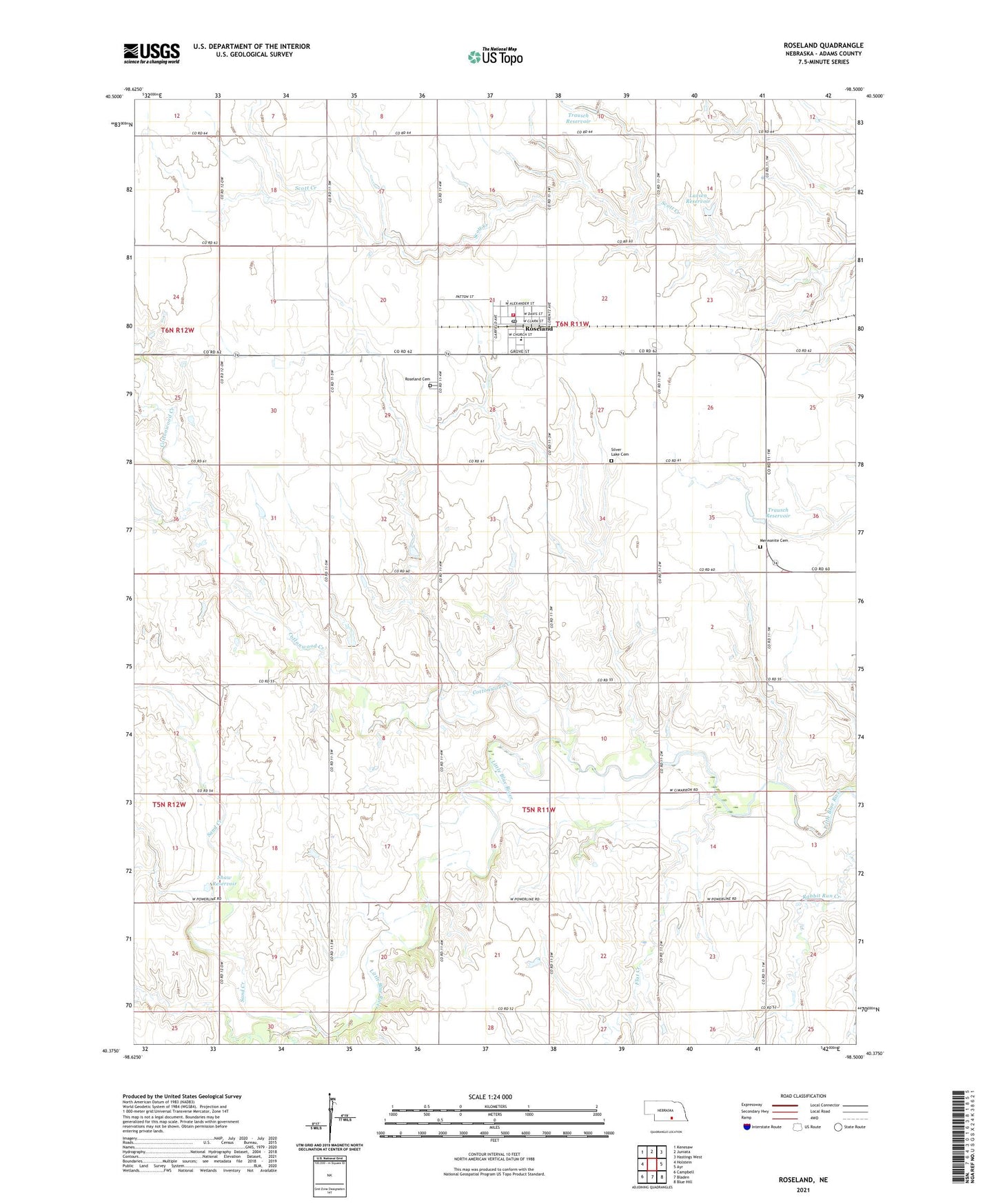
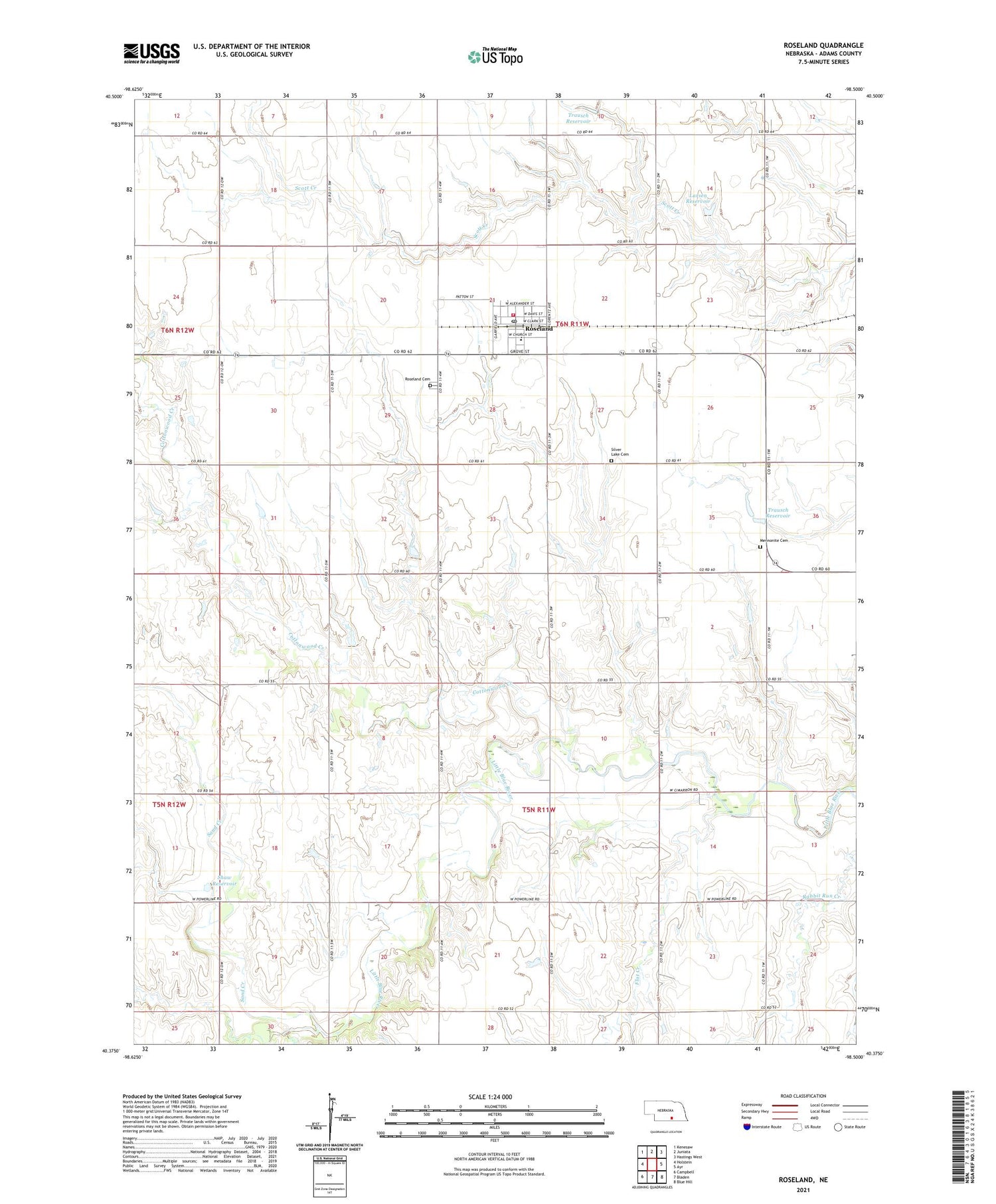
2021 topographic map quadrangle Roseland in the state of Nebraska. Scale: 1:24000. Based on the newly updated USGS 7.5' US Topo map series, this map is in the following counties: Adams. The map contains contour data, water features, and other items you are used to seeing on USGS maps, but also has updated roads and other features. This is the next generation of topographic maps. Printed on high-quality waterproof paper with UV fade-resistant inks.
Quads adjacent to this one:
West: Holstein
Northwest: Kenesaw
North: Juniata
Northeast: Hastings West
East: Ayr
Southeast: Blue Hill
South: Bladen
Southwest: Campbell
This map covers the same area as the classic USGS quad with code o40098d5.
Contains the following named places: Agri Co-op Elevator, Cottonwood Creek, Flat Creek, Larsen Reservoir, Larsen Reservoir Dam, Mennonite Cemetery, Roseland, Roseland Cemetery, Roseland Post Office, Roseland Volunteer Fire Department, Sacred Heart Church, Sand Creek, Shaw Dam, Shaw Reservoir, Silver Lake Cemetery, Silver Lake High School, Township of Roseland, Township of Silver Lake, Trausch Dam, Trausch Reservoir, Village of Roseland, ZIP Code: 68973