MyTopo
Carns Nebraska US Topo Map
Couldn't load pickup availability
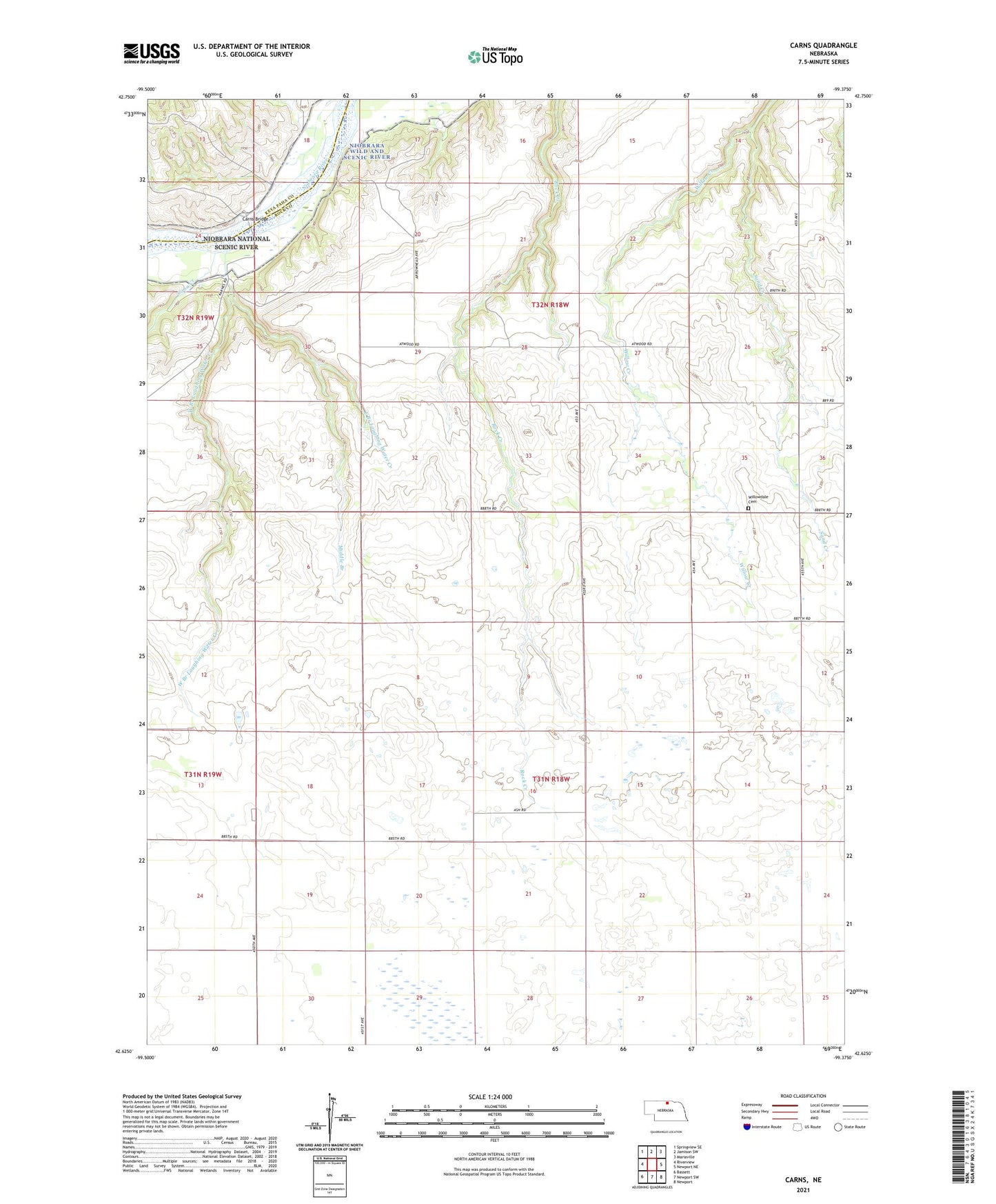
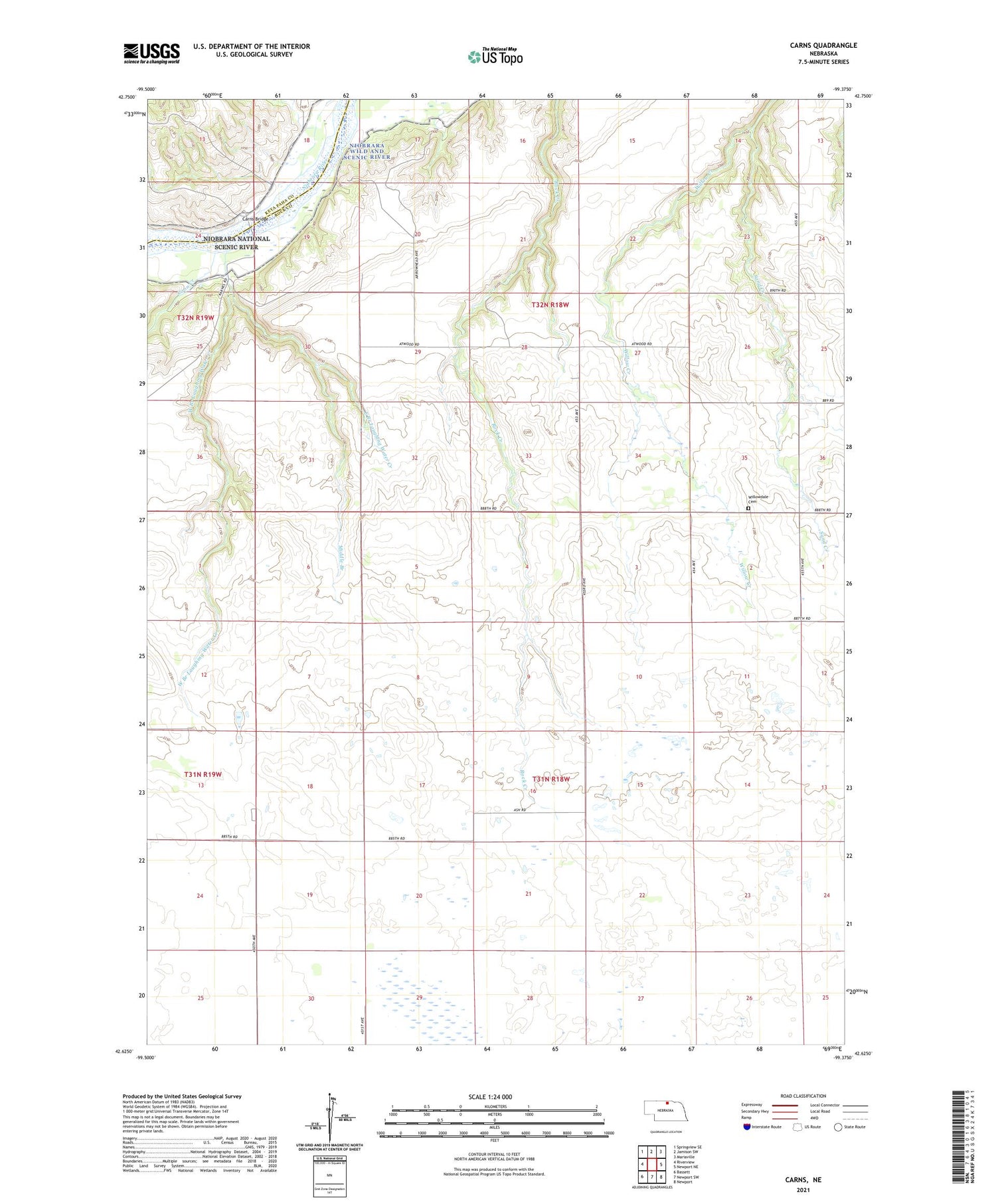
2021 topographic map quadrangle Carns in the state of Nebraska. Scale: 1:24000. Based on the newly updated USGS 7.5' US Topo map series, this map is in the following counties: Rock, Keya Paha. The map contains contour data, water features, and other items you are used to seeing on USGS maps, but also has updated roads and other features. This is the next generation of topographic maps. Printed on high-quality waterproof paper with UV fade-resistant inks.
Quads adjacent to this one:
West: Riverview
Northwest: Springview SE
North: Jamison SW
Northeast: Mariaville
East: Newport NE
Southeast: Newport
South: Newport SW
Southwest: Bassett
Contains the following named places: Carns, Carns Bridge, Carns Post Office, Coon Creek, Dugger School, East Branch Laughing Water Creek, Laughing Water Creek, Long Pine Election Precinct, Mariaville School, Middle Branch, Rock Creek School, Sand Creek, Township of Long Pine, Turkey Foot School, West Branch Laughing Water Creek, Willowdale Cemetery, Willowdale School