MyTopo
Bassett Nebraska US Topo Map
Couldn't load pickup availability
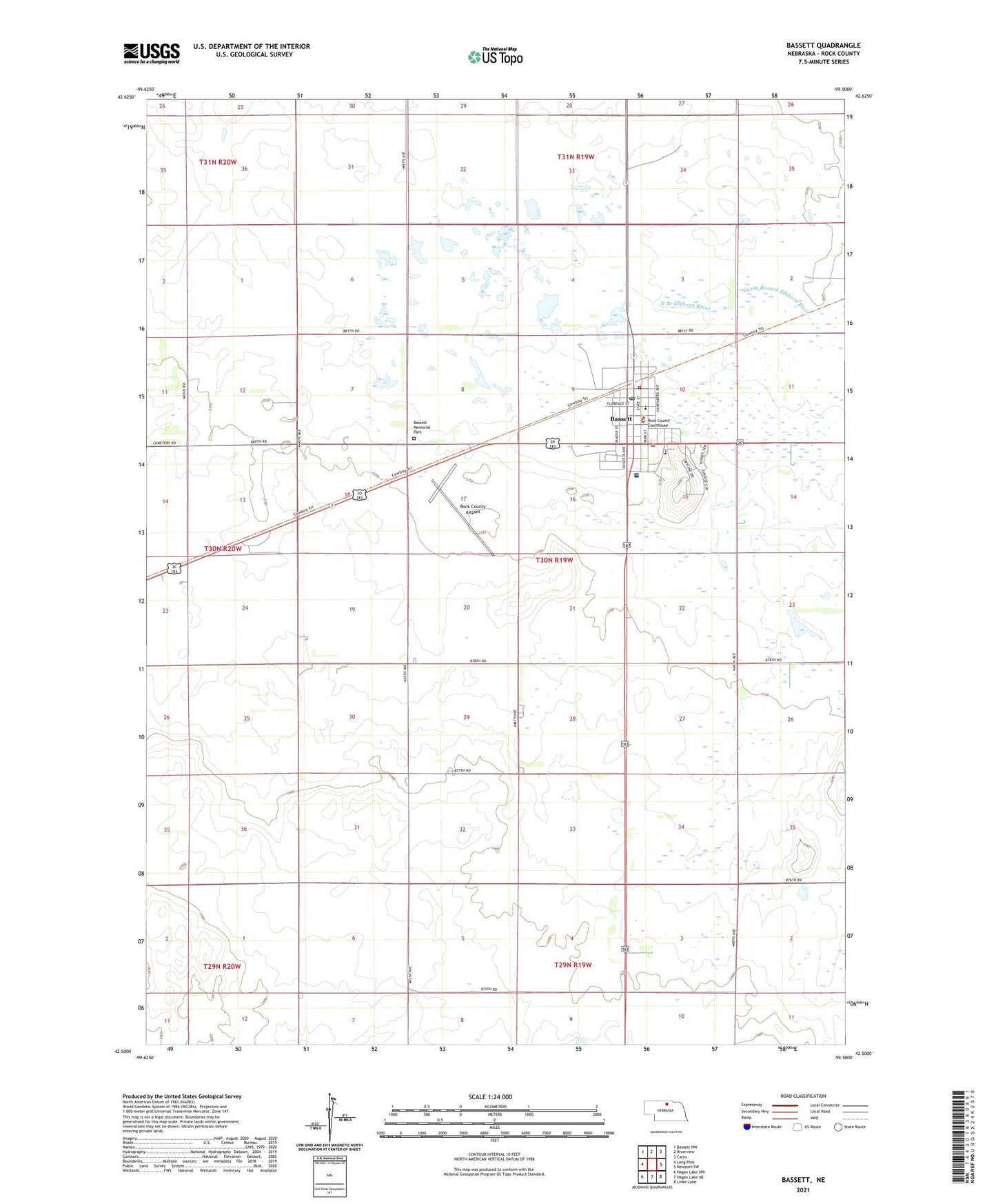
2021 topographic map quadrangle Bassett in the state of Nebraska. Scale: 1:24000. Based on the newly updated USGS 7.5' US Topo map series, this map is in the following counties: Rock. The map contains contour data, water features, and other items you are used to seeing on USGS maps, but also has updated roads and other features. This is the next generation of topographic maps. Printed on high-quality waterproof paper with UV fade-resistant inks.
Quads adjacent to this one:
West: Long Pine
Northwest: Bassett NW
North: Riverview
Northeast: Carns
East: Newport SW
Southeast: Linke Lake
South: Hagan Lake NE
Southwest: Hagan Lake NW
This map covers the same area as the classic USGS quad with code o42099e5.
Contains the following named places: Bassett, Bassett Assembly of God Church, Bassett Country Club, Bassett Dental Clinic, Bassett Election Precinct, Bassett Grade School, Bassett Memorial Park, Bassett Police Department, Bassett Post Office, Bassett Tourist Park, Bassett Volunteer Fire Department, City of Bassett, Emmanuel Southern Baptist Church, Frauen Ranch, Holy Cross Catholic Church, Rock County Airport, Rock County Ambulance Association, Rock County Clinic, Rock County Court House, Rock County Fairgrounds, Rock County High School, Rock County Hospital, Rock County Long Term Care, Rock County Public Library, Rock County Sheriff's Office, Saint Peters Lutheran Church, School Number 15, School Number 17, Township of Bassett, United Methodist Church, Valley Grove Church