MyTopo
Clatonia Nebraska US Topo Map
Couldn't load pickup availability
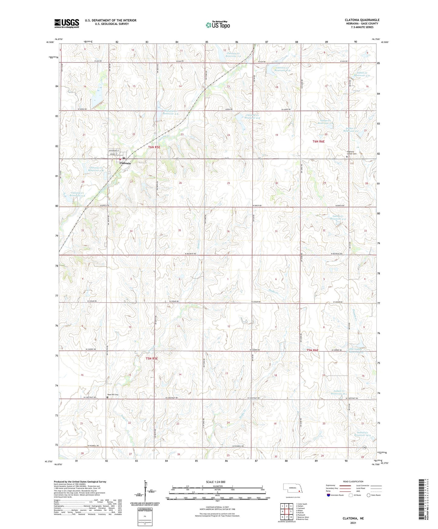
2021 topographic map quadrangle Clatonia in the state of Nebraska. Scale: 1:24000. Based on the newly updated USGS 7.5' US Topo map series, this map is in the following counties: Gage. The map contains contour data, water features, and other items you are used to seeing on USGS maps, but also has updated roads and other features. This is the next generation of topographic maps. Printed on high-quality waterproof paper with UV fade-resistant inks.
Quads adjacent to this one:
West: Wilber
Northwest: Crete South
North: Hallam
Northeast: Cortland
East: Pickrell
Southeast: Beatrice East
South: Beatrice West
Southwest: Plymouth
Contains the following named places: Barkley School, Clatonia, Clatonia Creek Dam 2-A, Clatonia Creek Dam 2-B, Clatonia Creek Dam 3-A, Clatonia Creek Dam 4-A, Clatonia Creek Dam 6-A, Clatonia Creek Dam 7-A, Clatonia Creek Dam 8-D, Clatonia Creek Reservoir 2-A, Clatonia Creek Reservoir 2-B, Clatonia Creek Reservoir 3-A, Clatonia Creek Reservoir 4-A, Clatonia Creek Reservoir 6-A, Clatonia Creek Reservoir 7-A, Clatonia Creek Reservoir 8-D, Clatonia Post Office, Clatonia Rescue Squad, Clatonia School, Clatonia Suburban Fire Department, Farmers Cooperative Elevator, Highland Center Cemetery, Indian Creek Dam 16-1, Indian Creek Dam 16-A, Indian Creek Dam 2-A, Indian Creek Dam 3-A, Indian Creek Dam 3-B, Indian Creek Dam 3-C, Indian Creek Reservoir 16-1, Indian Creek Reservoir 16-A, Indian Creek Reservoir 2-A, Indian Creek Reservoir 3-A, Indian Creek Reservoir 3-B, Indian Creek Reservoir 3-C, Little Indian Creek Dam 15-A, Little Indian Creek Reservoir 15, Moon School, Prairie Star School, Prince Henry School, Rose Hill Cemetery, Russell School, Saint Pauls Church, School Number 42, Township of Clatonia, Township of Grant, Village of Clatonia, ZIP Code: 68328