MyTopo
Curtis Nebraska US Topo Map
Couldn't load pickup availability
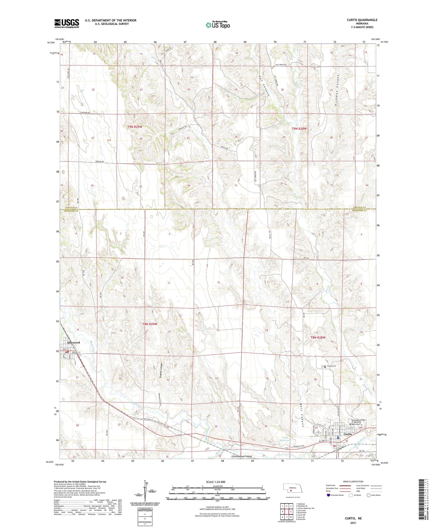
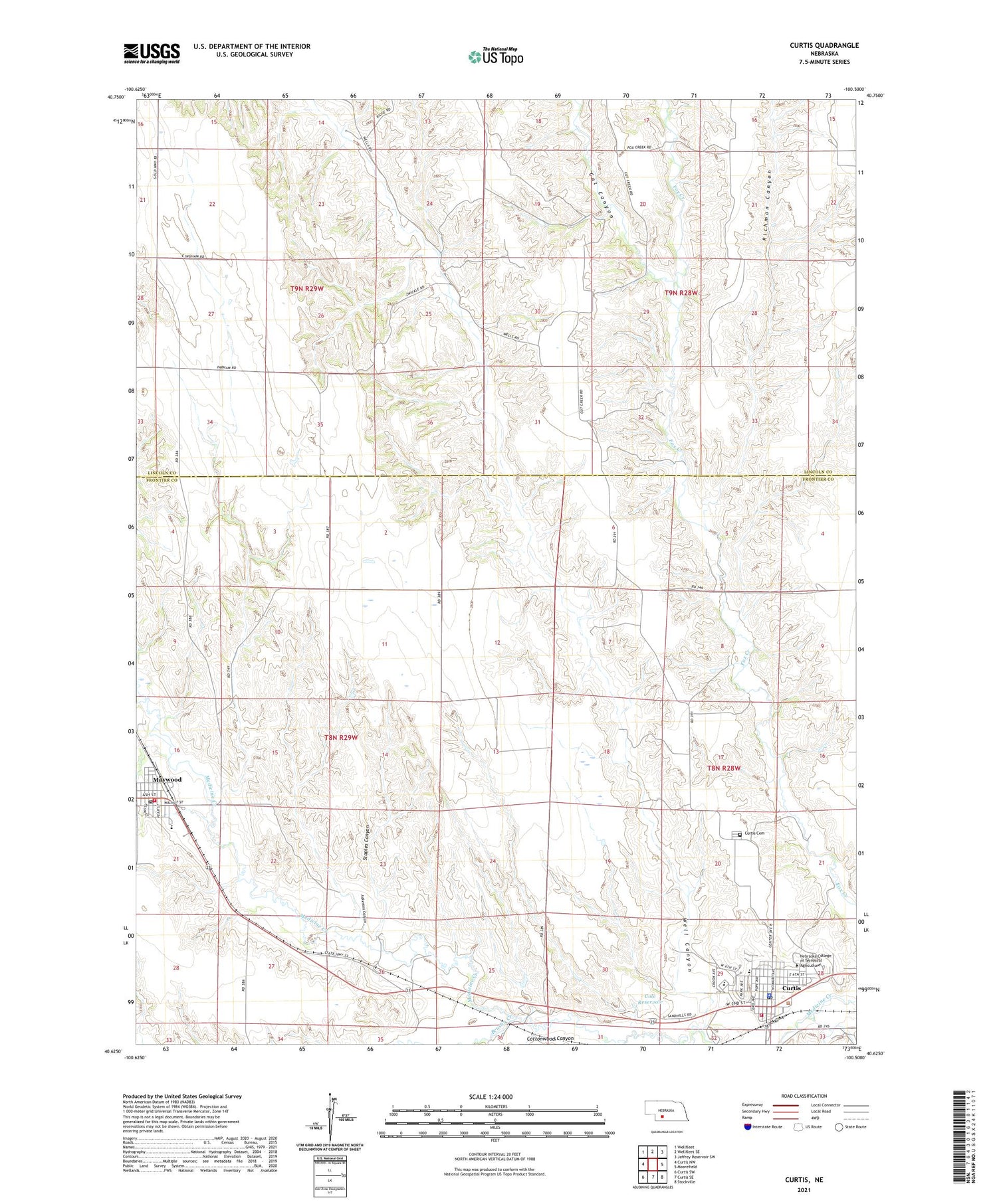
2021 topographic map quadrangle Curtis in the state of Nebraska. Scale: 1:24000. Based on the newly updated USGS 7.5' US Topo map series, this map is in the following counties: Frontier, Lincoln. The map contains contour data, water features, and other items you are used to seeing on USGS maps, but also has updated roads and other features. This is the next generation of topographic maps. Printed on high-quality waterproof paper with UV fade-resistant inks.
Quads adjacent to this one:
West: Curtis NW
Northwest: Wellfleet
North: Wellfleet SE
Northeast: Jeffrey Reservoir SW
East: Moorefield
Southeast: Stockville
South: Curtis SE
Southwest: Curtis SW
Contains the following named places: Aakenson Canyon, Baha'i Faith, Berean Fundamental Church, Brushy Creek, City of Curtis, Cole Dam, Cole Reservoir, Cottonwood Canyon, Curtis, Curtis Cemetery, Curtis Medical Center, Curtis Police Department, Curtis Post Office, Curtis Volunteer Fire Department, Cut Canyon, East Laird Election Precinct, Frontier County Ambulance Services Curtis, Frontier County Ambulance Services Maywood, Frontier County Sheriff's Office, Hansen Memorial Reserve State Wildlife Management Area, Klyte Burt Memorial Library, Lutheran Church, Maywood, Maywood Christian Church, Maywood Co-op Elevator, Maywood Post Office, Maywood Public Schools, Maywood Volunteer Fire Department, Medicine Valley Elementary School, Medicine Valley Junior-Senior High School, Nebraska College of Technical Agriculture, Richman Canyon, Saint James Catholic Church, Saint Johns Lutheran Church, Staples Canyon, Sunset Haven, Township of Laird East, United Church of Christ, United Methodist Church, Village of Maywood, Vineyard Faith Fellowship Church, Well Canyon