
MyTopo
Dawson Nebraska US Topo Map
Couldn't load pickup availability
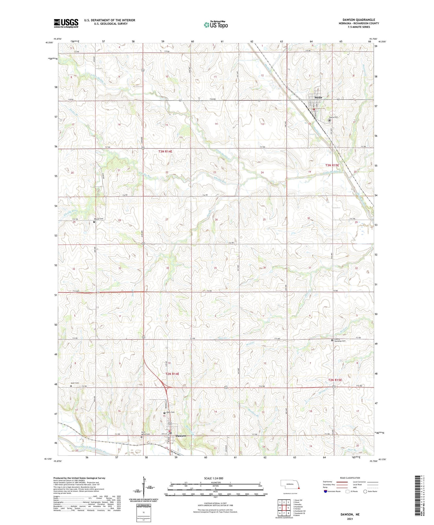
2021 topographic map quadrangle Dawson in the state of Nebraska. Scale: 1:24000. Based on the newly updated USGS 7.5' US Topo map series, this map is in the following counties: Richardson. The map contains contour data, water features, and other items you are used to seeing on USGS maps, but also has updated roads and other features. This is the next generation of topographic maps. Printed on high-quality waterproof paper with UV fade-resistant inks.
Quads adjacent to this one:
West: Humboldt
Northwest: Howe SW
North: Howe
Northeast: Nemaha
East: Verdon
Southeast: Salem
South: Humboldt SE
Southwest: Humboldt SW
Contains the following named places: Community Church, Dawson, Dawson Post Office, Dawson Rural Volunteer Fire Department, Dawson-Verdon Public Schools, Dry Branch, Grace Bible Fellowship Church, Grand Avenue School, Grant Election Precinct, Hazel-Dell School, Heim Cemetery, Hoosier Creek, John G Smith Memorial Library, Liberty Township Cemetery, Little Muddy Creek, Mound Cemetery, Mount Hope School, Porter Branch, Porter Election Precinct, Prospect Church, Saint Mary Catholic Church, Saint Marys Cemetery, Salem Grain Company Incorporated Elevator, Southeast Nebraska Consolidated Schools, Starr Cemetery, Stella, Stella Cemetery, Stella Community Library, Stella Post Office, Stella Rural Fire Department, Township of Grant, Township of Porter, Township of West Muddy, Village of Dawson, Village of Stella, West Muddy Election Precinct, Whisky Run, ZIP Code: 68442


