MyTopo
Humboldt SE Nebraska US Topo Map
Couldn't load pickup availability
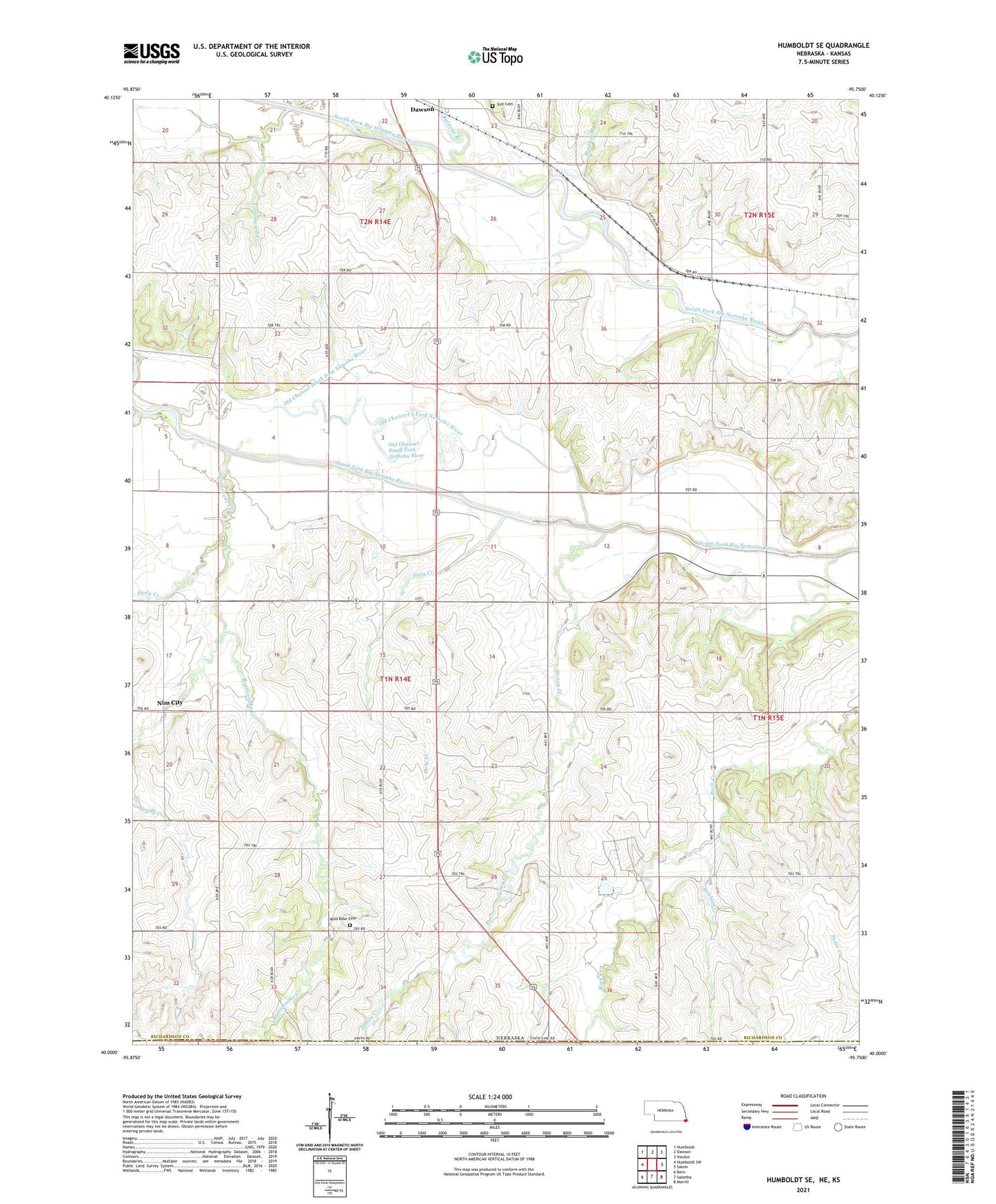
2021 topographic map quadrangle Humboldt SE in the state of Nebraska. Scale: 1:24000. Based on the newly updated USGS 7.5' US Topo map series, this map is in the following counties: Richardson, Nemaha, Brown. The map contains contour data, water features, and other items you are used to seeing on USGS maps, but also has updated roads and other features. This is the next generation of topographic maps. Printed on high-quality waterproof paper with UV fade-resistant inks.
Quads adjacent to this one:
West: Humboldt SW
Northwest: Humboldt
North: Dawson
Northeast: Verdon
East: Salem
Southeast: Morrill
South: Sabetha
Southwest: Bern
This map covers the same area as the classic USGS quad with code o40095a7.
Contains the following named places: Barneys Branch, Bethany Church, Bradley Branch, Cottonwood Creek, Dawson Oil Field, Easly Creek, Fourmile Creek, Geer Post Office, Holy Creek, Honey Creek, Honey Creek School, Iliff Cemetery, Miles Ranch, Nemaha Election Precinct, New Salem, Nim City, Old Channel South Fork Nemaha River, Rabbit Creek, Rattlesnake Creek, Spring Creek, Township of Nemaha, Wild Rose Cemetery, Zion Church, ZIP Code: 68337