MyTopo
Denton Nebraska US Topo Map
Couldn't load pickup availability
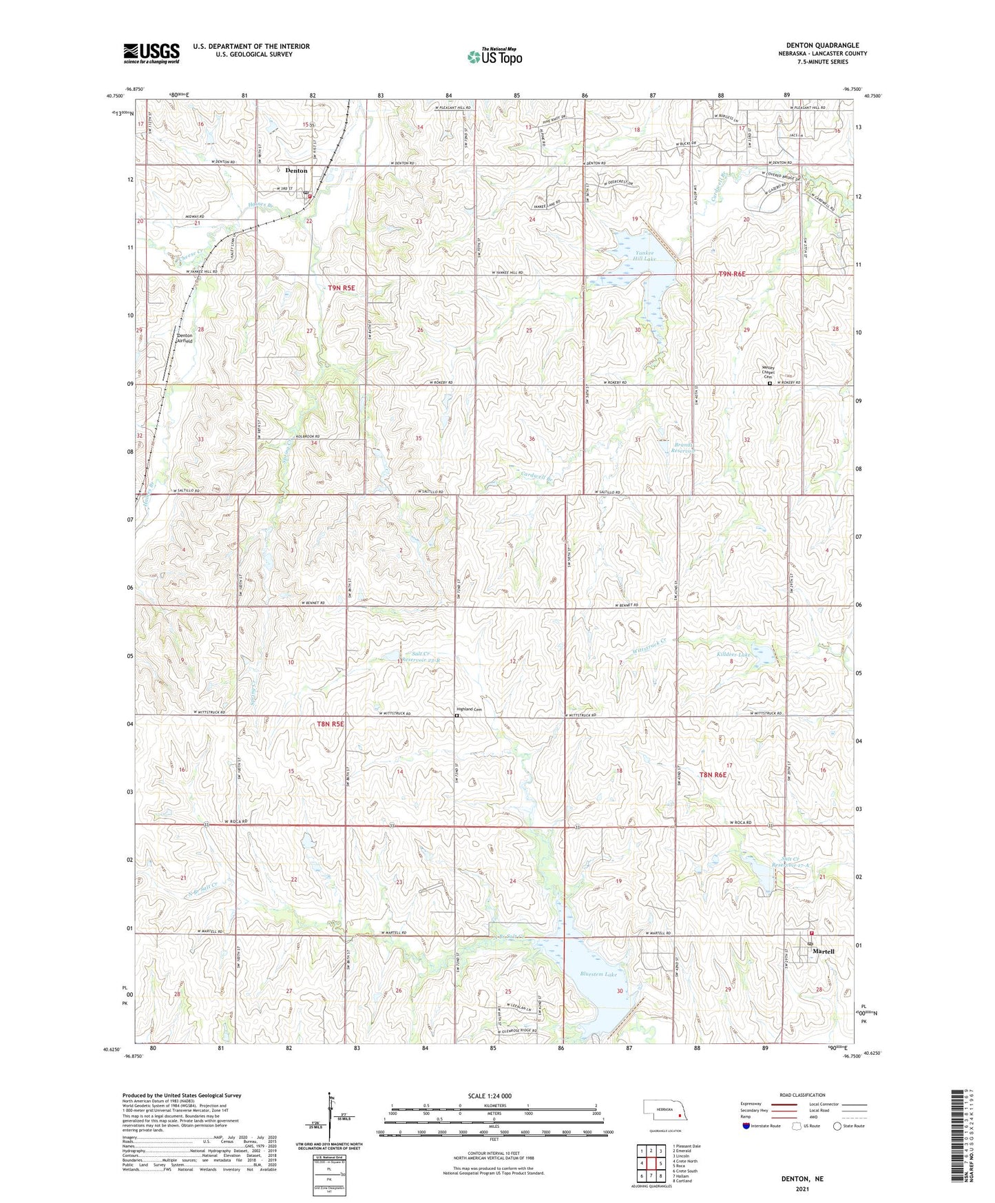
2021 topographic map quadrangle Denton in the state of Nebraska. Scale: 1:24000. Based on the newly updated USGS 7.5' US Topo map series, this map is in the following counties: Lancaster. The map contains contour data, water features, and other items you are used to seeing on USGS maps, but also has updated roads and other features. This is the next generation of topographic maps. Printed on high-quality waterproof paper with UV fade-resistant inks.
Quads adjacent to this one:
West: Crete North
Northwest: Pleasant Dale
North: Emerald
Northeast: Lincoln
East: Roca
Southeast: Cortland
South: Hallam
Southwest: Crete South
Contains the following named places: Area Five Campground, Area Three Campground, Bluestem Dam-Site 4 Dam, Bluestem Lake, Bluestem Lake State Recreation Area, Brandt Dam, Brandt Reservoir, Cheese Creek, Civilian Conservation Corps Co 2738 Historical Marker, Denton, Denton Airfield, Denton Election Precinct, Denton Post Office, Denton United Methodist Church, Highland Cemetery, Highland Election Precinct, Killdeer Lake, Killdeer Lake State Wildlife Management Area, Martell, Martell Census Designated Place, Martell Post Office, Martell United Methodist Church, North Branch Salt Creek, Saint Mary Catholic Church, Salt Creek Dam 16-A, Salt Creek Dam 17-A, Salt Creek Dam 23-B, Salt Creek Reservoir 17-A, Salt Creek Reservoir 23-B, Southwest Alliance Church, Southwest Rural Fire District Station 2, Southwest Rural Fire District Station 3, Spring Creek, Township of Denton, Township of Highland, Village of Denton, Wesley Chapel Cemetery, Yankee Hill Dam-Site 10 Dam, Yankee Hill Election Precinct, Yankee Hill Lake, Yankee Hill State Wildlife Management Area, ZIP Codes: 68339, 68523