MyTopo
Douglas Nebraska US Topo Map
Couldn't load pickup availability
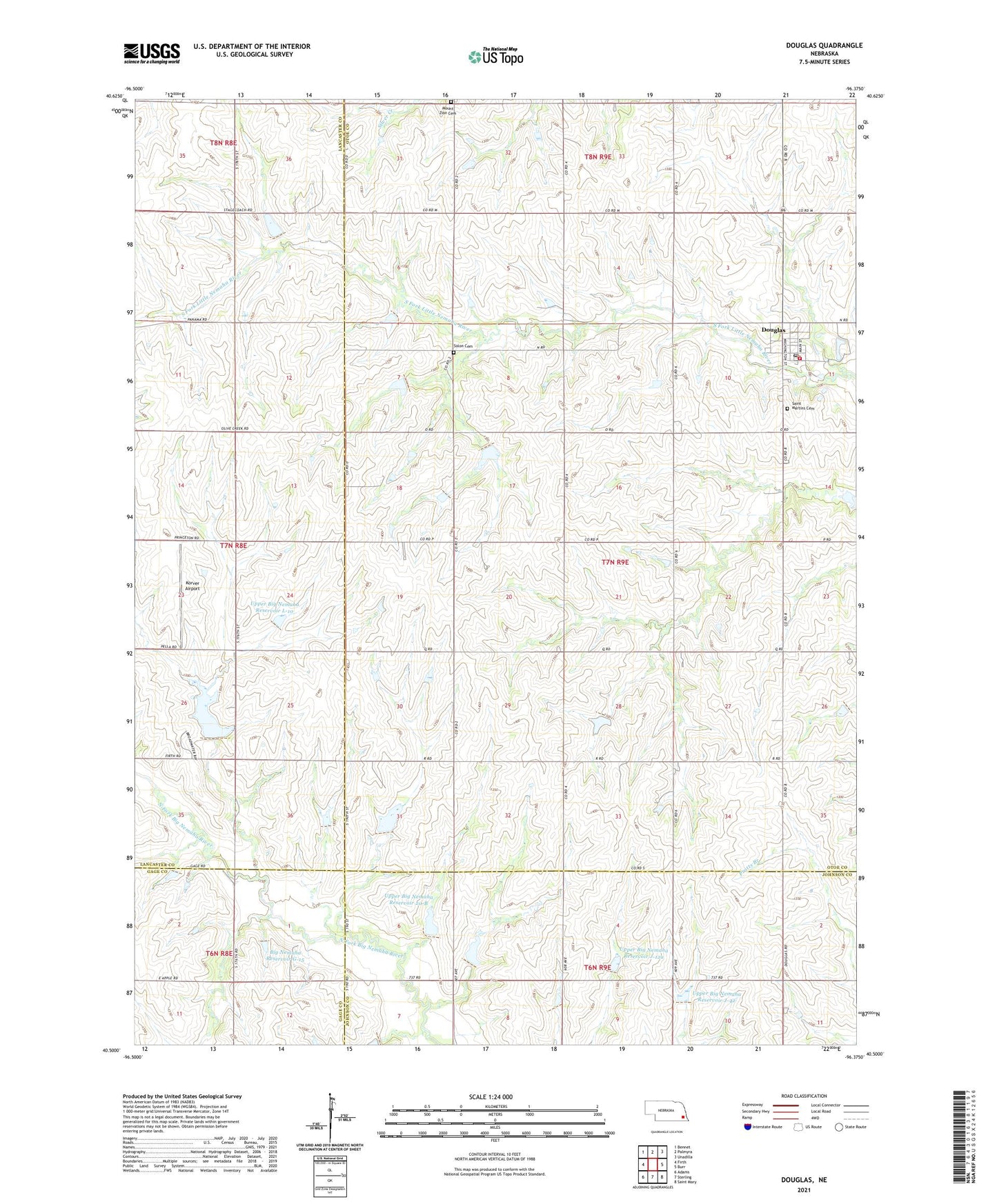
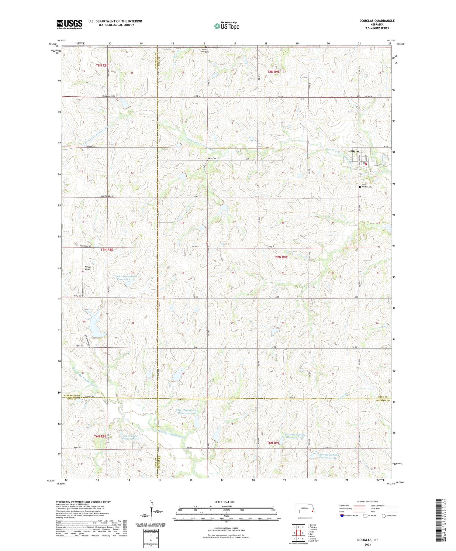
2021 topographic map quadrangle Douglas in the state of Nebraska. Scale: 1:24000. Based on the newly updated USGS 7.5' US Topo map series, this map is in the following counties: Otoe, Lancaster, Johnson, Gage. The map contains contour data, water features, and other items you are used to seeing on USGS maps, but also has updated roads and other features. This is the next generation of topographic maps. Printed on high-quality waterproof paper with UV fade-resistant inks.
Quads adjacent to this one:
West: Firth
Northwest: Bennet
North: Palmyra
Northeast: Unadilla
East: Burr
Southeast: Saint Mary
South: Sterling
Southwest: Adams
Contains the following named places: Big Nemaha Dam G-15, Big Nemaha Reservoir G-15, Douglas, Douglas Post Office, Douglas Public Library, Douglas Rescue Squad, Douglas Schools, Douglas Volunteer Fire Department, Hendricks Election Precinct, Korver Airport, Latrobe Post Office, Mount Zion Cemetery, Saint Martin Catholic Church, Saint Martins Cemetery, Solon Cemetery, Township of Hendricks, United Methodist Church, Upper Big Nemaha Dam 20-B, Upper Big Nemaha Dam 21-B, Upper Big Nemaha Dam J-12a, Upper Big Nemaha Dam J-42, Upper Big Nemaha Dam L-10, Upper Big Nemaha Reservoir 20-B, Upper Big Nemaha Reservoir 21-B, Upper Big Nemaha Reservoir J-12a, Upper Big Nemaha Reservoir J-42, Upper Big Nemaha Reservoir L-10, Village of Douglas, ZIP Code: 68344