MyTopo
Saint Mary Nebraska US Topo Map
Couldn't load pickup availability
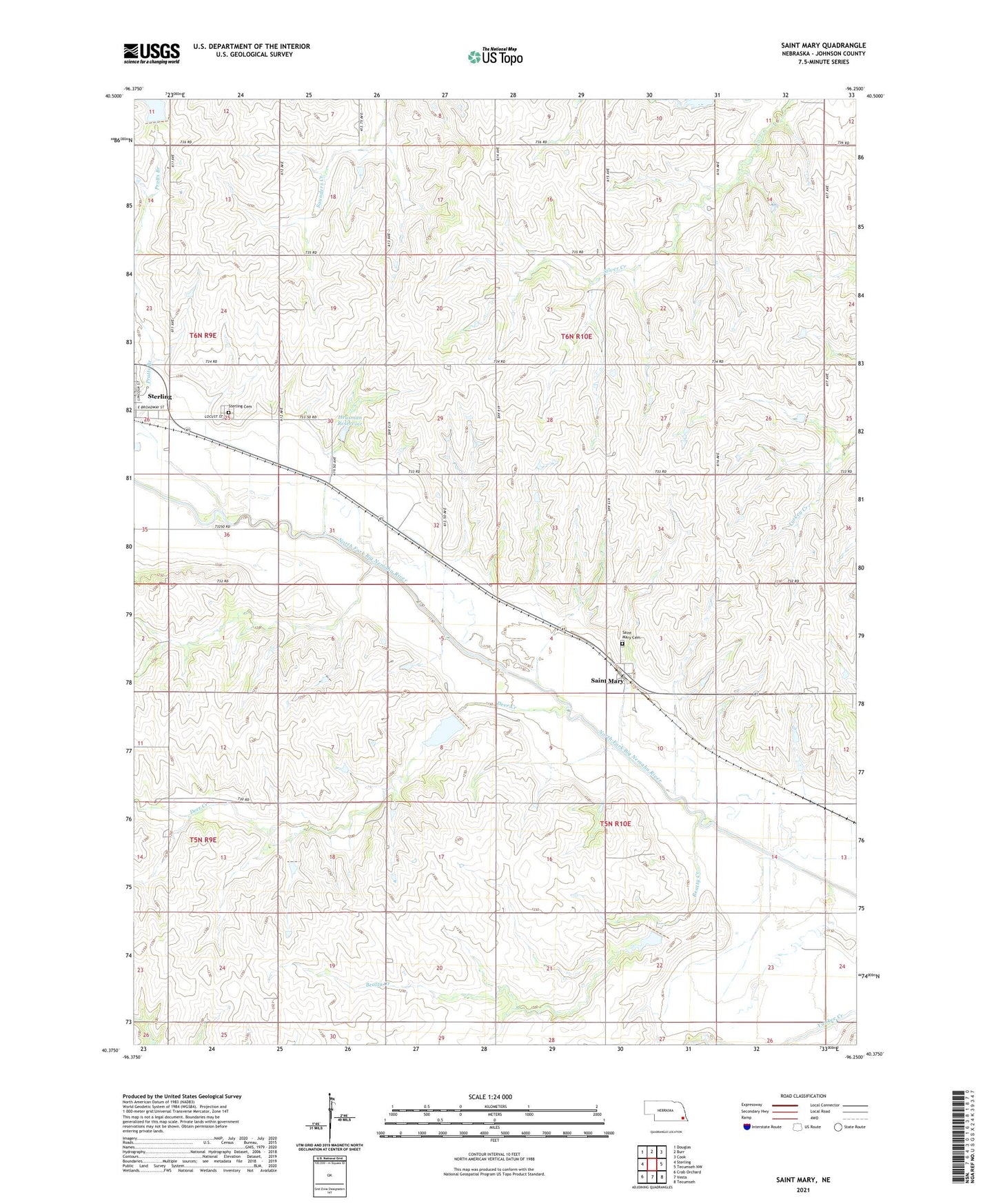
2021 topographic map quadrangle Saint Mary in the state of Nebraska. Scale: 1:24000. Based on the newly updated USGS 7.5' US Topo map series, this map is in the following counties: Johnson. The map contains contour data, water features, and other items you are used to seeing on USGS maps, but also has updated roads and other features. This is the next generation of topographic maps. Printed on high-quality waterproof paper with UV fade-resistant inks.
Quads adjacent to this one:
West: Sterling
Northwest: Douglas
North: Burr
Northeast: Cook
East: Tecumseh NW
Southeast: Tecumseh
South: Vesta
Southwest: Crab Orchard
This map covers the same area as the classic USGS quad with code o40096d3.
Contains the following named places: Beatty Creek, Deer Creek, Farmers Co-op Elevator, Helena Election Precinct, Heusman Dam, Heusman Reservoir, Johnson County, Pratts Branch, Saint Mary, Saint Mary Catholic Church, Saint Mary Cemetery, Saint Mary Post Office, Sterling Cemetery, Township of Helena, Township of Vesta, Vesta Election Precinct, ZIP Code: 68443