MyTopo
Edison Nebraska US Topo Map
Couldn't load pickup availability
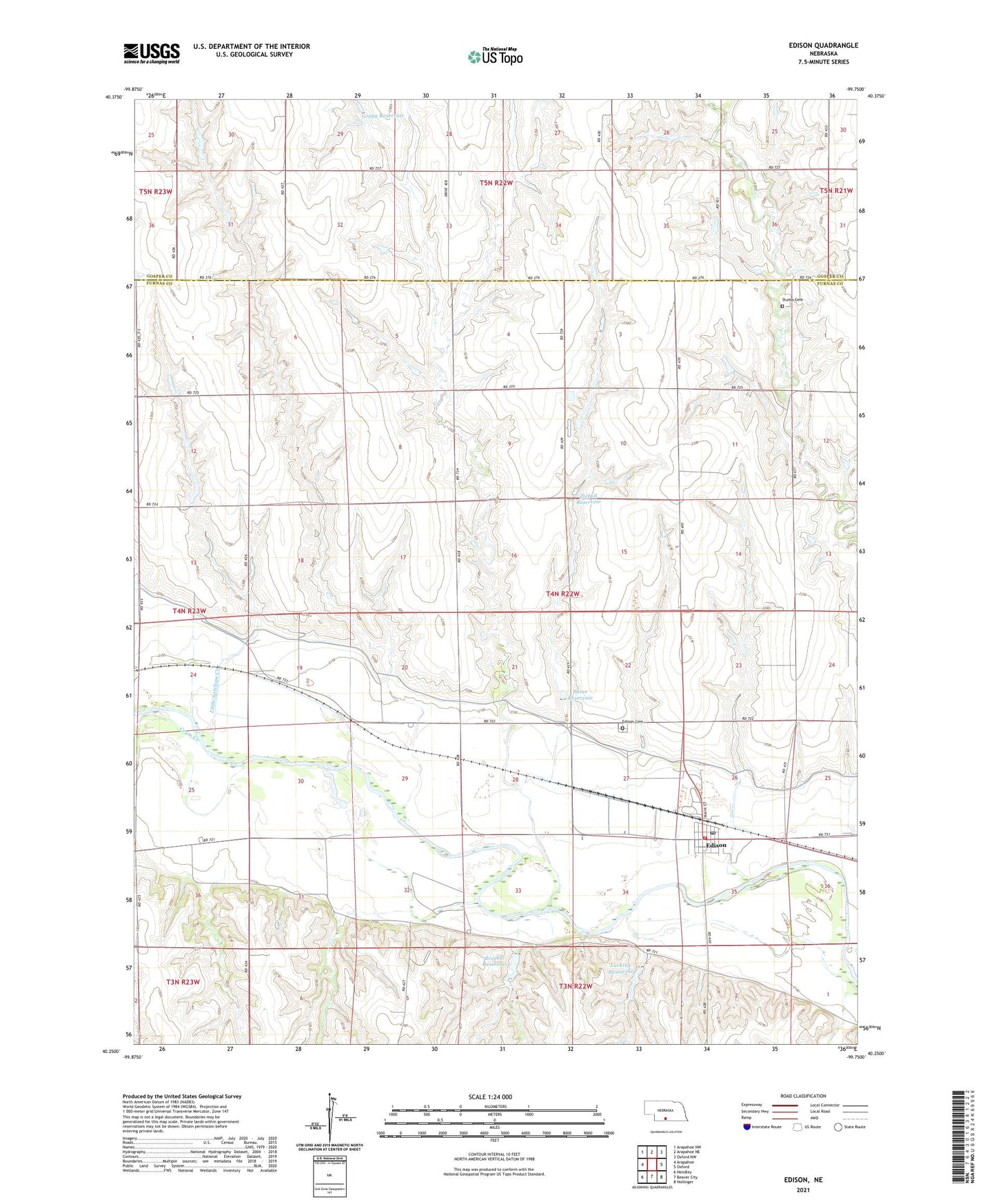
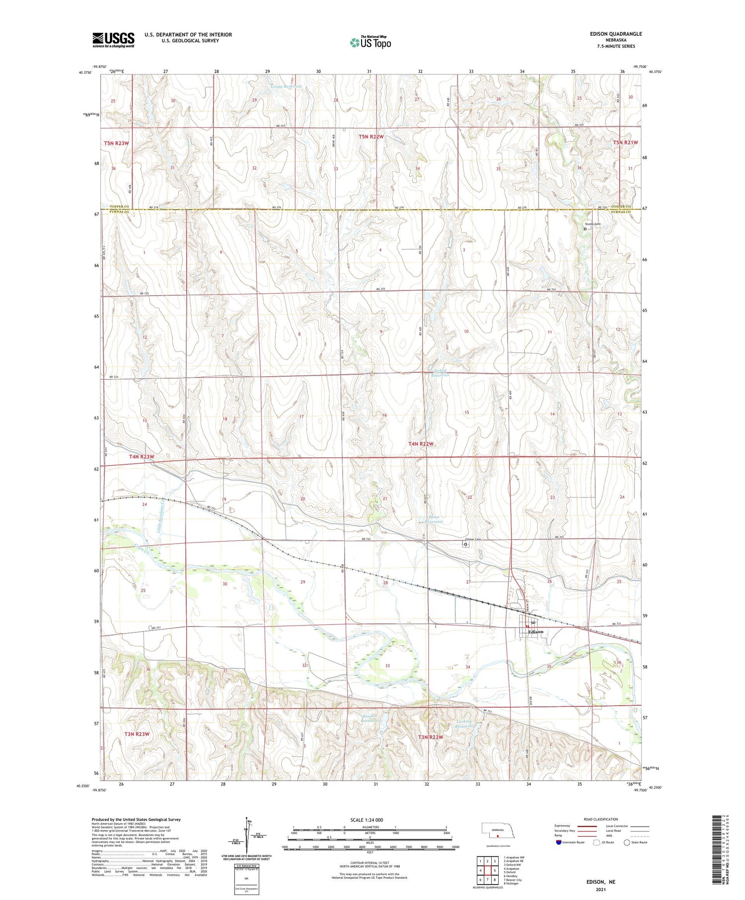
2021 topographic map quadrangle Edison in the state of Nebraska. Scale: 1:24000. Based on the newly updated USGS 7.5' US Topo map series, this map is in the following counties: Furnas, Gosper. The map contains contour data, water features, and other items you are used to seeing on USGS maps, but also has updated roads and other features. This is the next generation of topographic maps. Printed on high-quality waterproof paper with UV fade-resistant inks.
Quads adjacent to this one:
West: Arapahoe
Northwest: Arapahoe NW
North: Arapahoe NE
Northeast: Oxford NW
East: Oxford
Southeast: Hollinger
South: Beaver City
Southwest: Hendley
Contains the following named places: Big Antelope Creek, Broeker Dam, Broeker Reservoir, Dry Creek, Edison, Edison Cemetery, Edison Christian Church, Edison Election Precinct, Edison Non-Stock Co-op Elevator, Edison Post Office, Edison Volunteer Fire Department, Gregg Dam, Gregg Reservoir, Little Antelope Creek, Lueking Dam, Lueking Reservoir, Paine Reservoir, Paine Reservoir Dam, Small Schoolhouse Historical Marker, Stump Cemetery, Township of Edison, Village of Edison, Ziebell Dam, Ziebell Reservoir, ZIP Code: 68936