MyTopo
Arapahoe Nebraska US Topo Map
Couldn't load pickup availability
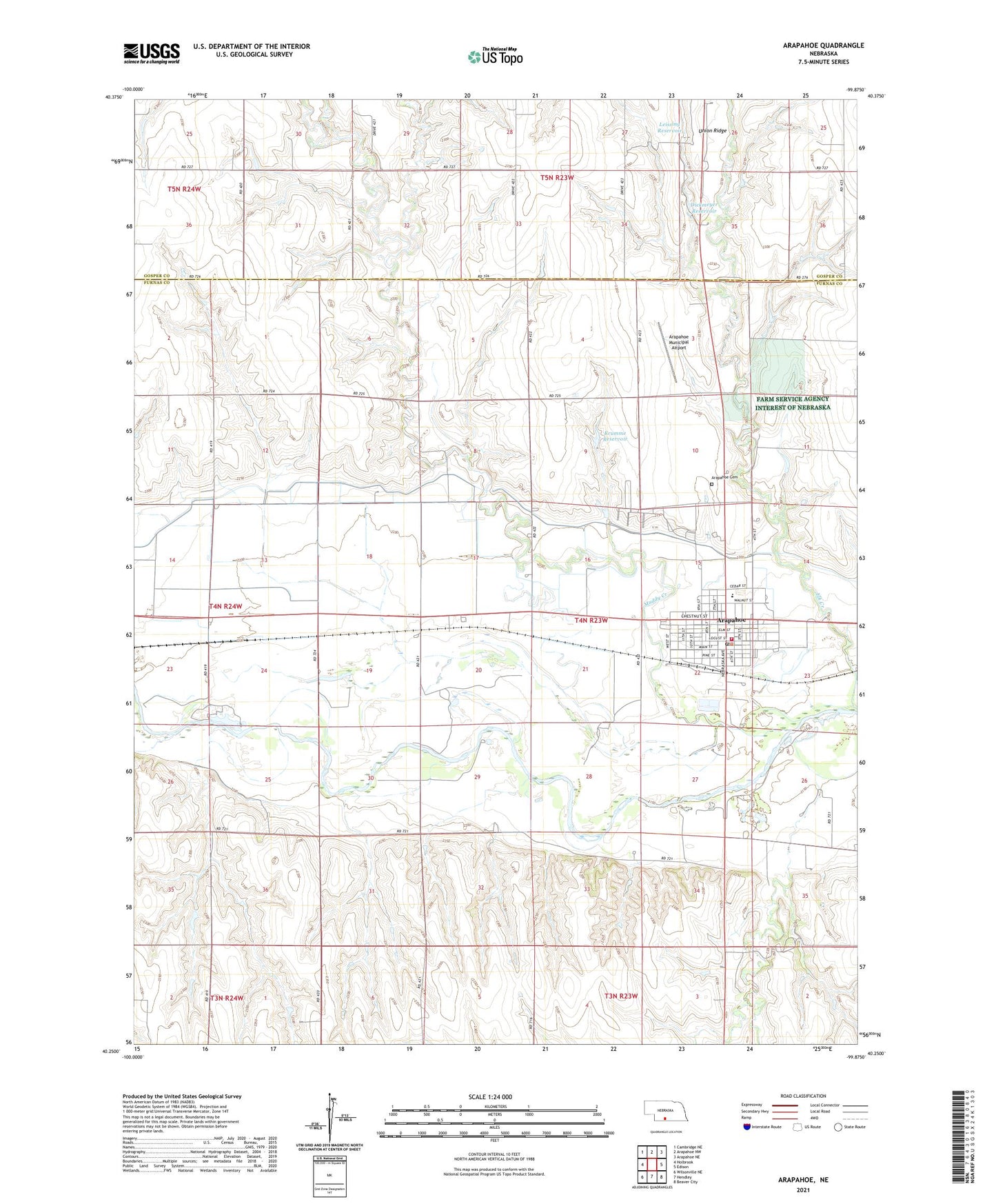
2021 topographic map quadrangle Arapahoe in the state of Nebraska. Scale: 1:24000. Based on the newly updated USGS 7.5' US Topo map series, this map is in the following counties: Furnas, Gosper. The map contains contour data, water features, and other items you are used to seeing on USGS maps, but also has updated roads and other features. This is the next generation of topographic maps. Printed on high-quality waterproof paper with UV fade-resistant inks.
Quads adjacent to this one:
West: Holbrook
Northwest: Cambridge NE
North: Arapahoe NW
Northeast: Arapahoe NE
East: Edison
Southeast: Beaver City
South: Hendley
Southwest: Wilsonville NE
This map covers the same area as the classic USGS quad with code o40099c8.
Contains the following named places: Arapahoe, Arapahoe Cemetery, Arapahoe Election Precinct, Arapahoe Golf Course, Arapahoe Good Samaritan Center, Arapahoe Medical Clinic, Arapahoe Municipal Airport, Arapahoe Post Office, Arapahoe Public Library, Arapahoe Public Schools, Arapahoe Volunteer Ambulance, Arapahoe Volunteer Fire Department, Christian Church of Christ, City of Arapahoe, Crum Creek, Dickmeyer Dam, Dickmeyer Reservoir, East Branch Muddy Creek, Elder Creek, Elk Creek, First United Methodist Church, Golter Overflow Dam, Golter Reservoir, Krumme Dam, Krumme Reservoir, Leissing Dam, Leissing Reservoir, Muddy Creek, Prairie Pines Retirement Community, Saint Germanus Catholic Church, Saint Matthews Church, Saint Pauls Episcopal Church, Shady Rest Camp Motel Campground, Timmons Creek, Township of Arapahoe, Trinity Lutheran Church, ZIP Code: 68922