MyTopo
Hampton Nebraska US Topo Map
Couldn't load pickup availability
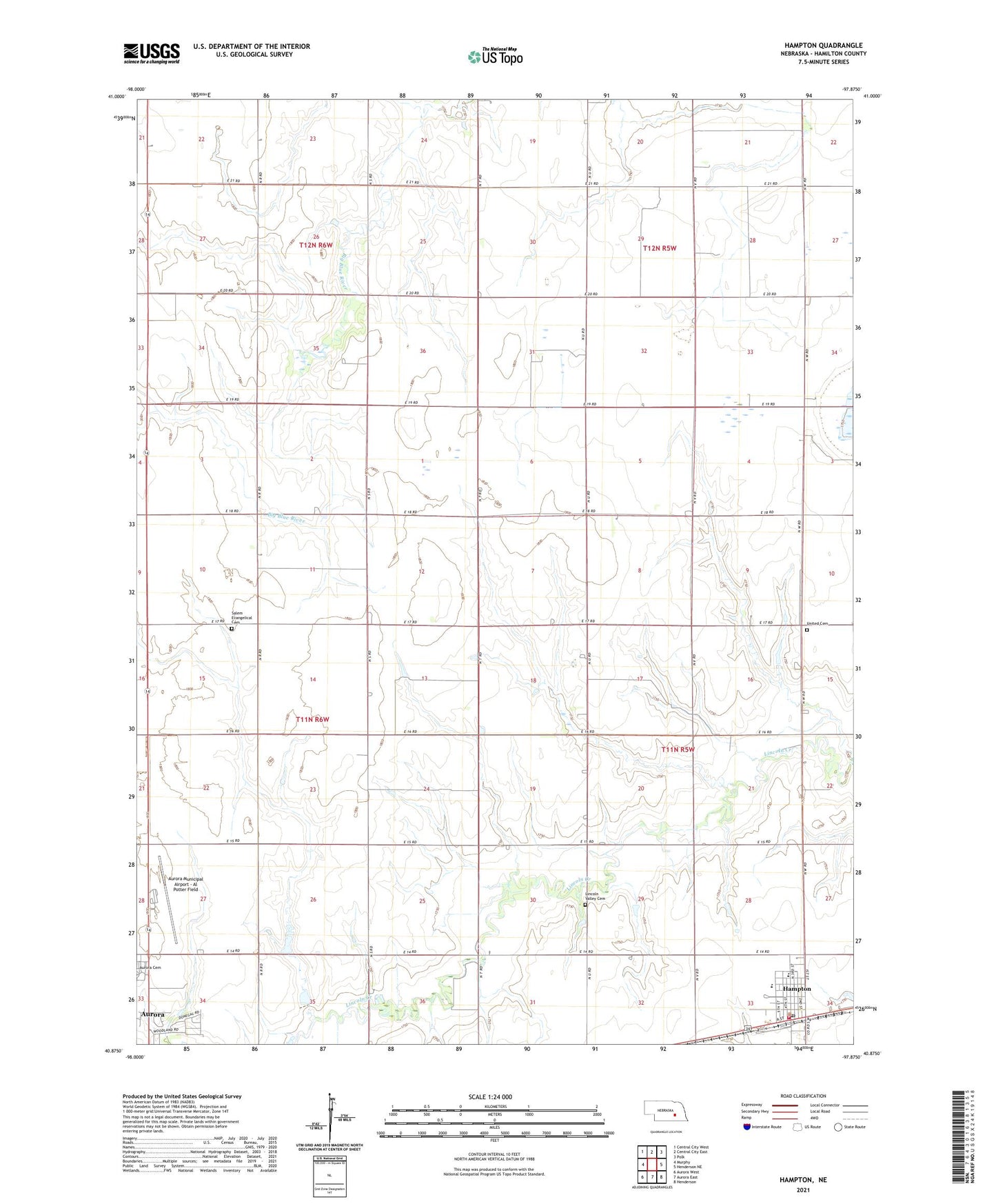
2021 topographic map quadrangle Hampton in the state of Nebraska. Scale: 1:24000. Based on the newly updated USGS 7.5' US Topo map series, this map is in the following counties: Hamilton. The map contains contour data, water features, and other items you are used to seeing on USGS maps, but also has updated roads and other features. This is the next generation of topographic maps. Printed on high-quality waterproof paper with UV fade-resistant inks.
Quads adjacent to this one:
West: Murphy
Northwest: Central City West
North: Central City East
Northeast: Polk
East: Henderson NE
Southeast: Henderson
South: Aurora East
Southwest: Aurora West
Contains the following named places: Aurora Municipal Airport - Al Potter Field, Countryside Bible Church, Hampton, Hampton Post Office, Hampton Public Schools, Hampton Volunteer Fire and Rescue, Lincoln Valley Cemetery, Marquette-Carlson Airport, Saint Johns Church, Saint Peter Lutheran Church, Saint Peters Evangelical Lutheran School, Salem Evangelical Cemetery, Township of Grant, Township of Valley, United Cemetery, United Co-op Incorporated Elevator, United Lutheran Church, Village of Hampton, ZIP Code: 68843