MyTopo
Henderson Nebraska US Topo Map
Couldn't load pickup availability
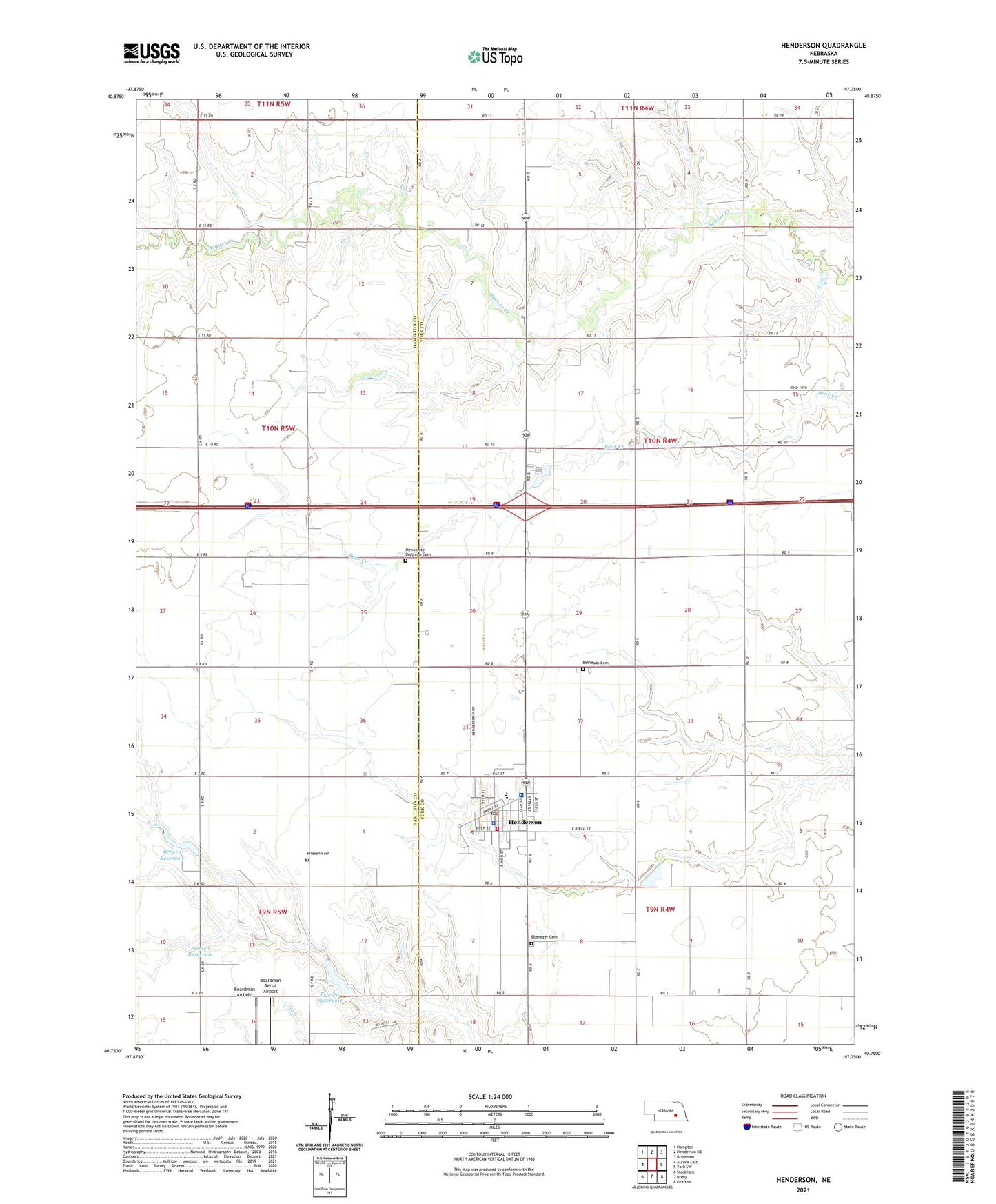
2021 topographic map quadrangle Henderson in the state of Nebraska. Scale: 1:24000. Based on the newly updated USGS 7.5' US Topo map series, this map is in the following counties: York, Hamilton. The map contains contour data, water features, and other items you are used to seeing on USGS maps, but also has updated roads and other features. This is the next generation of topographic maps. Printed on high-quality waterproof paper with UV fade-resistant inks.
Quads adjacent to this one:
West: Aurora East
Northwest: Hampton
North: Henderson NE
Northeast: Bradshaw
East: York SW
Southeast: Grafton
South: Bixby
Southwest: Stockham
This map covers the same area as the classic USGS quad with code o40097g7.
Contains the following named places: Bergen Dam, Bergen Reservoir, Bethesda Cemetery, Bethesda Mennonite Church, Boardman Aerial Airport, Brown Election Precinct, Calvary Bible Church, City of Henderson, Community Bible Church, Ebenezer Cemetery, Faith Evangelical Bible Church, Farmers Co-op Elevator, Friesen Cemetery, Friesen Dam, Friesen Reservoir, Henderson, Henderson City Park, Henderson Community Hospital, Henderson Family Care, Henderson Family Dentistry, Henderson Mennonite Centennial Historical Marker, Henderson Municipal Golf Course, Henderson Nebraska Centennial Historical Marker, Henderson Nursing Home, Henderson Police Department, Henderson Post Office, Henderson Public Schools, Henderson Rural Fire and Rescue, Henderson/York KOA Kampground, Kroeker Grain and Lumber Elevator, Mennonite Brethren Cemetery, Mennonite Brethren Church, Porcupine Ranch Historical Marker, Sara Neufeld Nursing Home, Tena Ediger Nursing Home, Township of Brown, Wayferer II Motor Inn Campground, Western Campground, William W Peters Nursing Home, ZIP Code: 68371