MyTopo
Huddle Table Nebraska US Topo Map
Couldn't load pickup availability
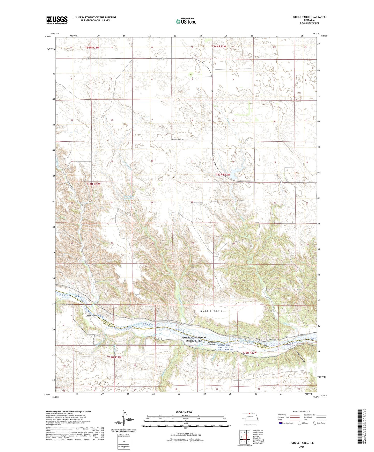
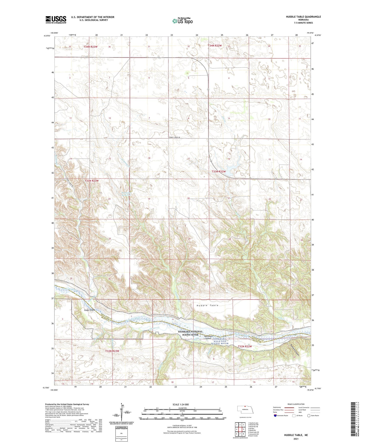
2021 topographic map quadrangle Huddle Table in the state of Nebraska. Scale: 1:24000. Based on the newly updated USGS 7.5' US Topo map series, this map is in the following counties: Keya Paha, Brown. The map contains contour data, water features, and other items you are used to seeing on USGS maps, but also has updated roads and other features. This is the next generation of topographic maps. Printed on high-quality waterproof paper with UV fade-resistant inks.
Quads adjacent to this one:
West: Norden
Northwest: Hayford Lake
North: Meadville NW
Northeast: Meadville NE
East: Meadville
Southeast: Dutch Creek
South: Ainsworth NW
Southwest: Wood Lake NE
Contains the following named places: Barney Creek, Batchelder Dam, Batchelder Reservoir, Bronson Creek, Buzzard Canyon, Cedar Island, Chase Ranch, Chimney Creek, Cub Creek, Cub Creek Dam, Cub Creek Reservoir, Garden Creek, Hartman Island, Hazel Creek, Huddle Table, Hurlbut Ranch, Jeff Creek, Johnny Kirkpatrick Ranch, Kirkpatrick Ranch, Niobrara Wild and Scenic River, Pine Knoll School, School Number 8, School Number 9, Smith Creek, Turkey Creek, Turkey Creek School, Union Church