MyTopo
Norden Nebraska US Topo Map
Couldn't load pickup availability
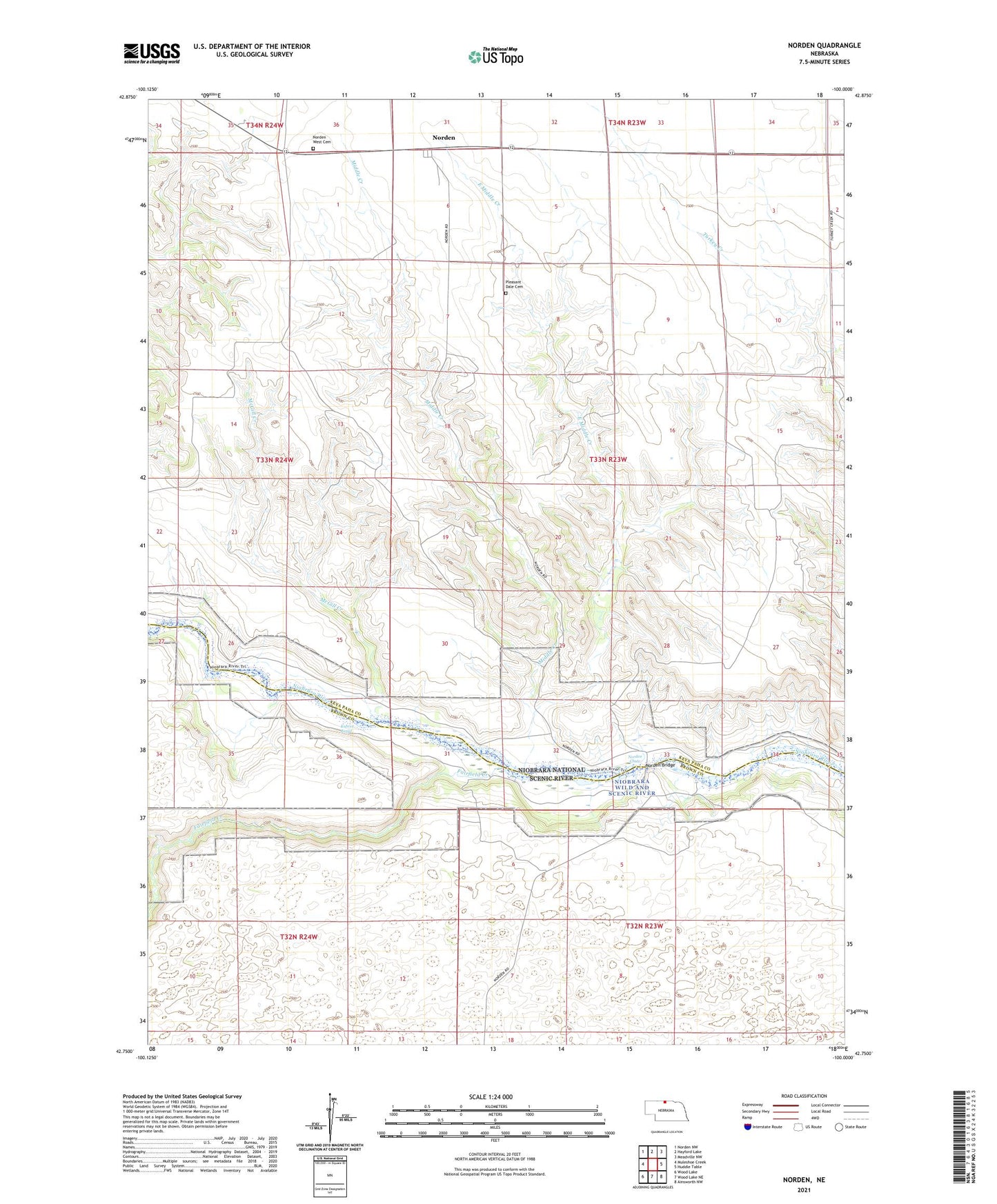
2021 topographic map quadrangle Norden in the state of Nebraska. Scale: 1:24000. Based on the newly updated USGS 7.5' US Topo map series, this map is in the following counties: Keya Paha, Brown. The map contains contour data, water features, and other items you are used to seeing on USGS maps, but also has updated roads and other features. This is the next generation of topographic maps. Printed on high-quality waterproof paper with UV fade-resistant inks.
Quads adjacent to this one:
West: Muleshoe Creek
Northwest: Norden NW
North: Hayford Lake
Northeast: Meadville NW
East: Huddle Table
Southeast: Ainsworth NW
South: Wood Lake NE
Southwest: Wood Lake
This map covers the same area as the classic USGS quad with code o42100g1.
Contains the following named places: East Middle Creek, Egelhoff Ranch, Fairfield Campground, Fairfield Creek, Keya Paha County Fairground, Kuhres Rapid, McGill Creek, McMara Ranch, Middle Creek, Norden, Norden Bridge, Norden Chute, Norden Post Office, Norden Public School, Norden West Cemetery, North River Trail, Pleasant Dale Cemetery, Rock Barn Outfitters Campground, School Number 12, School Number 31, School Number 36, Wolbach Ranch