MyTopo
Kimball Nebraska US Topo Map
Couldn't load pickup availability
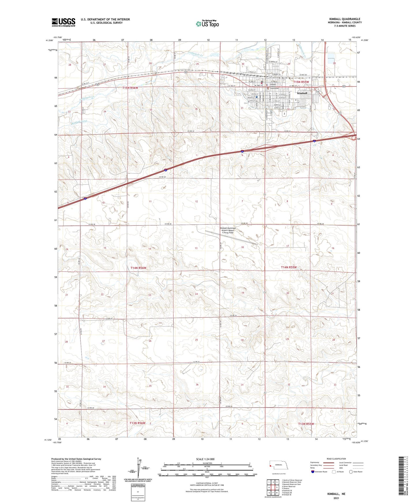
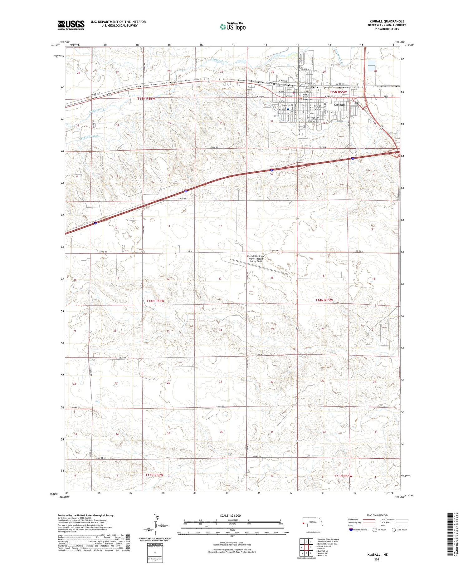
2021 topographic map quadrangle Kimball in the state of Nebraska. Scale: 1:24000. Based on the newly updated USGS 7.5' US Topo map series, this map is in the following counties: Kimball. The map contains contour data, water features, and other items you are used to seeing on USGS maps, but also has updated roads and other features. This is the next generation of topographic maps. Printed on high-quality waterproof paper with UV fade-resistant inks.
Quads adjacent to this one:
West: Oliver Reservoir
Northwest: North of Oliver Reservoir
North: Bennett Reservoir West
Northeast: Bennett Reservoir East
East: Owasco
Southeast: Kimball SE
South: Kimball SW
Southwest: Bushnell SE
Contains the following named places: Antelope Election Precinct, Cederburg Dam, Cederburg Reservoir, Church of Christ, City of Kimball, Family Clinic, First Baptist Church, First English Lutheran Church, First United Presbyterian Church, Gotte Park, High Plains Cooperative Elevator, Janicek Dam, Janicek Reservoir, Kimball, Kimball Assembly of God Church, Kimball Canal, Kimball City Park, Kimball County, Kimball County Ambulance Service, Kimball County Courthouse, Kimball County Hospital Clinic, Kimball County Manor, Kimball County Sheriff's Office, Kimball Evangelical Free Church, Kimball Health Services, Kimball High School, Kimball Junior High School, Kimball KOA Campground, Kimball Municipal Airport/Robert E Arraj Field, Kimball Number 1 Election Precinct, Kimball Number 2 Election Precinct, Kimball Police Department, Kimball Post Office, Kimball Public Library, Kimball Southern Baptist Church, Kimball Vision Clinic, Kimball Volunteer Fire Department, Kimball-Banner Counties Fairgrounds, Kingdom Hall of Jehovah Witnesses, Mary Lynch Elementary School, Plains Historical Museum, Prairie Dale School, Ridgewood Mobile Home Park, Saint Hildas Episcopal Church, Saint Joesphs School, Saint Johns Lutheran Church, Saint Josephs Catholic Church, School Number 5, Stahlas North Court, Trinity United Methodist Church, Twin Pines Campground, West School, Yung North Dam, Yung North Reservoir, Yung South Dam, Yung South Reservoir, ZIP Code: 69145