MyTopo
Lena Nebraska US Topo Map
Couldn't load pickup availability
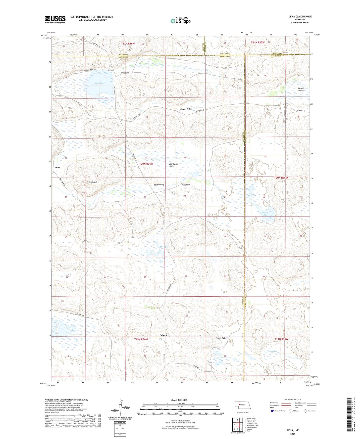
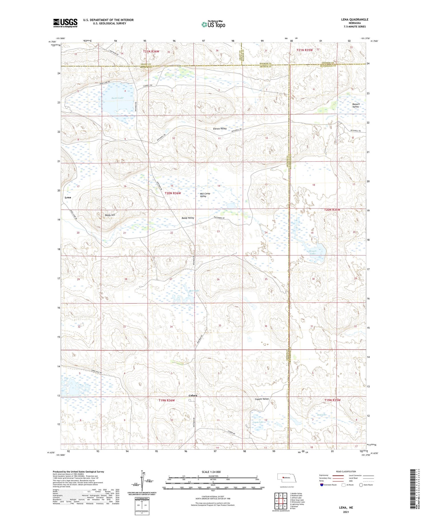
2021 topographic map quadrangle Lena in the state of Nebraska. Scale: 1:24000. Based on the newly updated USGS 7.5' US Topo map series, this map is in the following counties: Arthur, McPherson, Grant, Hooker. The map contains contour data, water features, and other items you are used to seeing on USGS maps, but also has updated roads and other features. This is the next generation of topographic maps. Printed on high-quality waterproof paper with UV fade-resistant inks.
Quads adjacent to this one:
West: Bean Soup Lake
Northwest: Middle Valley
North: Rosebud Lake
Northeast: Jefford Lake
East: Whitewater Lake
Southeast: Flats
South: Bucktail
Southwest: Lightning Valley
Contains the following named places: Baldy Hill, Baldy Valley, Bassett Valley, Box Lake, Box Lake Ranch, Brown Lake, Calora, Calora Post Office, Coyote Lake, Coyote Valley, Eleven Valley, J Macomber Ranch, Lena, Lena Post Office, Mill Camp Valley, Omara Ranch, Prairie Dale School, Reid Lake, Rothwell Ranch, Swan Lake, Threemile Lake, W Macomber Ranch