MyTopo
Litchfield Nebraska US Topo Map
Couldn't load pickup availability
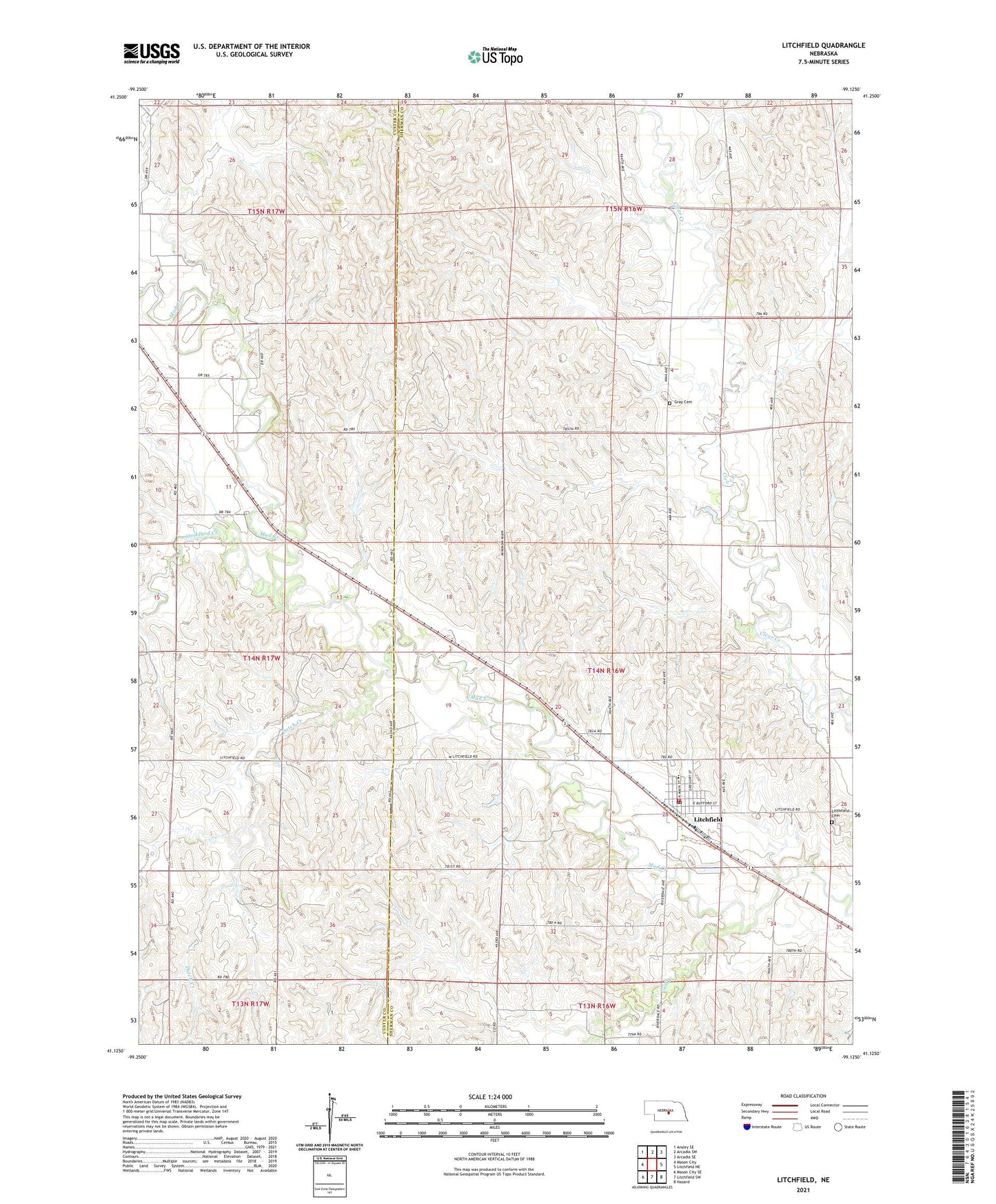
2021 topographic map quadrangle Litchfield in the state of Nebraska. Scale: 1:24000. Based on the newly updated USGS 7.5' US Topo map series, this map is in the following counties: Sherman, Custer. The map contains contour data, water features, and other items you are used to seeing on USGS maps, but also has updated roads and other features. This is the next generation of topographic maps. Printed on high-quality waterproof paper with UV fade-resistant inks.
Quads adjacent to this one:
West: Mason City
Northwest: Ansley SE
North: Arcadia SW
Northeast: Arcadia SE
East: Litchfield NE
Southeast: Hazard
South: Litchfield SW
Southwest: Mason City SE
Contains the following named places: Christian Church, Clear Creek School, Dutch Creek, Fairview School, Gavin Siding, Gray Cemetery, Harrison Election Precinct, Kamper Korner, Litchfield, Litchfield Cemetery, Litchfield Post Office, Litchfield Public Library, Litchfield Public Schools, Litchfield Volunteer Fire Department, Muddy Mills School, Oak Creek, Round Grove Post Office, Round Grove School, Sheltler School, Stoddard Creek, Township of Harrison, Village of Litchfield, Willow Dell School