MyTopo
Hazard Nebraska US Topo Map
Couldn't load pickup availability
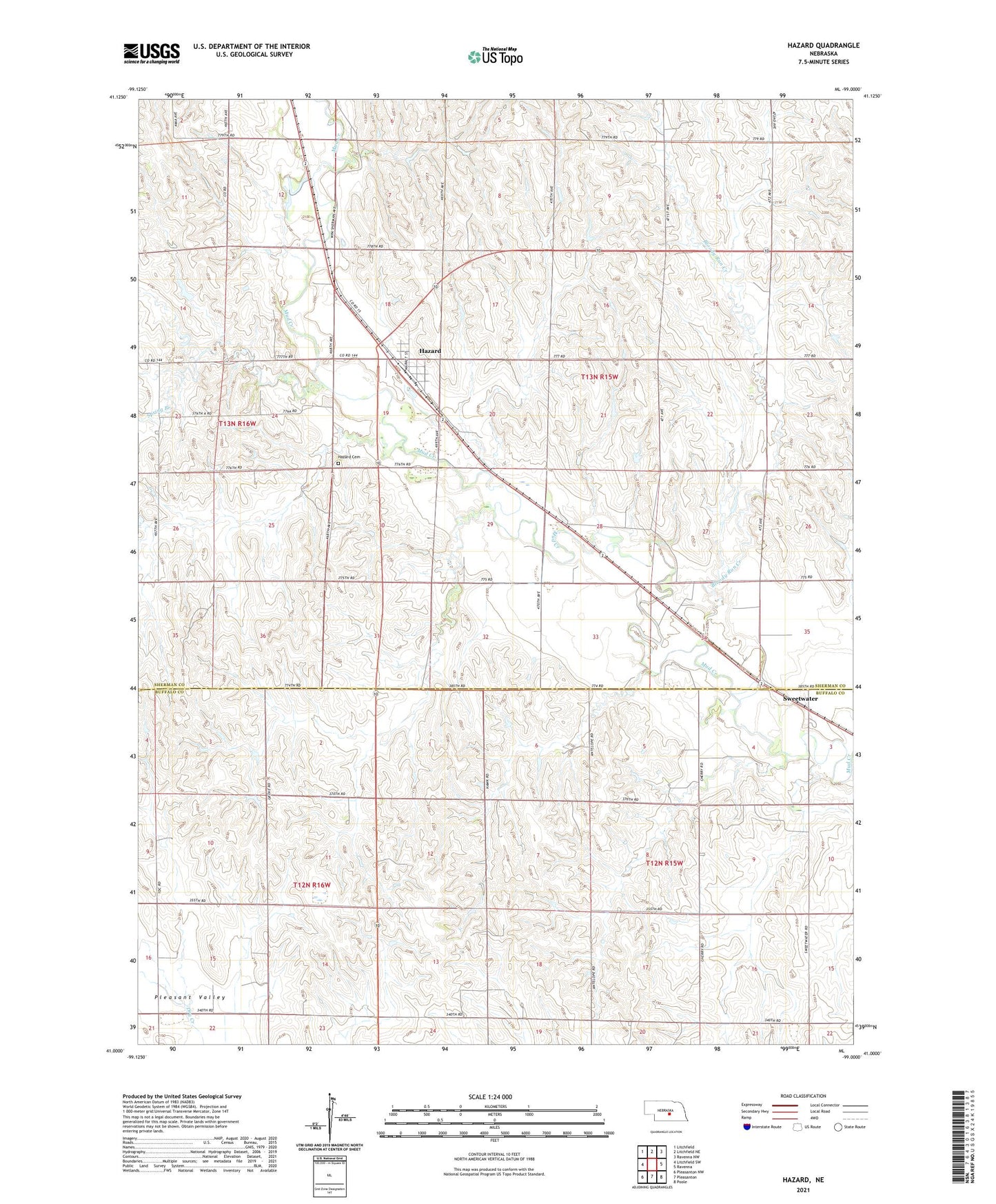
2021 topographic map quadrangle Hazard in the state of Nebraska. Scale: 1:24000. Based on the newly updated USGS 7.5' US Topo map series, this map is in the following counties: Sherman, Buffalo. The map contains contour data, water features, and other items you are used to seeing on USGS maps, but also has updated roads and other features. This is the next generation of topographic maps. Printed on high-quality waterproof paper with UV fade-resistant inks.
Quads adjacent to this one:
West: Litchfield SW
Northwest: Litchfield
North: Litchfield NE
Northeast: Ravenna NW
East: Ravenna
Southeast: Poole
South: Pleasanton
Southwest: Pleasanton NW
This map covers the same area as the classic USGS quad with code o41099a1.
Contains the following named places: Bentora School, Bloody Run Creek, Bloody Run School, Brock School, Cappelen School, Faith Lutheran Church, Hazard, Hazard Cemetery, Hazard Post Office, Hazard Public School, Hazard Volunteer Fire Department, Litchfield Recreation Grounds, Newberg School, Pleasant Hill School, Saint Gabriel Catholic Church, Spring Branch, Sweetwater, Sweetwater Post Office, Sweetwater School, Township of Beaver, Township of Hazard, Village of Hazard, Yanda Dam, Yanda Reservoir, ZIP Code: 68844